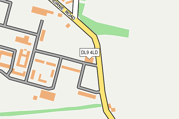
DL9 4LD is located in the Scotton & Lower Wensleydale electoral ward, within the unitary authority of North Yorkshire and the English Parliamentary constituency of Richmond (Yorks). The Sub Integrated Care Board (ICB) Location is NHS Humber and North Yorkshire ICB - 42D and the police force is North Yorkshire. This postcode has been in use since January 1980.


GetTheData
Source: OS OpenMap – Local (Ordnance Survey)
Source: OS VectorMap District (Ordnance Survey)
Licence: Open Government Licence (requires attribution)
| Easting | 419912 |
| Northing | 496632 |
| Latitude | 54.364822 |
| Longitude | -1.695058 |
GetTheData
Source: Open Postcode Geo
Licence: Open Government Licence
| Country | England |
| Postcode District | DL9 |
➜ See where DL9 is on a map ➜ Where is Catterick Garrison? | |
GetTheData
Source: Land Registry Price Paid Data
Licence: Open Government Licence
Elevation or altitude of DL9 4LD as distance above sea level:
| Metres | Feet | |
|---|---|---|
| Elevation | 140m | 459ft |
Elevation is measured from the approximate centre of the postcode, to the nearest point on an OS contour line from OS Terrain 50, which has contour spacing of ten vertical metres.
➜ How high above sea level am I? Find the elevation of your current position using your device's GPS.
GetTheData
Source: Open Postcode Elevation
Licence: Open Government Licence
| Ward | Scotton & Lower Wensleydale |
| Constituency | Richmond (Yorks) |
GetTheData
Source: ONS Postcode Database
Licence: Open Government Licence
| Loos Road | Scotton | 503m |
| Loos Road | Scotton | 507m |
| Cunningham Road (Horne Road) | Hipswell | 853m |
| Cunningham Road (Horne Road) | Hipswell | 854m |
| Goodwood Road (Loos Road) | Scotton | 1,023m |
GetTheData
Source: NaPTAN
Licence: Open Government Licence
GetTheData
Source: ONS Postcode Database
Licence: Open Government Licence


➜ Get more ratings from the Food Standards Agency
GetTheData
Source: Food Standards Agency
Licence: FSA terms & conditions
| Last Collection | |||
|---|---|---|---|
| Location | Mon-Fri | Sat | Distance |
| Hilyard Row, Catterick Garrison | 17:00 | 11:00 | 1,449m |
| Vimy Barracks, Catterick Garris | 17:00 | 11:15 | 1,831m |
| Hipswell Road West, Catterick G | 16:00 | 11:00 | 2,346m |
GetTheData
Source: Dracos
Licence: Creative Commons Attribution-ShareAlike
The below table lists the International Territorial Level (ITL) codes (formerly Nomenclature of Territorial Units for Statistics (NUTS) codes) and Local Administrative Units (LAU) codes for DL9 4LD:
| ITL 1 Code | Name |
|---|---|
| TLE | Yorkshire and The Humber |
| ITL 2 Code | Name |
| TLE2 | North Yorkshire |
| ITL 3 Code | Name |
| TLE22 | North Yorkshire CC |
| LAU 1 Code | Name |
| E07000166 | Richmondshire |
GetTheData
Source: ONS Postcode Directory
Licence: Open Government Licence
The below table lists the Census Output Area (OA), Lower Layer Super Output Area (LSOA), and Middle Layer Super Output Area (MSOA) for DL9 4LD:
| Code | Name | |
|---|---|---|
| OA | E00171339 | |
| LSOA | E01027750 | Richmondshire 004B |
| MSOA | E02005785 | Richmondshire 004 |
GetTheData
Source: ONS Postcode Directory
Licence: Open Government Licence
| DL9 4LA | Horne Road | 167m |
| DL9 4JZ | Horne Road | 237m |
| DL9 4JT | Cleveland Road | 252m |
| DL9 4JU | Castleton Road | 399m |
| DL9 4JS | Cleveland Road | 412m |
| DL9 4JR | Cleveland Road | 472m |
| DL9 4JX | Danby Street | 501m |
| DL9 4JY | Castleton Road | 521m |
| DL9 4JN | Carlton Road | 581m |
| DL9 4JL | Harley Lane | 598m |
GetTheData
Source: Open Postcode Geo; Land Registry Price Paid Data
Licence: Open Government Licence