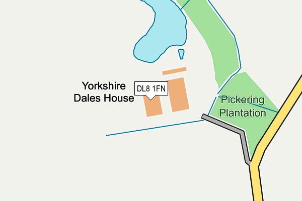
DL8 1FN is located in the Scotton & Lower Wensleydale electoral ward, within the unitary authority of North Yorkshire and the English Parliamentary constituency of Richmond (Yorks). The Sub Integrated Care Board (ICB) Location is NHS Humber and North Yorkshire ICB - 42D and the police force is North Yorkshire. This postcode has been in use since February 2021.


GetTheData
Source: OS OpenMap – Local (Ordnance Survey)
Source: OS VectorMap District (Ordnance Survey)
Licence: Open Government Licence (requires attribution)
| Easting | 423496 |
| Northing | 492337 |
| Latitude | 54.326082 |
| Longitude | -1.640245 |
GetTheData
Source: Open Postcode Geo
Licence: Open Government Licence
| Country | England |
| Postcode District | DL8 |
➜ See where DL8 is on a map | |
GetTheData
Source: Land Registry Price Paid Data
Licence: Open Government Licence
Elevation or altitude of DL8 1FN as distance above sea level:
| Metres | Feet | |
|---|---|---|
| Elevation | 70m | 230ft |
Elevation is measured from the approximate centre of the postcode, to the nearest point on an OS contour line from OS Terrain 50, which has contour spacing of ten vertical metres.
➜ How high above sea level am I? Find the elevation of your current position using your device's GPS.
GetTheData
Source: Open Postcode Elevation
Licence: Open Government Licence
| Ward | Scotton & Lower Wensleydale |
| Constituency | Richmond (Yorks) |
GetTheData
Source: ONS Postcode Database
Licence: Open Government Licence
GetTheData
Source: ONS Postcode Database
Licence: Open Government Licence


➜ Get more ratings from the Food Standards Agency
GetTheData
Source: Food Standards Agency
Licence: FSA terms & conditions
| Last Collection | |||
|---|---|---|---|
| Location | Mon-Fri | Sat | Distance |
| Little Crakehall | 16:00 | 10:00 | 2,149m |
| Masham Road | 17:30 | 11:40 | 5,356m |
| Rigby Terrace | 16:45 | 11:30 | 5,363m |
GetTheData
Source: Dracos
Licence: Creative Commons Attribution-ShareAlike
The below table lists the International Territorial Level (ITL) codes (formerly Nomenclature of Territorial Units for Statistics (NUTS) codes) and Local Administrative Units (LAU) codes for DL8 1FN:
| ITL 1 Code | Name |
|---|---|
| TLE | Yorkshire and The Humber |
| ITL 2 Code | Name |
| TLE2 | North Yorkshire |
| ITL 3 Code | Name |
| TLE22 | North Yorkshire CC |
| LAU 1 Code | Name |
| E07000166 | Richmondshire |
GetTheData
Source: ONS Postcode Directory
Licence: Open Government Licence
The below table lists the Census Output Area (OA), Lower Layer Super Output Area (LSOA), and Middle Layer Super Output Area (MSOA) for DL8 1FN:
| Code | Name | |
|---|---|---|
| OA | E00141350 | |
| LSOA | E01027756 | Richmondshire 006B |
| MSOA | E02005787 | Richmondshire 006 |
GetTheData
Source: ONS Postcode Directory
Licence: Open Government Licence
| DL8 1AJ | Mill Close Lane | 465m |
| DL8 1JZ | 632m | |
| DL8 1PB | 1097m | |
| DL8 1PA | 1175m | |
| DL8 1JX | 1239m | |
| DL8 1PE | 1245m | |
| DL8 1NU | 1322m | |
| DL8 1NP | North Road | 1497m |
| DL8 1NS | Silver Street | 1506m |
| DL8 1NR | 1528m |
GetTheData
Source: Open Postcode Geo; Land Registry Price Paid Data
Licence: Open Government Licence