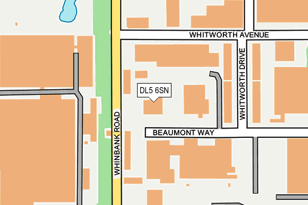
DL5 6SN is located in the Aycliffe East electoral ward, within the unitary authority of County Durham and the English Parliamentary constituency of Sedgefield. The Sub Integrated Care Board (ICB) Location is NHS North East and North Cumbria ICB - 84H and the police force is Durham. This postcode has been in use since January 1980.


GetTheData
Source: OS OpenMap – Local (Ordnance Survey)
Source: OS VectorMap District (Ordnance Survey)
Licence: Open Government Licence (requires attribution)
| Easting | 427467 |
| Northing | 523122 |
| Latitude | 54.602540 |
| Longitude | -1.576346 |
GetTheData
Source: Open Postcode Geo
Licence: Open Government Licence
| Country | England |
| Postcode District | DL5 |
➜ See where DL5 is on a map ➜ Where is Newton Aycliffe? | |
GetTheData
Source: Land Registry Price Paid Data
Licence: Open Government Licence
Elevation or altitude of DL5 6SN as distance above sea level:
| Metres | Feet | |
|---|---|---|
| Elevation | 90m | 295ft |
Elevation is measured from the approximate centre of the postcode, to the nearest point on an OS contour line from OS Terrain 50, which has contour spacing of ten vertical metres.
➜ How high above sea level am I? Find the elevation of your current position using your device's GPS.
GetTheData
Source: Open Postcode Elevation
Licence: Open Government Licence
| Ward | Aycliffe East |
| Constituency | Sedgefield |
GetTheData
Source: ONS Postcode Database
Licence: Open Government Licence
| Moores Factory (Durham Way South) | Aycliffe Industrial Estate | 361m |
| Durham Way | Aycliffe Industrial Estate | 421m |
| Moores Factory (Durham Way South) | Aycliffe Industrial Estate | 424m |
| Durham Way South | Aycliffe Industrial Estate | 519m |
| Durham Way | Aycliffe Industrial Estate | 528m |
| Heighington Station | 0.7km |
| Newton Aycliffe Station | 1.5km |
| Shildon Station | 4.7km |
GetTheData
Source: NaPTAN
Licence: Open Government Licence
GetTheData
Source: ONS Postcode Database
Licence: Open Government Licence


➜ Get more ratings from the Food Standards Agency
GetTheData
Source: Food Standards Agency
Licence: FSA terms & conditions
| Last Collection | |||
|---|---|---|---|
| Location | Mon-Fri | Sat | Distance |
| Beveridge Way | 17:30 | 12:00 | 1,240m |
| Burn Lane | 16:45 | 11:15 | 2,324m |
| Garburn Place | 16:45 | 10:45 | 2,621m |
GetTheData
Source: Dracos
Licence: Creative Commons Attribution-ShareAlike
The below table lists the International Territorial Level (ITL) codes (formerly Nomenclature of Territorial Units for Statistics (NUTS) codes) and Local Administrative Units (LAU) codes for DL5 6SN:
| ITL 1 Code | Name |
|---|---|
| TLC | North East (England) |
| ITL 2 Code | Name |
| TLC1 | Tees Valley and Durham |
| ITL 3 Code | Name |
| TLC14 | Durham |
| LAU 1 Code | Name |
| E06000047 | County Durham |
GetTheData
Source: ONS Postcode Directory
Licence: Open Government Licence
The below table lists the Census Output Area (OA), Lower Layer Super Output Area (LSOA), and Middle Layer Super Output Area (MSOA) for DL5 6SN:
| Code | Name | |
|---|---|---|
| OA | E00105680 | |
| LSOA | E01020826 | County Durham 063B |
| MSOA | E02004344 | County Durham 063 |
GetTheData
Source: ONS Postcode Directory
Licence: Open Government Licence
| DL5 6AU | Whinfield Drive | 426m |
| DL5 6SG | Ketton Way | 464m |
| DL5 6ZE | Welbury Way | 538m |
| DL5 6HT | Woodham Road | 599m |
| DL5 6DE | Leaside | 783m |
| DL5 6LA | Bickford Terrace | 806m |
| DL5 6HX | Leaside | 846m |
| DL5 6LD | Congreve Terrace | 877m |
| DL5 6DU | Leaside North | 879m |
| DL5 6LN | Old A1 Road | 895m |
GetTheData
Source: Open Postcode Geo; Land Registry Price Paid Data
Licence: Open Government Licence