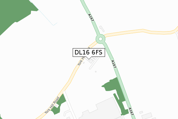
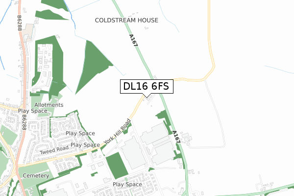
DL16 6FS is located in the Tudhoe electoral ward, within the unitary authority of County Durham and the English Parliamentary constituency of Bishop Auckland. The Sub Integrated Care Board (ICB) Location is NHS North East and North Cumbria ICB - 84H and the police force is Durham. This postcode has been in use since September 2018.


GetTheData
Source: OS Open Zoomstack (Ordnance Survey)
Licence: Open Government Licence (requires attribution)
Attribution: Contains OS data © Crown copyright and database right 2025
Source: Open Postcode Geo
Licence: Open Government Licence (requires attribution)
Attribution: Contains OS data © Crown copyright and database right 2025; Contains Royal Mail data © Royal Mail copyright and database right 2025; Source: Office for National Statistics licensed under the Open Government Licence v.3.0
| Easting | 427651 |
| Northing | 535444 |
| Latitude | 54.713260 |
| Longitude | -1.572338 |
GetTheData
Source: Open Postcode Geo
Licence: Open Government Licence
| Country | England |
| Postcode District | DL16 |
➜ See where DL16 is on a map | |
GetTheData
Source: Land Registry Price Paid Data
Licence: Open Government Licence
| Ward | Tudhoe |
| Constituency | Bishop Auckland |
GetTheData
Source: ONS Postcode Database
Licence: Open Government Licence
| Coach And Horses (A167) | Hett | 131m |
| Coach And Horses (A167) | Hett | 204m |
| Meadowfield Avenue-north End (Meadowfield Avenue) | Durham Gate | 324m |
| Meadowfield Avenue-north End (Meadowfield Avenue) | Durham Gate | 414m |
| Hett Moor Lane End (Unclassified Lane) | Hett | 496m |
GetTheData
Source: NaPTAN
Licence: Open Government Licence
GetTheData
Source: ONS Postcode Database
Licence: Open Government Licence


➜ Get more ratings from the Food Standards Agency
GetTheData
Source: Food Standards Agency
Licence: FSA terms & conditions
| Last Collection | |||
|---|---|---|---|
| Location | Mon-Fri | Sat | Distance |
| Tudhoe Colliery | 17:00 | 10:45 | 1,049m |
| York Hill | 17:00 | 10:45 | 1,088m |
| Hett | 16:00 | 10:15 | 1,303m |
GetTheData
Source: Dracos
Licence: Creative Commons Attribution-ShareAlike
The below table lists the International Territorial Level (ITL) codes (formerly Nomenclature of Territorial Units for Statistics (NUTS) codes) and Local Administrative Units (LAU) codes for DL16 6FS:
| ITL 1 Code | Name |
|---|---|
| TLC | North East (England) |
| ITL 2 Code | Name |
| TLC1 | Tees Valley and Durham |
| ITL 3 Code | Name |
| TLC14 | Durham |
| LAU 1 Code | Name |
| E06000047 | County Durham |
GetTheData
Source: ONS Postcode Directory
Licence: Open Government Licence
The below table lists the Census Output Area (OA), Lower Layer Super Output Area (LSOA), and Middle Layer Super Output Area (MSOA) for DL16 6FS:
| Code | Name | |
|---|---|---|
| OA | E00105784 | |
| LSOA | E01020843 | County Durham 047E |
| MSOA | E02004333 | County Durham 047 |
GetTheData
Source: ONS Postcode Directory
Licence: Open Government Licence
| DL16 6TW | Meadow Green | 617m |
| DL16 6TR | Castle Close | 649m |
| DL16 6TP | Fox Covert | 677m |
| DL16 6TN | Meadow Green | 704m |
| DH6 5JX | 726m | |
| DL16 6FE | Clover Court | 731m |
| DL16 6SR | Wolsey Road | 759m |
| DL16 6FQ | Harebell Close | 767m |
| DL16 6SP | Wolsey Road | 782m |
| DL16 6PD | Abbey Green | 820m |
GetTheData
Source: Open Postcode Geo; Land Registry Price Paid Data
Licence: Open Government Licence