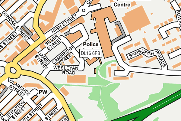
DL16 6FB is located in the Tudhoe electoral ward, within the unitary authority of County Durham and the English Parliamentary constituency of Bishop Auckland. The Sub Integrated Care Board (ICB) Location is NHS North East and North Cumbria ICB - 84H and the police force is Durham. This postcode has been in use since June 2002.


GetTheData
Source: OS OpenMap – Local (Ordnance Survey)
Source: OS VectorMap District (Ordnance Survey)
Licence: Open Government Licence (requires attribution)
| Easting | 425857 |
| Northing | 533731 |
| Latitude | 54.697952 |
| Longitude | -1.600324 |
GetTheData
Source: Open Postcode Geo
Licence: Open Government Licence
| Country | England |
| Postcode District | DL16 |
➜ See where DL16 is on a map ➜ Where is Spennymoor? | |
GetTheData
Source: Land Registry Price Paid Data
Licence: Open Government Licence
Elevation or altitude of DL16 6FB as distance above sea level:
| Metres | Feet | |
|---|---|---|
| Elevation | 110m | 361ft |
Elevation is measured from the approximate centre of the postcode, to the nearest point on an OS contour line from OS Terrain 50, which has contour spacing of ten vertical metres.
➜ How high above sea level am I? Find the elevation of your current position using your device's GPS.
GetTheData
Source: Open Postcode Elevation
Licence: Open Government Licence
| Ward | Tudhoe |
| Constituency | Bishop Auckland |
GetTheData
Source: ONS Postcode Database
Licence: Open Government Licence
| Asda Store Front (Store Carpark) | Spennymoor | 246m |
| Cheapside Stand F (Cheapside) | Spennymoor | 289m |
| Charles Street (Clyde Terrace) | Spennymoor | 302m |
| Cheapside Stand C (Cheapside) | Spennymoor | 313m |
| Cheapside Stand B (Cheapside) | Spennymoor | 324m |
| Bishop Auckland Station | 6.7km |
GetTheData
Source: NaPTAN
Licence: Open Government Licence
GetTheData
Source: ONS Postcode Database
Licence: Open Government Licence


➜ Get more ratings from the Food Standards Agency
GetTheData
Source: Food Standards Agency
Licence: FSA terms & conditions
| Last Collection | |||
|---|---|---|---|
| Location | Mon-Fri | Sat | Distance |
| Parkwood Precinct | 17:15 | 11:45 | 193m |
| Post Office | 17:15 | 11:30 | 318m |
| Co Op, Holborn Street | 18:30 | 11:30 | 319m |
GetTheData
Source: Dracos
Licence: Creative Commons Attribution-ShareAlike
The below table lists the International Territorial Level (ITL) codes (formerly Nomenclature of Territorial Units for Statistics (NUTS) codes) and Local Administrative Units (LAU) codes for DL16 6FB:
| ITL 1 Code | Name |
|---|---|
| TLC | North East (England) |
| ITL 2 Code | Name |
| TLC1 | Tees Valley and Durham |
| ITL 3 Code | Name |
| TLC14 | Durham |
| LAU 1 Code | Name |
| E06000047 | County Durham |
GetTheData
Source: ONS Postcode Directory
Licence: Open Government Licence
The below table lists the Census Output Area (OA), Lower Layer Super Output Area (LSOA), and Middle Layer Super Output Area (MSOA) for DL16 6FB:
| Code | Name | |
|---|---|---|
| OA | E00105647 | |
| LSOA | E01020820 | County Durham 049C |
| MSOA | E02004335 | County Durham 049 |
GetTheData
Source: ONS Postcode Directory
Licence: Open Government Licence
| DL16 6DB | High Street | 136m |
| DL16 6DE | James Street | 160m |
| DL16 6NW | Bamburgh Parade | 169m |
| DL16 6AG | High Street | 174m |
| DL16 6AA | High Street | 178m |
| DL16 7TT | South Street | 204m |
| DL16 6DD | High Street | 212m |
| DL16 7TY | Baff Street | 213m |
| DL16 6AB | Festival Walk | 217m |
| DL16 6BD | Board Street | 223m |
GetTheData
Source: Open Postcode Geo; Land Registry Price Paid Data
Licence: Open Government Licence