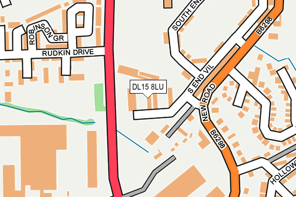
DL15 8LU is located in the Crook electoral ward, within the unitary authority of County Durham and the English Parliamentary constituency of North West Durham. The Sub Integrated Care Board (ICB) Location is NHS North East and North Cumbria ICB - 84H and the police force is Durham. This postcode has been in use since April 1985.


GetTheData
Source: OS OpenMap – Local (Ordnance Survey)
Source: OS VectorMap District (Ordnance Survey)
Licence: Open Government Licence (requires attribution)
| Easting | 416165 |
| Northing | 534923 |
| Latitude | 54.709066 |
| Longitude | -1.750637 |
GetTheData
Source: Open Postcode Geo
Licence: Open Government Licence
| Country | England |
| Postcode District | DL15 |
➜ See where DL15 is on a map ➜ Where is Crook? | |
GetTheData
Source: Land Registry Price Paid Data
Licence: Open Government Licence
Elevation or altitude of DL15 8LU as distance above sea level:
| Metres | Feet | |
|---|---|---|
| Elevation | 150m | 492ft |
Elevation is measured from the approximate centre of the postcode, to the nearest point on an OS contour line from OS Terrain 50, which has contour spacing of ten vertical metres.
➜ How high above sea level am I? Find the elevation of your current position using your device's GPS.
GetTheData
Source: Open Postcode Elevation
Licence: Open Government Licence
| Ward | Crook |
| Constituency | North West Durham |
GetTheData
Source: ONS Postcode Database
Licence: Open Government Licence
| Firtree Garage (A689 New Road) | Crook | 184m |
| Firtree Garage (A689 New Road) | Crook | 235m |
| South End Villas (A689 New Road) | Crook | 243m |
| South End Villas (A689 New Road) | Crook | 247m |
| New Road Factories (A689 New Road) | Crook | 381m |
GetTheData
Source: NaPTAN
Licence: Open Government Licence
GetTheData
Source: ONS Postcode Database
Licence: Open Government Licence


➜ Get more ratings from the Food Standards Agency
GetTheData
Source: Food Standards Agency
Licence: FSA terms & conditions
| Last Collection | |||
|---|---|---|---|
| Location | Mon-Fri | Sat | Distance |
| Temperance Terrace, Crook | 16:15 | 10:00 | 1,862m |
| Stanley P.o. | 16:15 | 10:30 | 2,789m |
| Old Hunwick | 17:00 | 10:30 | 3,664m |
GetTheData
Source: Dracos
Licence: Creative Commons Attribution-ShareAlike
The below table lists the International Territorial Level (ITL) codes (formerly Nomenclature of Territorial Units for Statistics (NUTS) codes) and Local Administrative Units (LAU) codes for DL15 8LU:
| ITL 1 Code | Name |
|---|---|
| TLC | North East (England) |
| ITL 2 Code | Name |
| TLC1 | Tees Valley and Durham |
| ITL 3 Code | Name |
| TLC14 | Durham |
| LAU 1 Code | Name |
| E06000047 | County Durham |
GetTheData
Source: ONS Postcode Directory
Licence: Open Government Licence
The below table lists the Census Output Area (OA), Lower Layer Super Output Area (LSOA), and Middle Layer Super Output Area (MSOA) for DL15 8LU:
| Code | Name | |
|---|---|---|
| OA | E00105973 | |
| LSOA | E01020879 | County Durham 046B |
| MSOA | E02004350 | County Durham 046 |
GetTheData
Source: ONS Postcode Directory
Licence: Open Government Licence
| DL15 8JZ | Castle Close | 72m |
| DL15 8LF | South End Villas | 130m |
| DL15 8JT | Morson Avenue | 144m |
| DL15 9GG | Brown Court | 162m |
| DL15 8LB | Brookside Avenue | 182m |
| DL15 9GR | Peases Way | 200m |
| DL15 9GQ | Clemitson Way | 207m |
| DL15 9GJ | Rudkin Drive | 219m |
| DL15 8LG | South End Villas | 240m |
| DL15 9GH | Mowbray Close | 242m |
GetTheData
Source: Open Postcode Geo; Land Registry Price Paid Data
Licence: Open Government Licence