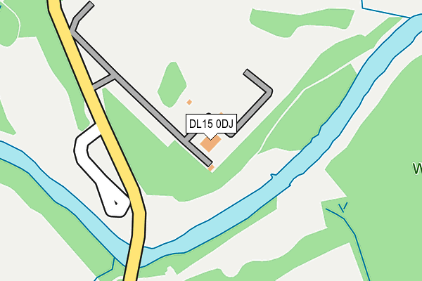
DL15 0DJ lies on Stony Bank in Willington, Crook. DL15 0DJ is located in the Willington and Hunwick electoral ward, within the unitary authority of County Durham and the English Parliamentary constituency of North West Durham. The Sub Integrated Care Board (ICB) Location is NHS North East and North Cumbria ICB - 84H and the police force is Durham. This postcode has been in use since July 1995.


GetTheData
Source: OS OpenMap – Local (Ordnance Survey)
Source: OS VectorMap District (Ordnance Survey)
Licence: Open Government Licence (requires attribution)
| Easting | 420735 |
| Northing | 534828 |
| Latitude | 54.708055 |
| Longitude | -1.679729 |
GetTheData
Source: Open Postcode Geo
Licence: Open Government Licence
| Street | Stony Bank |
| Locality | Willington |
| Town/City | Crook |
| Country | England |
| Postcode District | DL15 |
➜ See where DL15 is on a map | |
GetTheData
Source: Land Registry Price Paid Data
Licence: Open Government Licence
Elevation or altitude of DL15 0DJ as distance above sea level:
| Metres | Feet | |
|---|---|---|
| Elevation | 50m | 164ft |
Elevation is measured from the approximate centre of the postcode, to the nearest point on an OS contour line from OS Terrain 50, which has contour spacing of ten vertical metres.
➜ How high above sea level am I? Find the elevation of your current position using your device's GPS.
GetTheData
Source: Open Postcode Elevation
Licence: Open Government Licence
| Ward | Willington And Hunwick |
| Constituency | North West Durham |
GetTheData
Source: ONS Postcode Database
Licence: Open Government Licence
| White House (Low Willington) | Low Willington | 108m |
| White House (Low Willington) | Low Willington | 112m |
| Park (Low Willington) | Low Willington | 185m |
| Park (Low Willington) | Low Willington | 227m |
| Oak Avenue | Willington | 261m |
GetTheData
Source: NaPTAN
Licence: Open Government Licence
GetTheData
Source: ONS Postcode Database
Licence: Open Government Licence


➜ Get more ratings from the Food Standards Agency
GetTheData
Source: Food Standards Agency
Licence: FSA terms & conditions
| Last Collection | |||
|---|---|---|---|
| Location | Mon-Fri | Sat | Distance |
| Hunwick Post Office | 17:00 | 10:45 | 2,859m |
| Old Hunwick | 17:00 | 10:30 | 3,232m |
| Enterprise City | 18:25 | 07:00 | 3,442m |
GetTheData
Source: Dracos
Licence: Creative Commons Attribution-ShareAlike
| Risk of DL15 0DJ flooding from rivers and sea | Medium |
| ➜ DL15 0DJ flood map | |
GetTheData
Source: Open Flood Risk by Postcode
Licence: Open Government Licence
The below table lists the International Territorial Level (ITL) codes (formerly Nomenclature of Territorial Units for Statistics (NUTS) codes) and Local Administrative Units (LAU) codes for DL15 0DJ:
| ITL 1 Code | Name |
|---|---|
| TLC | North East (England) |
| ITL 2 Code | Name |
| TLC1 | Tees Valley and Durham |
| ITL 3 Code | Name |
| TLC14 | Durham |
| LAU 1 Code | Name |
| E06000047 | County Durham |
GetTheData
Source: ONS Postcode Directory
Licence: Open Government Licence
The below table lists the Census Output Area (OA), Lower Layer Super Output Area (LSOA), and Middle Layer Super Output Area (MSOA) for DL15 0DJ:
| Code | Name | |
|---|---|---|
| OA | E00106088 | |
| LSOA | E01020900 | County Durham 051C |
| MSOA | E02004351 | County Durham 051 |
GetTheData
Source: ONS Postcode Directory
Licence: Open Government Licence
| DL15 0BG | Low Willington | 67m |
| DL15 0BE | The Paddock | 178m |
| DL15 0DL | Queensway | 192m |
| DL15 0BD | Low Willington | 196m |
| DL15 0UP | Church View | 227m |
| DL15 0DN | Kingsmead | 254m |
| DL15 0GS | Fleming Way | 258m |
| DL15 0BJ | Oak Avenue | 271m |
| DL15 0GR | Surtees Drive | 299m |
| DL15 0UZ | Vicarage Gardens | 301m |
GetTheData
Source: Open Postcode Geo; Land Registry Price Paid Data
Licence: Open Government Licence