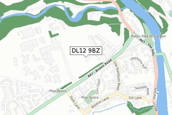
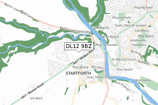
DL12 9BZ is located in the Barnard Castle West electoral ward, within the unitary authority of County Durham and the English Parliamentary constituency of Bishop Auckland. The Sub Integrated Care Board (ICB) Location is NHS North East and North Cumbria ICB - 84H and the police force is Durham. This postcode has been in use since August 2018.


GetTheData
Source: OS Open Zoomstack (Ordnance Survey)
Licence: Open Government Licence (requires attribution)
Attribution: Contains OS data © Crown copyright and database right 2025
Source: Open Postcode Geo
Licence: Open Government Licence (requires attribution)
Attribution: Contains OS data © Crown copyright and database right 2025; Contains Royal Mail data © Royal Mail copyright and database right 2025; Source: Office for National Statistics licensed under the Open Government Licence v.3.0
| Easting | 404378 |
| Northing | 516367 |
| Latitude | 54.542556 |
| Longitude | -1.933851 |
GetTheData
Source: Open Postcode Geo
Licence: Open Government Licence
| Country | England |
| Postcode District | DL12 |
➜ See where DL12 is on a map ➜ Where is Startforth? | |
GetTheData
Source: Land Registry Price Paid Data
Licence: Open Government Licence
| Ward | Barnard Castle West |
| Constituency | Bishop Auckland |
GetTheData
Source: ONS Postcode Database
Licence: Open Government Licence
| Royal Star (Bowes Road) | Startforth | 175m |
| Corn Close Hail And Ride (Corn Close) | Startforth | 178m |
| Boldron Lane Hail And Ride (Boldron Lane) | Startforth | 268m |
| Boldron Lane Hail And Ride (Boldron Lane) | Startforth | 275m |
| Deepdale Gardens (Lartington Lane) | Startforth | 300m |
GetTheData
Source: NaPTAN
Licence: Open Government Licence
| Percentage of properties with Next Generation Access | 100.0% |
| Percentage of properties with Superfast Broadband | 100.0% |
| Percentage of properties with Ultrafast Broadband | 100.0% |
| Percentage of properties with Full Fibre Broadband | 100.0% |
Superfast Broadband is between 30Mbps and 300Mbps
Ultrafast Broadband is > 300Mbps
| Percentage of properties unable to receive 2Mbps | 0.0% |
| Percentage of properties unable to receive 5Mbps | 0.0% |
| Percentage of properties unable to receive 10Mbps | 0.0% |
| Percentage of properties unable to receive 30Mbps | 0.0% |
GetTheData
Source: Ofcom
Licence: Ofcom Terms of Use (requires attribution)
GetTheData
Source: ONS Postcode Database
Licence: Open Government Licence


➜ Get more ratings from the Food Standards Agency
GetTheData
Source: Food Standards Agency
Licence: FSA terms & conditions
| Last Collection | |||
|---|---|---|---|
| Location | Mon-Fri | Sat | Distance |
| Corn Close | 16:30 | 11:00 | 123m |
| High Startforth | 16:45 | 11:00 | 303m |
| Startforth Park | 16:30 | 11:00 | 490m |
GetTheData
Source: Dracos
Licence: Creative Commons Attribution-ShareAlike
The below table lists the International Territorial Level (ITL) codes (formerly Nomenclature of Territorial Units for Statistics (NUTS) codes) and Local Administrative Units (LAU) codes for DL12 9BZ:
| ITL 1 Code | Name |
|---|---|
| TLC | North East (England) |
| ITL 2 Code | Name |
| TLC1 | Tees Valley and Durham |
| ITL 3 Code | Name |
| TLC14 | Durham |
| LAU 1 Code | Name |
| E06000047 | County Durham |
GetTheData
Source: ONS Postcode Directory
Licence: Open Government Licence
The below table lists the Census Output Area (OA), Lower Layer Super Output Area (LSOA), and Middle Layer Super Output Area (MSOA) for DL12 9BZ:
| Code | Name | |
|---|---|---|
| OA | E00171851 | |
| LSOA | E01020854 | County Durham 066C |
| MSOA | E02004347 | County Durham 066 |
GetTheData
Source: ONS Postcode Directory
Licence: Open Government Licence
| DL12 9AW | Corn Close | 165m |
| DL12 9BH | Startforth View | 187m |
| DL12 9AJ | Bowes Way | 190m |
| DL12 9AU | Low Startforth Road | 195m |
| DL12 9DY | Stainmore Close | 196m |
| DL12 9DX | The Paddock | 210m |
| DL12 9AX | Deerbolt Bank | 267m |
| DL12 9BQ | Ullathorne Rise | 294m |
| DL12 9AR | Boldron Lane | 301m |
| DL12 9AH | 322m |
GetTheData
Source: Open Postcode Geo; Land Registry Price Paid Data
Licence: Open Government Licence