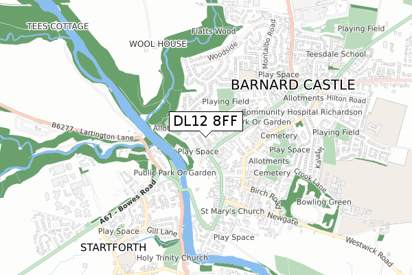
DL12 8FF is located in the Barnard Castle East electoral ward, within the unitary authority of County Durham and the English Parliamentary constituency of Bishop Auckland. The Sub Integrated Care Board (ICB) Location is NHS North East and North Cumbria ICB - 84H and the police force is Durham. This postcode has been in use since February 2020.


GetTheData
Source: OS Open Zoomstack (Ordnance Survey)
Licence: Open Government Licence (requires attribution)
Attribution: Contains OS data © Crown copyright and database right 2025
Source: Open Postcode Geo
Licence: Open Government Licence (requires attribution)
Attribution: Contains OS data © Crown copyright and database right 2025; Contains Royal Mail data © Royal Mail copyright and database right 2025; Source: Office for National Statistics licensed under the Open Government Licence v.3.0
| Easting | 410473 |
| Northing | 514936 |
| Latitude | 54.529608 |
| Longitude | -1.839692 |
GetTheData
Source: Open Postcode Geo
Licence: Open Government Licence
| Country | England |
| Postcode District | DL12 |
➜ See where DL12 is on a map | |
GetTheData
Source: Land Registry Price Paid Data
Licence: Open Government Licence
| Ward | Barnard Castle East |
| Constituency | Bishop Auckland |
GetTheData
Source: ONS Postcode Database
Licence: Open Government Licence
| Village (Street Not Known) | Whorlton | 89m |
| Village (Street Not Known) | Whorlton | 107m |
| Thorpe Hall (Street Not Known) | Wycliffe | 853m |
| Thorpe Hall (Street Not Known) | Wycliffe | 855m |
| Cottages (Bc - Whorlton U-c Lane) | Westwick | 1,015m |
GetTheData
Source: NaPTAN
Licence: Open Government Licence
GetTheData
Source: ONS Postcode Database
Licence: Open Government Licence

➜ Get more ratings from the Food Standards Agency
GetTheData
Source: Food Standards Agency
Licence: FSA terms & conditions
| Last Collection | |||
|---|---|---|---|
| Location | Mon-Fri | Sat | Distance |
| Hutton Magna | 16:15 | 11:00 | 3,236m |
| Smallways | 16:00 | 07:30 | 3,852m |
| Stainton Grove | 16:00 | 09:00 | 4,549m |
GetTheData
Source: Dracos
Licence: Creative Commons Attribution-ShareAlike
The below table lists the International Territorial Level (ITL) codes (formerly Nomenclature of Territorial Units for Statistics (NUTS) codes) and Local Administrative Units (LAU) codes for DL12 8FF:
| ITL 1 Code | Name |
|---|---|
| TLC | North East (England) |
| ITL 2 Code | Name |
| TLC1 | Tees Valley and Durham |
| ITL 3 Code | Name |
| TLC14 | Durham |
| LAU 1 Code | Name |
| E06000047 | County Durham |
GetTheData
Source: ONS Postcode Directory
Licence: Open Government Licence
The below table lists the Census Output Area (OA), Lower Layer Super Output Area (LSOA), and Middle Layer Super Output Area (MSOA) for DL12 8FF:
| Code | Name | |
|---|---|---|
| OA | E00105918 | |
| LSOA | E01020867 | County Durham 064H |
| MSOA | E02004345 | County Durham 064 |
GetTheData
Source: ONS Postcode Directory
Licence: Open Government Licence
| DL12 8XL | The Steadings | 51m |
| DL12 8XD | 93m | |
| DL12 8UY | Grange Terrace | 137m |
| DL12 8XE | The Green | 146m |
| DL12 8XA | 162m | |
| DL12 8UZ | Grange Cottages | 192m |
| DL12 8XQ | 193m | |
| DL12 8XF | Hallgarth | 234m |
| DL12 8XG | 247m | |
| DL12 9TP | 756m |
GetTheData
Source: Open Postcode Geo; Land Registry Price Paid Data
Licence: Open Government Licence