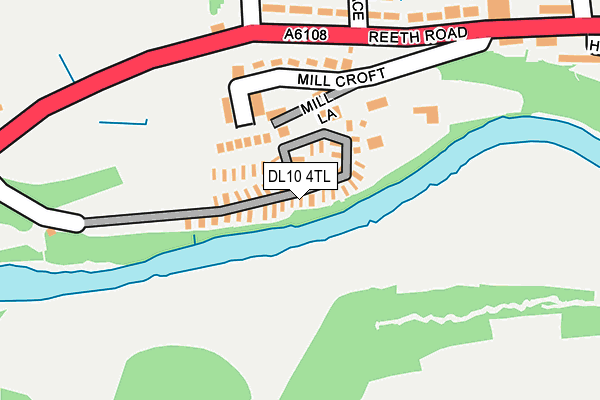
DL10 4TL is located in the Richmond electoral ward, within the unitary authority of North Yorkshire and the English Parliamentary constituency of Richmond (Yorks). The Sub Integrated Care Board (ICB) Location is NHS Humber and North Yorkshire ICB - 42D and the police force is North Yorkshire. This postcode has been in use since January 1980.


GetTheData
Source: OS OpenMap – Local (Ordnance Survey)
Source: OS VectorMap District (Ordnance Survey)
Licence: Open Government Licence (requires attribution)
| Easting | 415972 |
| Northing | 500907 |
| Latitude | 54.403379 |
| Longitude | -1.755466 |
GetTheData
Source: Open Postcode Geo
Licence: Open Government Licence
| Country | England |
| Postcode District | DL10 |
➜ See where DL10 is on a map ➜ Where is Richmond? | |
GetTheData
Source: Land Registry Price Paid Data
Licence: Open Government Licence
Elevation or altitude of DL10 4TL as distance above sea level:
| Metres | Feet | |
|---|---|---|
| Elevation | 110m | 361ft |
Elevation is measured from the approximate centre of the postcode, to the nearest point on an OS contour line from OS Terrain 50, which has contour spacing of ten vertical metres.
➜ How high above sea level am I? Find the elevation of your current position using your device's GPS.
GetTheData
Source: Open Postcode Elevation
Licence: Open Government Licence
| Ward | Richmond |
| Constituency | Richmond (Yorks) |
GetTheData
Source: ONS Postcode Database
Licence: Open Government Licence
| Whitcliffe Place | Hurgill | 188m |
| Whitcliffe Place (Reeth Road) | Hurgill | 189m |
| Whitcliffe Place (Reeth Road) | Hurgill | 192m |
| Coronation Place | Hurgill | 194m |
| The Old Convent (Reeth Road) | Hurgill | 268m |
GetTheData
Source: NaPTAN
Licence: Open Government Licence
| Median download speed | 36.8Mbps |
| Average download speed | 33.9Mbps |
| Maximum download speed | 47.51Mbps |
| Median upload speed | 5.0Mbps |
| Average upload speed | 4.2Mbps |
| Maximum upload speed | 5.84Mbps |
GetTheData
Source: Ofcom
Licence: Ofcom Terms of Use (requires attribution)
GetTheData
Source: ONS Postcode Database
Licence: Open Government Licence


➜ Get more ratings from the Food Standards Agency
GetTheData
Source: Food Standards Agency
Licence: FSA terms & conditions
| Last Collection | |||
|---|---|---|---|
| Location | Mon-Fri | Sat | Distance |
| Reeth Road | 17:15 | 11:00 | 293m |
| West End | 17:15 | 11:30 | 705m |
| The Green, | 17:15 | 11:00 | 1,009m |
GetTheData
Source: Dracos
Licence: Creative Commons Attribution-ShareAlike
| Risk of DL10 4TL flooding from rivers and sea | High |
| ➜ DL10 4TL flood map | |
GetTheData
Source: Open Flood Risk by Postcode
Licence: Open Government Licence
The below table lists the International Territorial Level (ITL) codes (formerly Nomenclature of Territorial Units for Statistics (NUTS) codes) and Local Administrative Units (LAU) codes for DL10 4TL:
| ITL 1 Code | Name |
|---|---|
| TLE | Yorkshire and The Humber |
| ITL 2 Code | Name |
| TLE2 | North Yorkshire |
| ITL 3 Code | Name |
| TLE22 | North Yorkshire CC |
| LAU 1 Code | Name |
| E07000166 | Richmondshire |
GetTheData
Source: ONS Postcode Directory
Licence: Open Government Licence
The below table lists the Census Output Area (OA), Lower Layer Super Output Area (LSOA), and Middle Layer Super Output Area (MSOA) for DL10 4TL:
| Code | Name | |
|---|---|---|
| OA | E00141417 | |
| LSOA | E01027769 | Richmondshire 002E |
| MSOA | E02005783 | Richmondshire 002 |
GetTheData
Source: ONS Postcode Directory
Licence: Open Government Licence
| DL10 4HN | Mill Lane | 87m |
| DL10 4TR | Mill Croft | 112m |
| DL10 4HG | Reeth Road | 192m |
| DL10 4HB | Whitcliffe Terrace | 215m |
| DL10 4EX | Reeth Road | 239m |
| DL10 4HF | Coronation Place | 242m |
| DL10 4EA | Milltop | 265m |
| DL10 4EZ | Willance Grove | 274m |
| DL10 4EY | Fieldings Yard | 279m |
| DL10 4HD | Whitcliffe Place | 280m |
GetTheData
Source: Open Postcode Geo; Land Registry Price Paid Data
Licence: Open Government Licence