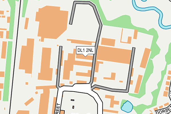
DL1 2NL is located in the Stephenson electoral ward, within the unitary authority of Darlington and the English Parliamentary constituency of Darlington. The Sub Integrated Care Board (ICB) Location is NHS North East and North Cumbria ICB - 16C and the police force is Durham. This postcode has been in use since July 1990.


GetTheData
Source: OS OpenMap – Local (Ordnance Survey)
Source: OS VectorMap District (Ordnance Survey)
Licence: Open Government Licence (requires attribution)
| Easting | 429952 |
| Northing | 515840 |
| Latitude | 54.536949 |
| Longitude | -1.538610 |
GetTheData
Source: Open Postcode Geo
Licence: Open Government Licence
| Country | England |
| Postcode District | DL1 |
➜ See where DL1 is on a map ➜ Where is Darlington? | |
GetTheData
Source: Land Registry Price Paid Data
Licence: Open Government Licence
Elevation or altitude of DL1 2NL as distance above sea level:
| Metres | Feet | |
|---|---|---|
| Elevation | 50m | 164ft |
Elevation is measured from the approximate centre of the postcode, to the nearest point on an OS contour line from OS Terrain 50, which has contour spacing of ten vertical metres.
➜ How high above sea level am I? Find the elevation of your current position using your device's GPS.
GetTheData
Source: Open Postcode Elevation
Licence: Open Government Licence
| Ward | Stephenson |
| Constituency | Darlington |
GetTheData
Source: ONS Postcode Database
Licence: Open Government Licence
| River View Industrial Estate (Dodsworth Street) | Albert Hill | 106m |
| St Williams Rc Church (Barton Street) | Albert Hill | 245m |
| Albert Hill Wmc (Dodsworth Street) | Albert Hill | 292m |
| Albert Hill Wmc (Dodsworth Street) | Albert Hill | 304m |
| St William's Rc Church (Barton Street) | Albert Hill | 322m |
| North Road Station | 1km |
| Darlington Station | 1.9km |
| Dinsdale Station | 5.2km |
GetTheData
Source: NaPTAN
Licence: Open Government Licence
GetTheData
Source: ONS Postcode Database
Licence: Open Government Licence


➜ Get more ratings from the Food Standards Agency
GetTheData
Source: Food Standards Agency
Licence: FSA terms & conditions
| Last Collection | |||
|---|---|---|---|
| Location | Mon-Fri | Sat | Distance |
| Haughton Road | 17:30 | 11:00 | 423m |
| Killinghall Street | 17:30 | 11:15 | 442m |
| Littlebeck Drive | 17:30 | 11:00 | 514m |
GetTheData
Source: Dracos
Licence: Creative Commons Attribution-ShareAlike
The below table lists the International Territorial Level (ITL) codes (formerly Nomenclature of Territorial Units for Statistics (NUTS) codes) and Local Administrative Units (LAU) codes for DL1 2NL:
| ITL 1 Code | Name |
|---|---|
| TLC | North East (England) |
| ITL 2 Code | Name |
| TLC1 | Tees Valley and Durham |
| ITL 3 Code | Name |
| TLC13 | Darlington |
| LAU 1 Code | Name |
| E06000005 | Darlington |
GetTheData
Source: ONS Postcode Directory
Licence: Open Government Licence
The below table lists the Census Output Area (OA), Lower Layer Super Output Area (LSOA), and Middle Layer Super Output Area (MSOA) for DL1 2NL:
| Code | Name | |
|---|---|---|
| OA | E00062063 | |
| LSOA | E01012307 | Darlington 009A |
| MSOA | E02002567 | Darlington 009 |
GetTheData
Source: ONS Postcode Directory
Licence: Open Government Licence
| DL1 2LN | Barton Street | 184m |
| DL1 2PA | Alliance Industrial Estate | 200m |
| DL1 2LS | Church Grove | 236m |
| DL1 2LZ | Nestfield Street | 266m |
| DL1 2LP | Barton Street | 317m |
| DL1 2LJ | Cornwall Avenue | 336m |
| DL1 2LE | Devonshire Road | 339m |
| DL1 2LY | Grey Street | 341m |
| DL1 2LH | Dorset Drive | 345m |
| DL1 2ND | Prescott Street | 354m |
GetTheData
Source: Open Postcode Geo; Land Registry Price Paid Data
Licence: Open Government Licence