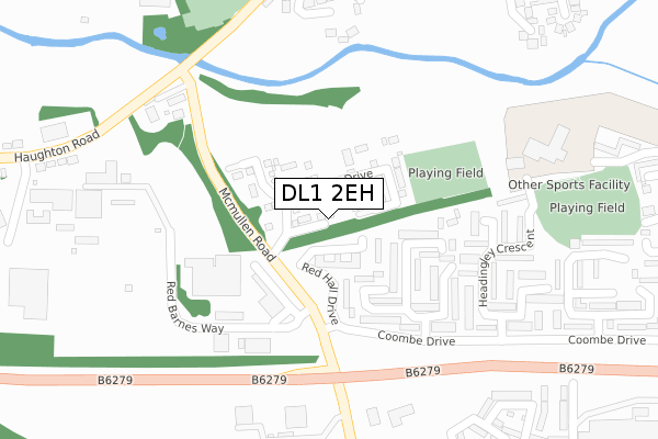
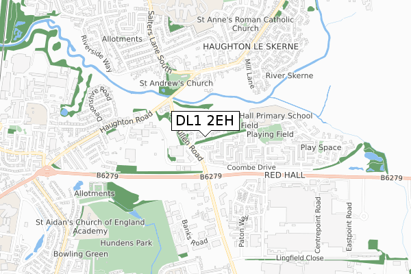
DL1 2EH is located in the Red Hall & Lingfield electoral ward, within the unitary authority of Darlington and the English Parliamentary constituency of Darlington. The Sub Integrated Care Board (ICB) Location is NHS North East and North Cumbria ICB - 16C and the police force is Durham. This postcode has been in use since July 2018.


GetTheData
Source: OS Open Zoomstack (Ordnance Survey)
Licence: Open Government Licence (requires attribution)
Attribution: Contains OS data © Crown copyright and database right 2025
Source: Open Postcode Geo
Licence: Open Government Licence (requires attribution)
Attribution: Contains OS data © Crown copyright and database right 2025; Contains Royal Mail data © Royal Mail copyright and database right 2025; Source: Office for National Statistics licensed under the Open Government Licence v.3.0
| Easting | 430926 |
| Northing | 515518 |
| Latitude | 54.534009 |
| Longitude | -1.523601 |
GetTheData
Source: Open Postcode Geo
Licence: Open Government Licence
| Country | England |
| Postcode District | DL1 |
➜ See where DL1 is on a map ➜ Where is Darlington? | |
GetTheData
Source: Land Registry Price Paid Data
Licence: Open Government Licence
| Ward | Red Hall & Lingfield |
| Constituency | Darlington |
GetTheData
Source: ONS Postcode Database
Licence: Open Government Licence
7, HEREFORD COURT, DARLINGTON, DL1 2EH 2019 18 MAR £170,996 |
GetTheData
Source: HM Land Registry Price Paid Data
Licence: Contains HM Land Registry data © Crown copyright and database right 2025. This data is licensed under the Open Government Licence v3.0.
| Red Hall Drive (Coombe Drive) | Red Hall | 185m |
| Red Hall Drive (Coombe Drive) | Red Hall | 192m |
| Mcmullen Road (Haughton Road) | Haughton Road | 296m |
| Mcmullen Road (Haughton Road) | Haughton Road | 314m |
| Blackett Road (Haughton Road) | Haughton Road | 366m |
| North Road Station | 2km |
| Darlington Station | 2.2km |
| Dinsdale Station | 4.2km |
GetTheData
Source: NaPTAN
Licence: Open Government Licence
| Percentage of properties with Next Generation Access | 100.0% |
| Percentage of properties with Superfast Broadband | 100.0% |
| Percentage of properties with Ultrafast Broadband | 100.0% |
| Percentage of properties with Full Fibre Broadband | 100.0% |
Superfast Broadband is between 30Mbps and 300Mbps
Ultrafast Broadband is > 300Mbps
| Percentage of properties unable to receive 2Mbps | 0.0% |
| Percentage of properties unable to receive 5Mbps | 0.0% |
| Percentage of properties unable to receive 10Mbps | 0.0% |
| Percentage of properties unable to receive 30Mbps | 0.0% |
GetTheData
Source: Ofcom
Licence: Ofcom Terms of Use (requires attribution)
GetTheData
Source: ONS Postcode Database
Licence: Open Government Licence


➜ Get more ratings from the Food Standards Agency
GetTheData
Source: Food Standards Agency
Licence: FSA terms & conditions
| Last Collection | |||
|---|---|---|---|
| Location | Mon-Fri | Sat | Distance |
| Coombe Drive | 17:00 | 11:15 | 335m |
| Haughton Le Skerne Post Office | 17:30 | 11:00 | 491m |
| Latimer Road | 17:30 | 11:15 | 602m |
GetTheData
Source: Dracos
Licence: Creative Commons Attribution-ShareAlike
The below table lists the International Territorial Level (ITL) codes (formerly Nomenclature of Territorial Units for Statistics (NUTS) codes) and Local Administrative Units (LAU) codes for DL1 2EH:
| ITL 1 Code | Name |
|---|---|
| TLC | North East (England) |
| ITL 2 Code | Name |
| TLC1 | Tees Valley and Durham |
| ITL 3 Code | Name |
| TLC13 | Darlington |
| LAU 1 Code | Name |
| E06000005 | Darlington |
GetTheData
Source: ONS Postcode Directory
Licence: Open Government Licence
The below table lists the Census Output Area (OA), Lower Layer Super Output Area (LSOA), and Middle Layer Super Output Area (MSOA) for DL1 2EH:
| Code | Name | |
|---|---|---|
| OA | E00062165 | |
| LSOA | E01012327 | Darlington 009B |
| MSOA | E02002567 | Darlington 009 |
GetTheData
Source: ONS Postcode Directory
Licence: Open Government Licence
| DL1 2RR | Red Barnes Way | 147m |
| DL1 2SL | Roker Close | 164m |
| DL1 2SW | Harringay Crescent | 196m |
| DL1 2TB | Mcmullen Road | 225m |
| DL1 2SP | Wimbledon Close | 240m |
| DL1 2SS | Trafford Close | 254m |
| DL1 2GA | Mcmullen Road | 255m |
| DL1 2SR | Headingley Crescent | 273m |
| DL1 2EA | Haughton Road | 279m |
| DL1 2ST | Headingley Crescent | 324m |
GetTheData
Source: Open Postcode Geo; Land Registry Price Paid Data
Licence: Open Government Licence