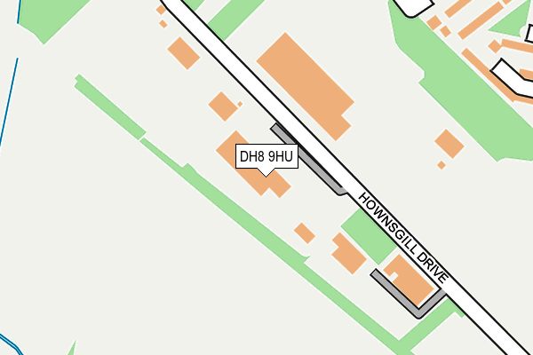
DH8 9HU lies on Hownsgill Drive in Consett. DH8 9HU is located in the Delves Lane electoral ward, within the unitary authority of County Durham and the English Parliamentary constituency of North West Durham. The Sub Integrated Care Board (ICB) Location is NHS North East and North Cumbria ICB - 84H and the police force is Durham. This postcode has been in use since January 1980.


GetTheData
Source: OS OpenMap – Local (Ordnance Survey)
Source: OS VectorMap District (Ordnance Survey)
Licence: Open Government Licence (requires attribution)
| Easting | 411760 |
| Northing | 549138 |
| Latitude | 54.836937 |
| Longitude | -1.818442 |
GetTheData
Source: Open Postcode Geo
Licence: Open Government Licence
| Street | Hownsgill Drive |
| Town/City | Consett |
| Country | England |
| Postcode District | DH8 |
➜ See where DH8 is on a map ➜ Where is Consett? | |
GetTheData
Source: Land Registry Price Paid Data
Licence: Open Government Licence
Elevation or altitude of DH8 9HU as distance above sea level:
| Metres | Feet | |
|---|---|---|
| Elevation | 200m | 656ft |
Elevation is measured from the approximate centre of the postcode, to the nearest point on an OS contour line from OS Terrain 50, which has contour spacing of ten vertical metres.
➜ How high above sea level am I? Find the elevation of your current position using your device's GPS.
GetTheData
Source: Open Postcode Elevation
Licence: Open Government Licence
| Ward | Delves Lane |
| Constituency | North West Durham |
GetTheData
Source: ONS Postcode Database
Licence: Open Government Licence
| Broadway (Delves Lane) | Delves | 350m |
| Broadway (Delves Lane) | Delves | 352m |
| Greenways (Delves Lane) | Delves | 371m |
| Briardale - Delves Lane (Briardale) | Delves | 392m |
| Greenways (Delves Lane) | Delves | 395m |
GetTheData
Source: NaPTAN
Licence: Open Government Licence
GetTheData
Source: ONS Postcode Database
Licence: Open Government Licence


➜ Get more ratings from the Food Standards Agency
GetTheData
Source: Food Standards Agency
Licence: FSA terms & conditions
| Last Collection | |||
|---|---|---|---|
| Location | Mon-Fri | Sat | Distance |
| Delves Lane Post Office | 16:45 | 11:45 | 457m |
| Greenways | 16:30 | 11:45 | 615m |
| Knitsley | 16:00 | 11:30 | 627m |
GetTheData
Source: Dracos
Licence: Creative Commons Attribution-ShareAlike
The below table lists the International Territorial Level (ITL) codes (formerly Nomenclature of Territorial Units for Statistics (NUTS) codes) and Local Administrative Units (LAU) codes for DH8 9HU:
| ITL 1 Code | Name |
|---|---|
| TLC | North East (England) |
| ITL 2 Code | Name |
| TLC1 | Tees Valley and Durham |
| ITL 3 Code | Name |
| TLC14 | Durham |
| LAU 1 Code | Name |
| E06000047 | County Durham |
GetTheData
Source: ONS Postcode Directory
Licence: Open Government Licence
The below table lists the Census Output Area (OA), Lower Layer Super Output Area (LSOA), and Middle Layer Super Output Area (MSOA) for DH8 9HU:
| Code | Name | |
|---|---|---|
| OA | E00104780 | |
| LSOA | E01020651 | County Durham 012B |
| MSOA | E02004304 | County Durham 012 |
GetTheData
Source: ONS Postcode Directory
Licence: Open Government Licence
| DH8 7AP | Broadway | 185m |
| DH8 7AU | Sunningdale | 204m |
| DH8 7AW | Fell Side | 272m |
| DH8 7AS | Sunningdale | 274m |
| DH8 7AN | Witton Street | 276m |
| DH8 7AT | Sunningdale | 276m |
| DH8 7AR | Broadway | 277m |
| DH8 7AG | Grange Street | 306m |
| DH8 7AF | Mill Street | 321m |
| DH8 7BA | Delves Lane | 323m |
GetTheData
Source: Open Postcode Geo; Land Registry Price Paid Data
Licence: Open Government Licence