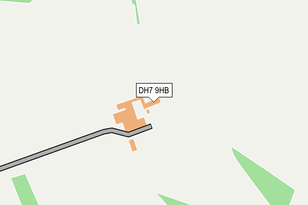
DH7 9HB is located in the Deerness electoral ward, within the unitary authority of County Durham and the English Parliamentary constituency of City of Durham. The Sub Integrated Care Board (ICB) Location is NHS North East and North Cumbria ICB - 84H and the police force is Durham. This postcode has been in use since January 1980.


GetTheData
Source: OS OpenMap – Local (Ordnance Survey)
Source: OS VectorMap District (Ordnance Survey)
Licence: Open Government Licence (requires attribution)
| Easting | 417777 |
| Northing | 541707 |
| Latitude | 54.769976 |
| Longitude | -1.725207 |
GetTheData
Source: Open Postcode Geo
Licence: Open Government Licence
| Country | England |
| Postcode District | DH7 |
➜ See where DH7 is on a map | |
GetTheData
Source: Land Registry Price Paid Data
Licence: Open Government Licence
Elevation or altitude of DH7 9HB as distance above sea level:
| Metres | Feet | |
|---|---|---|
| Elevation | 190m | 623ft |
Elevation is measured from the approximate centre of the postcode, to the nearest point on an OS contour line from OS Terrain 50, which has contour spacing of ten vertical metres.
➜ How high above sea level am I? Find the elevation of your current position using your device's GPS.
GetTheData
Source: Open Postcode Elevation
Licence: Open Government Licence
| Ward | Deerness |
| Constituency | City Of Durham |
GetTheData
Source: ONS Postcode Database
Licence: Open Government Licence
| Larks Hill Estate (Woodlands Road) | Esh Winning | 584m |
| Larks Hill Estate (Woodlands Road) | Esh Winning | 597m |
| Larks Hill - Osprey Close (Woodlands Road) | Esh Winning | 635m |
| Larks Hill - Osprey Close (Woodlands Road) | Esh Winning | 645m |
| Larks Hill - Merlin Court (Woodlands Road) | Esh Winning | 775m |
GetTheData
Source: NaPTAN
Licence: Open Government Licence
GetTheData
Source: ONS Postcode Database
Licence: Open Government Licence


➜ Get more ratings from the Food Standards Agency
GetTheData
Source: Food Standards Agency
Licence: FSA terms & conditions
| Last Collection | |||
|---|---|---|---|
| Location | Mon-Fri | Sat | Distance |
| Buttons Place, Waterhouses | 16:00 | 11:30 | 992m |
| Arbour Court Ave, Esh Winning | 16:10 | 10:30 | 1,074m |
| Esh Winning Post Office | 17:05 | 11:30 | 1,363m |
GetTheData
Source: Dracos
Licence: Creative Commons Attribution-ShareAlike
The below table lists the International Territorial Level (ITL) codes (formerly Nomenclature of Territorial Units for Statistics (NUTS) codes) and Local Administrative Units (LAU) codes for DH7 9HB:
| ITL 1 Code | Name |
|---|---|
| TLC | North East (England) |
| ITL 2 Code | Name |
| TLC1 | Tees Valley and Durham |
| ITL 3 Code | Name |
| TLC14 | Durham |
| LAU 1 Code | Name |
| E06000047 | County Durham |
GetTheData
Source: ONS Postcode Directory
Licence: Open Government Licence
The below table lists the Census Output Area (OA), Lower Layer Super Output Area (LSOA), and Middle Layer Super Output Area (MSOA) for DH7 9HB:
| Code | Name | |
|---|---|---|
| OA | E00105063 | |
| LSOA | E01020706 | County Durham 031B |
| MSOA | E02004316 | County Durham 031 |
GetTheData
Source: ONS Postcode Directory
Licence: Open Government Licence
| DH7 9JP | Osprey Close | 693m |
| DH7 9JS | Raven Court | 719m |
| DH7 9JT | Merlin Court | 732m |
| DH7 9JW | Falcon Way | 735m |
| DH7 9JN | Swallow Close | 823m |
| DH7 9BT | Laurel Court | 823m |
| DH7 9JF | Dene Park | 850m |
| DH7 9LZ | Briardene | 869m |
| DH7 9AL | Hamilton Close | 879m |
| DH7 9JB | Cypress Park | 899m |
GetTheData
Source: Open Postcode Geo; Land Registry Price Paid Data
Licence: Open Government Licence