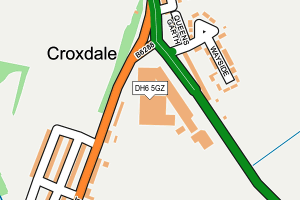
DH6 5GZ is located in the Coxhoe electoral ward, within the unitary authority of County Durham and the English Parliamentary constituency of City of Durham. The Sub Integrated Care Board (ICB) Location is NHS North East and North Cumbria ICB - 84H and the police force is Durham. This postcode has been in use since March 2017.


GetTheData
Source: OS OpenMap – Local (Ordnance Survey)
Source: OS VectorMap District (Ordnance Survey)
Licence: Open Government Licence (requires attribution)
| Easting | 426760 |
| Northing | 536867 |
| Latitude | 54.726096 |
| Longitude | -1.586037 |
GetTheData
Source: Open Postcode Geo
Licence: Open Government Licence
| Country | England |
| Postcode District | DH6 |
➜ See where DH6 is on a map ➜ Where is Croxdale? | |
GetTheData
Source: Land Registry Price Paid Data
Licence: Open Government Licence
| Ward | Coxhoe |
| Constituency | City Of Durham |
GetTheData
Source: ONS Postcode Database
Licence: Open Government Licence
| Roundabout (A167) | Croxdale | 66m |
| Roundabout (A167) | Croxdale | 93m |
| Corner Shop (B6288 Front Street) | Croxdale | 195m |
| Corner Shop (B6288 Front Street) | Croxdale | 260m |
| Rogerson Terrace (A167) | Croxdale | 284m |
GetTheData
Source: NaPTAN
Licence: Open Government Licence
GetTheData
Source: ONS Postcode Database
Licence: Open Government Licence


➜ Get more ratings from the Food Standards Agency
GetTheData
Source: Food Standards Agency
Licence: FSA terms & conditions
| Last Collection | |||
|---|---|---|---|
| Location | Mon-Fri | Sat | Distance |
| Johnsons Terrace, Croxdale | 16:00 | 10:15 | 440m |
| Sunderland Bridge | 16:00 | 10:30 | 753m |
| Tudhoe Colliery | 17:00 | 10:45 | 1,404m |
GetTheData
Source: Dracos
Licence: Creative Commons Attribution-ShareAlike
The below table lists the International Territorial Level (ITL) codes (formerly Nomenclature of Territorial Units for Statistics (NUTS) codes) and Local Administrative Units (LAU) codes for DH6 5GZ:
| ITL 1 Code | Name |
|---|---|
| TLC | North East (England) |
| ITL 2 Code | Name |
| TLC1 | Tees Valley and Durham |
| ITL 3 Code | Name |
| TLC14 | Durham |
| LAU 1 Code | Name |
| E06000047 | County Durham |
GetTheData
Source: ONS Postcode Directory
Licence: Open Government Licence
The below table lists the Census Output Area (OA), Lower Layer Super Output Area (LSOA), and Middle Layer Super Output Area (MSOA) for DH6 5GZ:
| Code | Name | |
|---|---|---|
| OA | E00105027 | |
| LSOA | E01020696 | County Durham 041B |
| MSOA | E02004318 | County Durham 041 |
GetTheData
Source: ONS Postcode Directory
Licence: Open Government Licence
| DH6 5HU | Valley View | 72m |
| DH6 5HP | Foster Terrace | 104m |
| DH6 5HW | Wayside | 146m |
| DH6 5HN | Queens Garth | 152m |
| DH6 5HX | Front Street East | 202m |
| DH6 5JA | Salvin Street | 227m |
| DH6 5JB | Wood View | 243m |
| DH6 5HY | Front Street | 243m |
| DH6 5HZ | Salvin Street | 250m |
| DH6 5JE | Windsor Court | 274m |
GetTheData
Source: Open Postcode Geo; Land Registry Price Paid Data
Licence: Open Government Licence