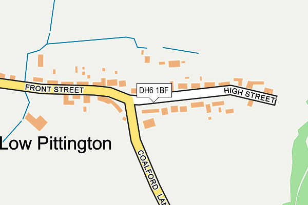
DH6 1BF is located in the Sherburn electoral ward, within the unitary authority of County Durham and the English Parliamentary constituency of City of Durham. The Sub Integrated Care Board (ICB) Location is NHS North East and North Cumbria ICB - 84H and the police force is Durham. This postcode has been in use since July 2017.


GetTheData
Source: OS OpenMap – Local (Ordnance Survey)
Source: OS VectorMap District (Ordnance Survey)
Licence: Open Government Licence (requires attribution)
| Easting | 432757 |
| Northing | 544787 |
| Latitude | 54.796912 |
| Longitude | -1.492040 |
GetTheData
Source: Open Postcode Geo
Licence: Open Government Licence
| Country | England |
| Postcode District | DH6 |
➜ See where DH6 is on a map | |
GetTheData
Source: Land Registry Price Paid Data
Licence: Open Government Licence
| Ward | Sherburn |
| Constituency | City Of Durham |
GetTheData
Source: ONS Postcode Database
Licence: Open Government Licence
| Front Street | Low Pittington | 182m |
| Front Street | Low Pittington | 254m |
| Blacksmiths Arms (Station Road) | Low Pittington | 343m |
| Blacksmiths Arms (Station Road) | Low Pittington | 353m |
| Wellington Street (St Johns Road) | High Pittington | 419m |
GetTheData
Source: NaPTAN
Licence: Open Government Licence
GetTheData
Source: ONS Postcode Database
Licence: Open Government Licence


➜ Get more ratings from the Food Standards Agency
GetTheData
Source: Food Standards Agency
Licence: FSA terms & conditions
| Last Collection | |||
|---|---|---|---|
| Location | Mon-Fri | Sat | Distance |
| Low Pittington | 16:45 | 09:45 | 22m |
| Pittington Post Office | 17:00 | 12:00 | 540m |
| Church Vale, Sherburn | 16:30 | 09:45 | 905m |
GetTheData
Source: Dracos
Licence: Creative Commons Attribution-ShareAlike
The below table lists the International Territorial Level (ITL) codes (formerly Nomenclature of Territorial Units for Statistics (NUTS) codes) and Local Administrative Units (LAU) codes for DH6 1BF:
| ITL 1 Code | Name |
|---|---|
| TLC | North East (England) |
| ITL 2 Code | Name |
| TLC1 | Tees Valley and Durham |
| ITL 3 Code | Name |
| TLC14 | Durham |
| LAU 1 Code | Name |
| E06000047 | County Durham |
GetTheData
Source: ONS Postcode Directory
Licence: Open Government Licence
The below table lists the Census Output Area (OA), Lower Layer Super Output Area (LSOA), and Middle Layer Super Output Area (MSOA) for DH6 1BF:
| Code | Name | |
|---|---|---|
| OA | E00105172 | |
| LSOA | E01020725 | County Durham 027A |
| MSOA | E02004311 | County Durham 027 |
GetTheData
Source: ONS Postcode Directory
Licence: Open Government Licence
| DH6 1BE | High Street | 66m |
| DH6 1BG | Coronation Crescent | 86m |
| DH6 1BH | Pioneer Cottages | 148m |
| DH6 1BQ | Front Street | 170m |
| DH6 1BP | Front Street | 233m |
| DH6 1BJ | Station Road | 330m |
| DH6 1AY | 353m | |
| DH6 1BD | Elemore Street | 403m |
| DH6 1AZ | Wellington Street | 430m |
| DH6 1BB | Hillside Grove | 432m |
GetTheData
Source: Open Postcode Geo; Land Registry Price Paid Data
Licence: Open Government Licence