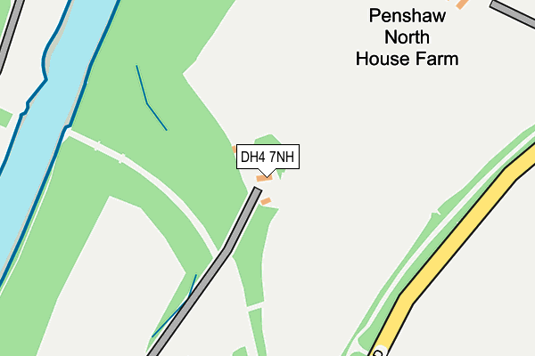
DH4 7NH is located in the Shiney Row electoral ward, within the metropolitan district of Sunderland and the English Parliamentary constituency of Houghton and Sunderland South. The Sub Integrated Care Board (ICB) Location is NHS North East and North Cumbria ICB - 00P and the police force is Northumbria. This postcode has been in use since January 1980.


GetTheData
Source: OS OpenMap – Local (Ordnance Survey)
Source: OS VectorMap District (Ordnance Survey)
Licence: Open Government Licence (requires attribution)
| Easting | 432243 |
| Northing | 554485 |
| Latitude | 54.884083 |
| Longitude | -1.498944 |
GetTheData
Source: Open Postcode Geo
Licence: Open Government Licence
| Country | England |
| Postcode District | DH4 |
➜ See where DH4 is on a map | |
GetTheData
Source: Land Registry Price Paid Data
Licence: Open Government Licence
Elevation or altitude of DH4 7NH as distance above sea level:
| Metres | Feet | |
|---|---|---|
| Elevation | 30m | 98ft |
Elevation is measured from the approximate centre of the postcode, to the nearest point on an OS contour line from OS Terrain 50, which has contour spacing of ten vertical metres.
➜ How high above sea level am I? Find the elevation of your current position using your device's GPS.
GetTheData
Source: Open Postcode Elevation
Licence: Open Government Licence
| Ward | Shiney Row |
| Constituency | Houghton And Sunderland South |
GetTheData
Source: ONS Postcode Database
Licence: Open Government Licence
| Langdale Road-eskdale (Landgdale Road) | Barnwell | 791m |
| Back Lane-the Limes (Back Lane) | Barnwell | 792m |
| Langdale Road-eskdale (Langdale Road) | Barnwell | 801m |
| Langdale Road-railway Monument (Langdale Road) | Barnwell | 825m |
| The Limes (Back Lane) | Barnwell | 835m |
GetTheData
Source: NaPTAN
Licence: Open Government Licence
| Percentage of properties with Next Generation Access | 66.7% |
| Percentage of properties with Superfast Broadband | 66.7% |
| Percentage of properties with Ultrafast Broadband | 0.0% |
| Percentage of properties with Full Fibre Broadband | 0.0% |
Superfast Broadband is between 30Mbps and 300Mbps
Ultrafast Broadband is > 300Mbps
| Percentage of properties unable to receive 2Mbps | 0.0% |
| Percentage of properties unable to receive 5Mbps | 33.3% |
| Percentage of properties unable to receive 10Mbps | 33.3% |
| Percentage of properties unable to receive 30Mbps | 33.3% |
GetTheData
Source: Ofcom
Licence: Ofcom Terms of Use (requires attribution)
GetTheData
Source: ONS Postcode Database
Licence: Open Government Licence


➜ Get more ratings from the Food Standards Agency
GetTheData
Source: Food Standards Agency
Licence: FSA terms & conditions
| Last Collection | |||
|---|---|---|---|
| Location | Mon-Fri | Sat | Distance |
| Gowanburn | 16:45 | 10:30 | 616m |
| Worm Hill Terrace | 17:15 | 12:30 | 1,141m |
| Arts Centre | 16:45 | 10:30 | 1,320m |
GetTheData
Source: Dracos
Licence: Creative Commons Attribution-ShareAlike
The below table lists the International Territorial Level (ITL) codes (formerly Nomenclature of Territorial Units for Statistics (NUTS) codes) and Local Administrative Units (LAU) codes for DH4 7NH:
| ITL 1 Code | Name |
|---|---|
| TLC | North East (England) |
| ITL 2 Code | Name |
| TLC2 | Northumberland, and Tyne and Wear |
| ITL 3 Code | Name |
| TLC23 | Sunderland |
| LAU 1 Code | Name |
| E08000024 | Sunderland |
GetTheData
Source: ONS Postcode Directory
Licence: Open Government Licence
The below table lists the Census Output Area (OA), Lower Layer Super Output Area (LSOA), and Middle Layer Super Output Area (MSOA) for DH4 7NH:
| Code | Name | |
|---|---|---|
| OA | E00165667 | |
| LSOA | E01032484 | Sunderland 032G |
| MSOA | E02001822 | Sunderland 032 |
GetTheData
Source: ONS Postcode Directory
Licence: Open Government Licence
| DH4 7NQ | 240m | |
| NE38 8LQ | 351m | |
| NE38 8JY | Jubilee Terrace | 503m |
| DH4 7NG | Railway Cottages | 528m |
| NE38 0RB | Leaplish | 591m |
| NE38 8PQ | Garrigill | 608m |
| NE38 8PH | Whittonstall | 682m |
| DH4 7HZ | Ennerdale Crescent | 694m |
| NE38 8SG | Gowanburn | 699m |
| DH4 7JA | Teesdale Avenue | 700m |
GetTheData
Source: Open Postcode Geo; Land Registry Price Paid Data
Licence: Open Government Licence