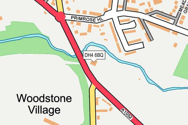
DH4 6BQ is located in the Lumley electoral ward, within the unitary authority of County Durham and the English Parliamentary constituency of North Durham. The Sub Integrated Care Board (ICB) Location is NHS North East and North Cumbria ICB - 84H and the police force is Durham. This postcode has been in use since January 1980.


GetTheData
Source: OS OpenMap – Local (Ordnance Survey)
Source: OS VectorMap District (Ordnance Survey)
Licence: Open Government Licence (requires attribution)
| Easting | 431105 |
| Northing | 550802 |
| Latitude | 54.851059 |
| Longitude | -1.517077 |
GetTheData
Source: Open Postcode Geo
Licence: Open Government Licence
| Country | England |
| Postcode District | DH4 |
➜ See where DH4 is on a map ➜ Where is Bournmoor? | |
GetTheData
Source: Land Registry Price Paid Data
Licence: Open Government Licence
Elevation or altitude of DH4 6BQ as distance above sea level:
| Metres | Feet | |
|---|---|---|
| Elevation | 40m | 131ft |
Elevation is measured from the approximate centre of the postcode, to the nearest point on an OS contour line from OS Terrain 50, which has contour spacing of ten vertical metres.
➜ How high above sea level am I? Find the elevation of your current position using your device's GPS.
GetTheData
Source: Open Postcode Elevation
Licence: Open Government Licence
| Ward | Lumley |
| Constituency | North Durham |
GetTheData
Source: ONS Postcode Database
Licence: Open Government Licence
| Fire Station (A1052) | Woodstone Village | 168m |
| Community Centre (Un-named Road Off A1052) | New Lambton | 176m |
| Community Centre (Un-named Road Off A1052) | New Lambton | 194m |
| Primrose Hill (Un-named Road) | Bournmoor | 215m |
| Aged Miners Homes (North View) | New Lambton | 263m |
| Chester-le-Street Station | 3.9km |
GetTheData
Source: NaPTAN
Licence: Open Government Licence
GetTheData
Source: ONS Postcode Database
Licence: Open Government Licence


➜ Get more ratings from the Food Standards Agency
GetTheData
Source: Food Standards Agency
Licence: FSA terms & conditions
| Last Collection | |||
|---|---|---|---|
| Location | Mon-Fri | Sat | Distance |
| The Meadows, Bournmoor | 17:00 | 11:45 | 536m |
| Chester Road | 16:45 | 11:30 | 867m |
| Castle Dene | 16:45 | 09:30 | 1,473m |
GetTheData
Source: Dracos
Licence: Creative Commons Attribution-ShareAlike
The below table lists the International Territorial Level (ITL) codes (formerly Nomenclature of Territorial Units for Statistics (NUTS) codes) and Local Administrative Units (LAU) codes for DH4 6BQ:
| ITL 1 Code | Name |
|---|---|
| TLC | North East (England) |
| ITL 2 Code | Name |
| TLC1 | Tees Valley and Durham |
| ITL 3 Code | Name |
| TLC14 | Durham |
| LAU 1 Code | Name |
| E06000047 | County Durham |
GetTheData
Source: ONS Postcode Directory
Licence: Open Government Licence
The below table lists the Census Output Area (OA), Lower Layer Super Output Area (LSOA), and Middle Layer Super Output Area (MSOA) for DH4 6BQ:
| Code | Name | |
|---|---|---|
| OA | E00104460 | |
| LSOA | E01020590 | County Durham 015A |
| MSOA | E02004295 | County Durham 015 |
GetTheData
Source: ONS Postcode Directory
Licence: Open Government Licence
| DH4 6DJ | Mill Court | 96m |
| DH4 6BJ | Callington Close | 96m |
| DH4 6BL | Callington Close | 152m |
| DH4 6BH | Primrose Hill | 158m |
| DH4 6BW | Panfield Terrace | 189m |
| DH4 6BZ | Orchid Square | 204m |
| DH4 6BP | Langtons Terrace | 222m |
| DH4 6DH | Woodburn Close | 232m |
| DH4 6EN | Primrose Crescent | 252m |
| DH4 6DA | North View | 252m |
GetTheData
Source: Open Postcode Geo; Land Registry Price Paid Data
Licence: Open Government Licence