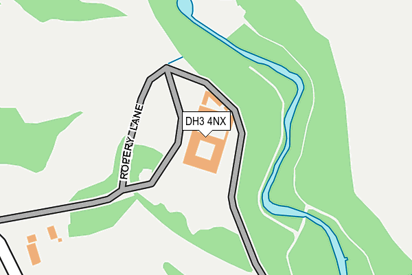
DH3 4NX is located in the Lumley electoral ward, within the unitary authority of County Durham and the English Parliamentary constituency of North Durham. The Sub Integrated Care Board (ICB) Location is NHS North East and North Cumbria ICB - 84H and the police force is Durham. This postcode has been in use since January 1980.


GetTheData
Source: OS OpenMap – Local (Ordnance Survey)
Source: OS VectorMap District (Ordnance Survey)
Licence: Open Government Licence (requires attribution)
| Easting | 428785 |
| Northing | 551068 |
| Latitude | 54.853587 |
| Longitude | -1.553182 |
GetTheData
Source: Open Postcode Geo
Licence: Open Government Licence
| Country | England |
| Postcode District | DH3 |
➜ See where DH3 is on a map | |
GetTheData
Source: Land Registry Price Paid Data
Licence: Open Government Licence
Elevation or altitude of DH3 4NX as distance above sea level:
| Metres | Feet | |
|---|---|---|
| Elevation | 30m | 98ft |
Elevation is measured from the approximate centre of the postcode, to the nearest point on an OS contour line from OS Terrain 50, which has contour spacing of ten vertical metres.
➜ How high above sea level am I? Find the elevation of your current position using your device's GPS.
GetTheData
Source: Open Postcode Elevation
Licence: Open Government Licence
| Ward | Lumley |
| Constituency | North Durham |
GetTheData
Source: ONS Postcode Database
Licence: Open Government Licence
| Golf Club - Bridge (B1284 Lumley New Road) | Chester-le-street | 375m |
| Golf Club - Bridge (B1284 Lumley New Road) | Chester-le-street | 393m |
| Durham County Cricket Ground (Unclassified) | Chester-le-street | 591m |
| Riverside Cricket Ground (B1284 Lumley New Road) | Chester-le-street | 653m |
| Riverside Cricket Ground (B1284 Lumley New Road) | Chester-le-street | 669m |
| Chester-le-Street Station | 1.6km |
GetTheData
Source: NaPTAN
Licence: Open Government Licence
GetTheData
Source: ONS Postcode Database
Licence: Open Government Licence


➜ Get more ratings from the Food Standards Agency
GetTheData
Source: Food Standards Agency
Licence: FSA terms & conditions
| Last Collection | |||
|---|---|---|---|
| Location | Mon-Fri | Sat | Distance |
| Ropery Lane | 18:30 | 11:45 | 916m |
| Bradman Drive | 17:30 | 11:30 | 931m |
| Castle Dene | 16:45 | 09:30 | 1,121m |
GetTheData
Source: Dracos
Licence: Creative Commons Attribution-ShareAlike
The below table lists the International Territorial Level (ITL) codes (formerly Nomenclature of Territorial Units for Statistics (NUTS) codes) and Local Administrative Units (LAU) codes for DH3 4NX:
| ITL 1 Code | Name |
|---|---|
| TLC | North East (England) |
| ITL 2 Code | Name |
| TLC1 | Tees Valley and Durham |
| ITL 3 Code | Name |
| TLC14 | Durham |
| LAU 1 Code | Name |
| E06000047 | County Durham |
GetTheData
Source: ONS Postcode Directory
Licence: Open Government Licence
The below table lists the Census Output Area (OA), Lower Layer Super Output Area (LSOA), and Middle Layer Super Output Area (MSOA) for DH3 4NX:
| Code | Name | |
|---|---|---|
| OA | E00104460 | |
| LSOA | E01020590 | County Durham 015A |
| MSOA | E02004295 | County Durham 015 |
GetTheData
Source: ONS Postcode Directory
Licence: Open Government Licence
| DH3 3PN | Park Road Central | 817m |
| DH3 3QT | Milburn Close | 842m |
| DH3 3PL | Queens Park | 846m |
| DH3 3NS | Castle Close | 879m |
| DH3 3QS | Bradman Drive | 881m |
| DH3 3NR | Plantagenet Avenue | 912m |
| DH3 3QU | Hutton Close | 913m |
| DH3 3NN | Ropery Lane | 918m |
| DH3 3NW | Lancaster Terrace | 928m |
| DH3 3PP | Lindom Avenue | 946m |
GetTheData
Source: Open Postcode Geo; Land Registry Price Paid Data
Licence: Open Government Licence