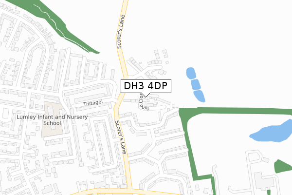
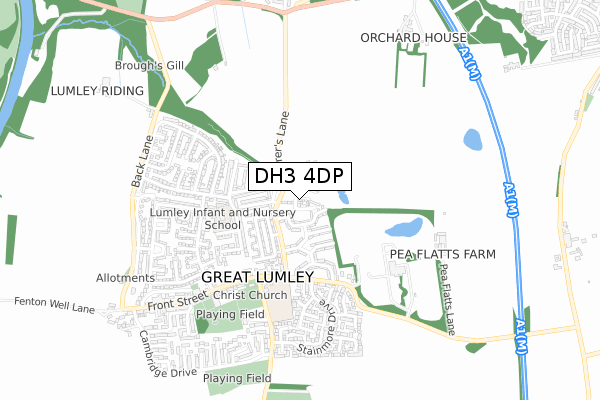
DH3 4DP is located in the Lumley electoral ward, within the unitary authority of County Durham and the English Parliamentary constituency of North Durham. The Sub Integrated Care Board (ICB) Location is NHS North East and North Cumbria ICB - 84H and the police force is Durham. This postcode has been in use since December 2019.


GetTheData
Source: OS Open Zoomstack (Ordnance Survey)
Licence: Open Government Licence (requires attribution)
Attribution: Contains OS data © Crown copyright and database right 2025
Source: Open Postcode Geo
Licence: Open Government Licence (requires attribution)
Attribution: Contains OS data © Crown copyright and database right 2025; Contains Royal Mail data © Royal Mail copyright and database right 2025; Source: Office for National Statistics licensed under the Open Government Licence v.3.0
| Easting | 429741 |
| Northing | 549583 |
| Latitude | 54.840196 |
| Longitude | -1.538458 |
GetTheData
Source: Open Postcode Geo
Licence: Open Government Licence
| Country | England |
| Postcode District | DH3 |
➜ See where DH3 is on a map ➜ Where is Great Lumley? | |
GetTheData
Source: Land Registry Price Paid Data
Licence: Open Government Licence
| Ward | Lumley |
| Constituency | North Durham |
GetTheData
Source: ONS Postcode Database
Licence: Open Government Licence
2023 30 OCT £328,000 |
2023 7 JUN £256,000 |
2022 13 JUL £230,000 |
2020 26 JUN £224,995 |
11, TYNE CLOSE, GREAT LUMLEY, CHESTER LE STREET, DH3 4DP 2020 6 MAR £226,895 |
14, TYNE CLOSE, GREAT LUMLEY, CHESTER LE STREET, DH3 4DP 2020 21 FEB £227,995 |
12, TYNE CLOSE, GREAT LUMLEY, CHESTER LE STREET, DH3 4DP 2020 31 JAN £232,995 |
2, TYNE CLOSE, GREAT LUMLEY, CHESTER LE STREET, DH3 4DP 2020 17 JAN £272,495 |
2020 16 JAN £232,995 |
8, TYNE CLOSE, GREAT LUMLEY, CHESTER LE STREET, DH3 4DP 2020 16 JAN £219,995 |
GetTheData
Source: HM Land Registry Price Paid Data
Licence: Contains HM Land Registry data © Crown copyright and database right 2025. This data is licensed under the Open Government Licence v3.0.
| Sevenacres (Scorers Lane) | Great Lumley | 146m |
| Sevenacres (Scorers Lane) | Great Lumley | 182m |
| Windsor Terrace (Scorers Lane) | Great Lumley | 239m |
| Don Crescent (Unclassified Road) | Great Lumley | 333m |
| Don Crescent (Unclassified Road) | Great Lumley | 343m |
| Chester-le-Street Station | 3km |
GetTheData
Source: NaPTAN
Licence: Open Government Licence
GetTheData
Source: ONS Postcode Database
Licence: Open Government Licence


➜ Get more ratings from the Food Standards Agency
GetTheData
Source: Food Standards Agency
Licence: FSA terms & conditions
| Last Collection | |||
|---|---|---|---|
| Location | Mon-Fri | Sat | Distance |
| Great Lumley | 17:00 | 11:30 | 588m |
| Woodstone Village | 17:00 | 11:45 | 593m |
| Castle Dene | 16:45 | 09:30 | 821m |
GetTheData
Source: Dracos
Licence: Creative Commons Attribution-ShareAlike
The below table lists the International Territorial Level (ITL) codes (formerly Nomenclature of Territorial Units for Statistics (NUTS) codes) and Local Administrative Units (LAU) codes for DH3 4DP:
| ITL 1 Code | Name |
|---|---|
| TLC | North East (England) |
| ITL 2 Code | Name |
| TLC1 | Tees Valley and Durham |
| ITL 3 Code | Name |
| TLC14 | Durham |
| LAU 1 Code | Name |
| E06000047 | County Durham |
GetTheData
Source: ONS Postcode Directory
Licence: Open Government Licence
The below table lists the Census Output Area (OA), Lower Layer Super Output Area (LSOA), and Middle Layer Super Output Area (MSOA) for DH3 4DP:
| Code | Name | |
|---|---|---|
| OA | E00104555 | |
| LSOA | E01020608 | County Durham 015C |
| MSOA | E02004295 | County Durham 015 |
GetTheData
Source: ONS Postcode Directory
Licence: Open Government Licence
| DH3 4LD | Trent Crescent | 83m |
| DH3 4LB | Ouse Crescent | 111m |
| DH3 4JU | Swale Crescent | 127m |
| DH3 4ND | Sherborne | 170m |
| DH3 4NF | Tintagel | 177m |
| DH3 4LA | Esk Avenue | 199m |
| DH3 4JT | Seven Acres | 207m |
| DH3 4JS | Seven Acres | 216m |
| DH3 4NE | Tintagel | 224m |
| DH3 4NB | Featherstone | 224m |
GetTheData
Source: Open Postcode Geo; Land Registry Price Paid Data
Licence: Open Government Licence