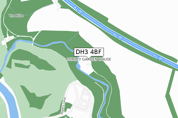
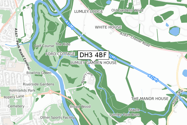
DH3 4BF is located in the Lumley electoral ward, within the unitary authority of County Durham and the English Parliamentary constituency of North Durham. The Sub Integrated Care Board (ICB) Location is NHS North East and North Cumbria ICB - 84H and the police force is Durham. This postcode has been in use since December 2018.


GetTheData
Source: OS Open Zoomstack (Ordnance Survey)
Licence: Open Government Licence (requires attribution)
Attribution: Contains OS data © Crown copyright and database right 2025
Source: Open Postcode Geo
Licence: Open Government Licence (requires attribution)
Attribution: Contains OS data © Crown copyright and database right 2025; Contains Royal Mail data © Royal Mail copyright and database right 2025; Source: Office for National Statistics licensed under the Open Government Licence v.3.0
| Easting | 428814 |
| Northing | 551303 |
| Latitude | 54.855706 |
| Longitude | -1.552720 |
GetTheData
Source: Open Postcode Geo
Licence: Open Government Licence
| Country | England |
| Postcode District | DH3 |
➜ See where DH3 is on a map | |
GetTheData
Source: Land Registry Price Paid Data
Licence: Open Government Licence
| Ward | Lumley |
| Constituency | North Durham |
GetTheData
Source: ONS Postcode Database
Licence: Open Government Licence
| White House (A1052 Chester Road) | Bournmoor | 520m |
| White House (A1052 Chester Road) | Bournmoor | 530m |
| Golf Club - Bridge (B1284 Lumley New Road) | Chester-le-street | 592m |
| Golf Club - Bridge (B1284 Lumley New Road) | Chester-le-street | 607m |
| Durham County Cricket Ground (Unclassified) | Chester-le-street | 743m |
| Chester-le-Street Station | 1.6km |
GetTheData
Source: NaPTAN
Licence: Open Government Licence
| Percentage of properties with Next Generation Access | 0.0% |
| Percentage of properties with Superfast Broadband | 0.0% |
| Percentage of properties with Ultrafast Broadband | 0.0% |
| Percentage of properties with Full Fibre Broadband | 0.0% |
Superfast Broadband is between 30Mbps and 300Mbps
Ultrafast Broadband is > 300Mbps
| Percentage of properties unable to receive 2Mbps | 0.0% |
| Percentage of properties unable to receive 5Mbps | 0.0% |
| Percentage of properties unable to receive 10Mbps | 0.0% |
| Percentage of properties unable to receive 30Mbps | 100.0% |
GetTheData
Source: Ofcom
Licence: Ofcom Terms of Use (requires attribution)
GetTheData
Source: ONS Postcode Database
Licence: Open Government Licence


➜ Get more ratings from the Food Standards Agency
GetTheData
Source: Food Standards Agency
Licence: FSA terms & conditions
| Last Collection | |||
|---|---|---|---|
| Location | Mon-Fri | Sat | Distance |
| Ropery Lane | 18:30 | 11:45 | 1,025m |
| Bradman Drive | 17:30 | 11:30 | 1,117m |
| Picktree Lodge Estate | 17:00 | 11:15 | 1,245m |
GetTheData
Source: Dracos
Licence: Creative Commons Attribution-ShareAlike
The below table lists the International Territorial Level (ITL) codes (formerly Nomenclature of Territorial Units for Statistics (NUTS) codes) and Local Administrative Units (LAU) codes for DH3 4BF:
| ITL 1 Code | Name |
|---|---|
| TLC | North East (England) |
| ITL 2 Code | Name |
| TLC1 | Tees Valley and Durham |
| ITL 3 Code | Name |
| TLC14 | Durham |
| LAU 1 Code | Name |
| E06000047 | County Durham |
GetTheData
Source: ONS Postcode Directory
Licence: Open Government Licence
The below table lists the Census Output Area (OA), Lower Layer Super Output Area (LSOA), and Middle Layer Super Output Area (MSOA) for DH3 4BF:
| Code | Name | |
|---|---|---|
| OA | E00104460 | |
| LSOA | E01020590 | County Durham 015A |
| MSOA | E02004295 | County Durham 015 |
GetTheData
Source: ONS Postcode Directory
Licence: Open Government Licence
| DH3 3PN | Park Road Central | 877m |
| DH3 3PL | Queens Park | 931m |
| DH3 3PP | Lindom Avenue | 1002m |
| DH3 3QT | Milburn Close | 1003m |
| DH3 3NS | Castle Close | 1019m |
| DH3 3PW | Roman Avenue | 1022m |
| DH3 3NN | Ropery Lane | 1028m |
| DH3 3NR | Plantagenet Avenue | 1038m |
| DH3 3PR | Eardulph Avenue | 1045m |
| DH3 3NW | Lancaster Terrace | 1050m |
GetTheData
Source: Open Postcode Geo; Land Registry Price Paid Data
Licence: Open Government Licence