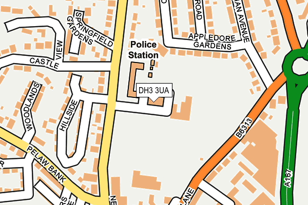
DH3 3UA is located in the Chester-le-Street East electoral ward, within the unitary authority of County Durham and the English Parliamentary constituency of North Durham. The Sub Integrated Care Board (ICB) Location is NHS North East and North Cumbria ICB - 84H and the police force is Durham. This postcode has been in use since January 2004.


GetTheData
Source: OS OpenMap – Local (Ordnance Survey)
Source: OS VectorMap District (Ordnance Survey)
Licence: Open Government Licence (requires attribution)
| Easting | 427521 |
| Northing | 551929 |
| Latitude | 54.861395 |
| Longitude | -1.572788 |
GetTheData
Source: Open Postcode Geo
Licence: Open Government Licence
| Country | England |
| Postcode District | DH3 |
➜ See where DH3 is on a map ➜ Where is Chester-le-Street? | |
GetTheData
Source: Land Registry Price Paid Data
Licence: Open Government Licence
Elevation or altitude of DH3 3UA as distance above sea level:
| Metres | Feet | |
|---|---|---|
| Elevation | 20m | 66ft |
Elevation is measured from the approximate centre of the postcode, to the nearest point on an OS contour line from OS Terrain 50, which has contour spacing of ten vertical metres.
➜ How high above sea level am I? Find the elevation of your current position using your device's GPS.
GetTheData
Source: Open Postcode Elevation
Licence: Open Government Licence
| Ward | Chester-le-street East |
| Constituency | North Durham |
GetTheData
Source: ONS Postcode Database
Licence: Open Government Licence
| Police Station (Newcastle Road) | Chester-le-street | 95m |
| Police Station (Newcastle Road) | Chester-le-street | 99m |
| Picktree Lane Bus Depot (Picktree Lane) | Chester-le-street | 179m |
| Picktree Lane Bus Depot (Picktree Lane) | Chester-le-street | 205m |
| Highfield Hospital (Newcastle Road) | Chester-le-street | 286m |
| Chester-le-Street Station | 0.8km |
GetTheData
Source: NaPTAN
Licence: Open Government Licence
GetTheData
Source: ONS Postcode Database
Licence: Open Government Licence


➜ Get more ratings from the Food Standards Agency
GetTheData
Source: Food Standards Agency
Licence: FSA terms & conditions
| Last Collection | |||
|---|---|---|---|
| Location | Mon-Fri | Sat | Distance |
| Picktree Lodge Estate | 17:00 | 11:15 | 212m |
| North Burns | 18:30 | 380m | |
| North Burns | 18:30 | 12:00 | 383m |
GetTheData
Source: Dracos
Licence: Creative Commons Attribution-ShareAlike
The below table lists the International Territorial Level (ITL) codes (formerly Nomenclature of Territorial Units for Statistics (NUTS) codes) and Local Administrative Units (LAU) codes for DH3 3UA:
| ITL 1 Code | Name |
|---|---|
| TLC | North East (England) |
| ITL 2 Code | Name |
| TLC1 | Tees Valley and Durham |
| ITL 3 Code | Name |
| TLC14 | Durham |
| LAU 1 Code | Name |
| E06000047 | County Durham |
GetTheData
Source: ONS Postcode Directory
Licence: Open Government Licence
The below table lists the Census Output Area (OA), Lower Layer Super Output Area (LSOA), and Middle Layer Super Output Area (MSOA) for DH3 3UA:
| Code | Name | |
|---|---|---|
| OA | E00104485 | |
| LSOA | E01020598 | County Durham 007C |
| MSOA | E02004292 | County Durham 007 |
GetTheData
Source: ONS Postcode Directory
Licence: Open Government Licence
| DH3 3TE | Chalmers View | 99m |
| DH3 3TX | Newcastle Road | 117m |
| DH3 3RX | Appledore Gardens | 129m |
| DH3 3TS | Newcastle Road | 132m |
| DH3 3TG | The Manse | 163m |
| DH3 3TZ | Newcastle Road | 168m |
| DH3 3TD | Newcastle Road | 182m |
| DH3 3TU | Hillside | 183m |
| DH3 3UQ | Springfield Gardens | 184m |
| DH3 3ST | Picktree Terrace | 186m |
GetTheData
Source: Open Postcode Geo; Land Registry Price Paid Data
Licence: Open Government Licence