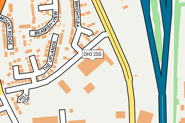
DH3 2SS is located in the Birtley electoral ward, within the metropolitan district of Gateshead and the English Parliamentary constituency of Blaydon. The Sub Integrated Care Board (ICB) Location is NHS North East and North Cumbria ICB - 13T and the police force is Northumbria. This postcode has been in use since April 1985.


GetTheData
Source: OS OpenMap – Local (Ordnance Survey)
Source: OS VectorMap District (Ordnance Survey)
Licence: Open Government Licence (requires attribution)
| Easting | 428150 |
| Northing | 556089 |
| Latitude | 54.898743 |
| Longitude | -1.562585 |
GetTheData
Source: Open Postcode Geo
Licence: Open Government Licence
| Country | England |
| Postcode District | DH3 |
➜ See where DH3 is on a map ➜ Where is Birtley? | |
GetTheData
Source: Land Registry Price Paid Data
Licence: Open Government Licence
Elevation or altitude of DH3 2SS as distance above sea level:
| Metres | Feet | |
|---|---|---|
| Elevation | 100m | 328ft |
Elevation is measured from the approximate centre of the postcode, to the nearest point on an OS contour line from OS Terrain 50, which has contour spacing of ten vertical metres.
➜ How high above sea level am I? Find the elevation of your current position using your device's GPS.
GetTheData
Source: Open Postcode Elevation
Licence: Open Government Licence
| Ward | Birtley |
| Constituency | Blaydon |
GetTheData
Source: ONS Postcode Database
Licence: Open Government Licence
| Fell Bank-the Uplands (Fell Bank) | Birtley | 66m |
| Fell Bank-the Uplands (Fell Bank) | Birtley | 72m |
| Portobello Road-fell Bank (Portobello Road) | Birtley | 82m |
| Portobello Road-fell Bank (Portobello Road) | Birtley | 105m |
| Portobello (Portobello Road) | Birtley | 282m |
| Chester-le-Street Station | 5km |
GetTheData
Source: NaPTAN
Licence: Open Government Licence
GetTheData
Source: ONS Postcode Database
Licence: Open Government Licence


➜ Get more ratings from the Food Standards Agency
GetTheData
Source: Food Standards Agency
Licence: FSA terms & conditions
| Last Collection | |||
|---|---|---|---|
| Location | Mon-Fri | Sat | Distance |
| Board Inn ,portobello | 17:30 | 11:15 | 317m |
| Harvey Close | 727m | ||
| Crowther Road | 16:30 | 10:30 | 728m |
GetTheData
Source: Dracos
Licence: Creative Commons Attribution-ShareAlike
The below table lists the International Territorial Level (ITL) codes (formerly Nomenclature of Territorial Units for Statistics (NUTS) codes) and Local Administrative Units (LAU) codes for DH3 2SS:
| ITL 1 Code | Name |
|---|---|
| TLC | North East (England) |
| ITL 2 Code | Name |
| TLC2 | Northumberland, and Tyne and Wear |
| ITL 3 Code | Name |
| TLC22 | Tyneside |
| LAU 1 Code | Name |
| E08000037 | Gateshead |
GetTheData
Source: ONS Postcode Directory
Licence: Open Government Licence
The below table lists the Census Output Area (OA), Lower Layer Super Output Area (LSOA), and Middle Layer Super Output Area (MSOA) for DH3 2SS:
| Code | Name | |
|---|---|---|
| OA | E00041438 | |
| LSOA | E01008176 | Gateshead 026E |
| MSOA | E02001707 | Gateshead 026 |
GetTheData
Source: ONS Postcode Directory
Licence: Open Government Licence
| DH3 1RL | Brightlea | 128m |
| DH3 1RJ | The Uplands | 176m |
| DH3 1RS | Beamish View | 235m |
| DH3 1RY | Mount Ridge | 276m |
| DH3 1BP | Hill Top | 284m |
| DH3 2SA | Penshaw Way | 291m |
| NE38 0AQ | Crowther Road | 328m |
| DH3 1RG | Fell Bank | 340m |
| DH3 1AQ | Fell Bank | 394m |
| DH3 2NW | Portmeads Rise | 395m |
GetTheData
Source: Open Postcode Geo; Land Registry Price Paid Data
Licence: Open Government Licence