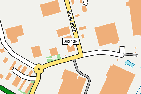
DH2 1SR is located in the North Lodge electoral ward, within the unitary authority of County Durham and the English Parliamentary constituency of North Durham. The Sub Integrated Care Board (ICB) Location is NHS North East and North Cumbria ICB - 84H and the police force is Durham. This postcode has been in use since July 1983.


GetTheData
Source: OS OpenMap – Local (Ordnance Survey)
Source: OS VectorMap District (Ordnance Survey)
Licence: Open Government Licence (requires attribution)
| Easting | 426674 |
| Northing | 553116 |
| Latitude | 54.872116 |
| Longitude | -1.585885 |
GetTheData
Source: Open Postcode Geo
Licence: Open Government Licence
| Country | England |
| Postcode District | DH2 |
➜ See where DH2 is on a map ➜ Where is Chester-le-Street? | |
GetTheData
Source: Land Registry Price Paid Data
Licence: Open Government Licence
Elevation or altitude of DH2 1SR as distance above sea level:
| Metres | Feet | |
|---|---|---|
| Elevation | 50m | 164ft |
Elevation is measured from the approximate centre of the postcode, to the nearest point on an OS contour line from OS Terrain 50, which has contour spacing of ten vertical metres.
➜ How high above sea level am I? Find the elevation of your current position using your device's GPS.
GetTheData
Source: Open Postcode Elevation
Licence: Open Government Licence
| Ward | North Lodge |
| Constituency | North Durham |
GetTheData
Source: ONS Postcode Database
Licence: Open Government Licence
| Backleys (Drum Road) | Drum Industrial Estate | 186m |
| Backleys (Drum Road) | Drum Industrial Estate | 229m |
| Mysons (Drum Road) | Drum Industrial Estate | 485m |
| Mysons (Drum Road) | Drum Industrial Estate | 544m |
| Lambton Worm Ph (North Road) | Chester-le-street | 691m |
| Chester-le-Street Station | 2km |
GetTheData
Source: NaPTAN
Licence: Open Government Licence
GetTheData
Source: ONS Postcode Database
Licence: Open Government Licence


➜ Get more ratings from the Food Standards Agency
GetTheData
Source: Food Standards Agency
Licence: FSA terms & conditions
| Last Collection | |||
|---|---|---|---|
| Location | Mon-Fri | Sat | Distance |
| Drum Road Ind Estate | 18:30 | 11:15 | 649m |
| North Road | 17:00 | 11:15 | 706m |
| Conyers Road | 17:00 | 11:45 | 766m |
GetTheData
Source: Dracos
Licence: Creative Commons Attribution-ShareAlike
The below table lists the International Territorial Level (ITL) codes (formerly Nomenclature of Territorial Units for Statistics (NUTS) codes) and Local Administrative Units (LAU) codes for DH2 1SR:
| ITL 1 Code | Name |
|---|---|
| TLC | North East (England) |
| ITL 2 Code | Name |
| TLC1 | Tees Valley and Durham |
| ITL 3 Code | Name |
| TLC14 | Durham |
| LAU 1 Code | Name |
| E06000047 | County Durham |
GetTheData
Source: ONS Postcode Directory
Licence: Open Government Licence
The below table lists the Census Output Area (OA), Lower Layer Super Output Area (LSOA), and Middle Layer Super Output Area (MSOA) for DH2 1SR:
| Code | Name | |
|---|---|---|
| OA | E00104570 | |
| LSOA | E01020612 | County Durham 007E |
| MSOA | E02004292 | County Durham 007 |
GetTheData
Source: ONS Postcode Directory
Licence: Open Government Licence
| DH2 1ST | 76m | |
| DH2 1AG | 321m | |
| DH2 1AN | Lumley Court | 351m |
| DH2 1AQ | Angel Park | 533m |
| DH3 4DE | Kingsmere | 548m |
| DH3 4AP | Wear Lodge | 560m |
| DH3 4DD | Kingsmere | 590m |
| DH3 4AW | Low Flatts Road | 594m |
| DH3 4DA | Queensmere | 625m |
| DH3 4AT | Lyndhurst Avenue | 659m |
GetTheData
Source: Open Postcode Geo; Land Registry Price Paid Data
Licence: Open Government Licence