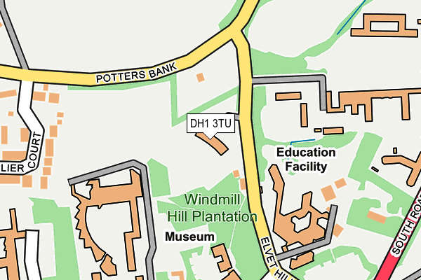
DH1 3TU is located in the Neville's Cross electoral ward, within the unitary authority of County Durham and the English Parliamentary constituency of City of Durham. The Sub Integrated Care Board (ICB) Location is NHS North East and North Cumbria ICB - 84H and the police force is Durham. This postcode has been in use since September 2002.


GetTheData
Source: OS OpenMap – Local (Ordnance Survey)
Source: OS VectorMap District (Ordnance Survey)
Licence: Open Government Licence (requires attribution)
| Easting | 427013 |
| Northing | 541272 |
| Latitude | 54.765657 |
| Longitude | -1.581691 |
GetTheData
Source: Open Postcode Geo
Licence: Open Government Licence
| Country | England |
| Postcode District | DH1 |
➜ See where DH1 is on a map ➜ Where is Durham? | |
GetTheData
Source: Land Registry Price Paid Data
Licence: Open Government Licence
Elevation or altitude of DH1 3TU as distance above sea level:
| Metres | Feet | |
|---|---|---|
| Elevation | 90m | 295ft |
Elevation is measured from the approximate centre of the postcode, to the nearest point on an OS contour line from OS Terrain 50, which has contour spacing of ten vertical metres.
➜ How high above sea level am I? Find the elevation of your current position using your device's GPS.
GetTheData
Source: Open Postcode Elevation
Licence: Open Government Licence
| Ward | Neville's Cross |
| Constituency | City Of Durham |
GetTheData
Source: ONS Postcode Database
Licence: Open Government Licence
| St Aidans College (Elvet Hill Road) | Durham | 85m |
| Oriental Museum (Elvet Hill Road) | Durham | 269m |
| South Road Colleges (A177 South Road) | Durham | 326m |
| South Road Colleges (A177 South Road) | Durham | 330m |
| New Inn - Quarryheads Lane (Quarryheads Lane) | Durham | 505m |
| Durham Station | 1.5km |
GetTheData
Source: NaPTAN
Licence: Open Government Licence
GetTheData
Source: ONS Postcode Database
Licence: Open Government Licence


➜ Get more ratings from the Food Standards Agency
GetTheData
Source: Food Standards Agency
Licence: FSA terms & conditions
| Last Collection | |||
|---|---|---|---|
| Location | Mon-Fri | Sat | Distance |
| South End, Elvet Hall | 16:15 | 10:15 | 330m |
| Riverside, Milburngate | 638m | ||
| Mountjoy Centre | 673m | ||
GetTheData
Source: Dracos
Licence: Creative Commons Attribution-ShareAlike
The below table lists the International Territorial Level (ITL) codes (formerly Nomenclature of Territorial Units for Statistics (NUTS) codes) and Local Administrative Units (LAU) codes for DH1 3TU:
| ITL 1 Code | Name |
|---|---|
| TLC | North East (England) |
| ITL 2 Code | Name |
| TLC1 | Tees Valley and Durham |
| ITL 3 Code | Name |
| TLC14 | Durham |
| LAU 1 Code | Name |
| E06000047 | County Durham |
GetTheData
Source: ONS Postcode Directory
Licence: Open Government Licence
The below table lists the Census Output Area (OA), Lower Layer Super Output Area (LSOA), and Middle Layer Super Output Area (MSOA) for DH1 3TU:
| Code | Name | |
|---|---|---|
| OA | E00105080 | |
| LSOA | E01033221 | County Durham 030G |
| MSOA | E02004314 | County Durham 030 |
GetTheData
Source: ONS Postcode Directory
Licence: Open Government Licence
| DH1 3RF | Chevallier Court | 328m |
| DH1 3TG | South Road | 332m |
| DH1 3DY | Quarryheads Lane | 389m |
| DH1 3RR | Potters Bank | 420m |
| DH1 3QY | Dickens Wynd | 434m |
| DH1 3DZ | Quarryheads Lane | 439m |
| DH1 3UB | Potters Close | 508m |
| DH1 3QU | Pickwick Close | 517m |
| DH1 4FH | Westhouse Avenue | 517m |
| DH1 3QX | Nickleby Chare | 519m |
GetTheData
Source: Open Postcode Geo; Land Registry Price Paid Data
Licence: Open Government Licence