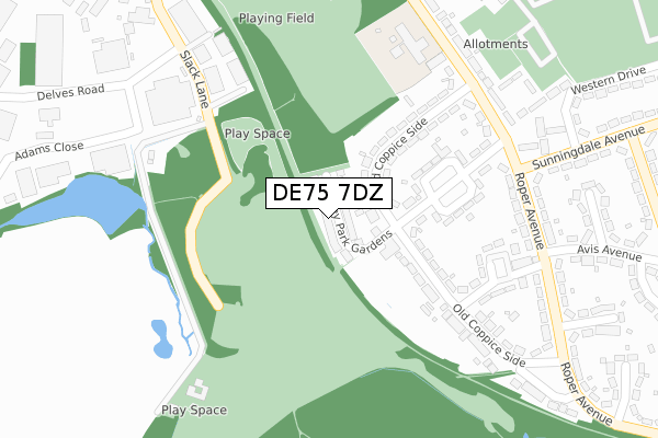
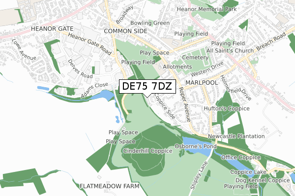
DE75 7DZ is located in the Smalley, Shipley & Horsley Woodhouse electoral ward, within the local authority district of Amber Valley and the English Parliamentary constituency of Amber Valley. The Sub Integrated Care Board (ICB) Location is NHS Derby and Derbyshire ICB - 15M and the police force is Derbyshire. This postcode has been in use since November 2018.


GetTheData
Source: OS Open Zoomstack (Ordnance Survey)
Licence: Open Government Licence (requires attribution)
Attribution: Contains OS data © Crown copyright and database right 2024
Source: Open Postcode Geo
Licence: Open Government Licence (requires attribution)
Attribution: Contains OS data © Crown copyright and database right 2024; Contains Royal Mail data © Royal Mail copyright and database right 2024; Source: Office for National Statistics licensed under the Open Government Licence v.3.0
| Easting | 443295 |
| Northing | 345463 |
| Latitude | 53.004759 |
| Longitude | -1.356259 |
GetTheData
Source: Open Postcode Geo
Licence: Open Government Licence
| Country | England |
| Postcode District | DE75 |
➜ See where DE75 is on a map ➜ Where is Heanor? | |
GetTheData
Source: Land Registry Price Paid Data
Licence: Open Government Licence
| Ward | Smalley, Shipley & Horsley Woodhouse |
| Constituency | Amber Valley |
GetTheData
Source: ONS Postcode Database
Licence: Open Government Licence
2024 19 APR £335,000 |
2021 20 DEC £327,000 |
28, SHIPLEY PARK GARDENS, HEANOR, DE75 7DZ 2020 25 SEP £359,950 |
2020 29 MAY £359,950 |
26, SHIPLEY PARK GARDENS, HEANOR, DE75 7DZ 2020 1 MAY £299,950 |
3, SHIPLEY PARK GARDENS, HEANOR, DE75 7DZ 2020 9 APR £360,450 |
27, SHIPLEY PARK GARDENS, HEANOR, DE75 7DZ 2019 8 AUG £490,595 |
29, SHIPLEY PARK GARDENS, HEANOR, DE75 7DZ 2019 5 JUL £349,950 |
2019 28 JUN £299,950 |
23, SHIPLEY PARK GARDENS, HEANOR, DE75 7DZ 2019 18 MAY £294,950 |
GetTheData
Source: HM Land Registry Price Paid Data
Licence: Contains HM Land Registry data © Crown copyright and database right 2024. This data is licensed under the Open Government Licence v3.0.
| Coppice Primary School (Roper Avenue) | Marlpool | 273m |
| Coppice Primary School (Roper Avenue) | Marlpool | 282m |
| Roper Avenue Shops (Roper Avenue) | Marlpool | 289m |
| Roper Avenue Shops (Roper Avenue) | Marlpool | 324m |
| Buxton Avenue | Marlpool | 495m |
| Langley Mill Station | 2.2km |
| Ilkeston Station | 5km |
GetTheData
Source: NaPTAN
Licence: Open Government Licence
| Percentage of properties with Next Generation Access | 100.0% |
| Percentage of properties with Superfast Broadband | 100.0% |
| Percentage of properties with Ultrafast Broadband | 100.0% |
| Percentage of properties with Full Fibre Broadband | 100.0% |
Superfast Broadband is between 30Mbps and 300Mbps
Ultrafast Broadband is > 300Mbps
| Percentage of properties unable to receive 2Mbps | 0.0% |
| Percentage of properties unable to receive 5Mbps | 0.0% |
| Percentage of properties unable to receive 10Mbps | 0.0% |
| Percentage of properties unable to receive 30Mbps | 0.0% |
GetTheData
Source: Ofcom
Licence: Ofcom Terms of Use (requires attribution)
GetTheData
Source: ONS Postcode Database
Licence: Open Government Licence


➜ Get more ratings from the Food Standards Agency
GetTheData
Source: Food Standards Agency
Licence: FSA terms & conditions
| Last Collection | |||
|---|---|---|---|
| Location | Mon-Fri | Sat | Distance |
| Roper Avenue Post Office | 17:30 | 10:30 | 311m |
| Stainsby Avenue | 17:30 | 07:30 | 517m |
| Burnthouse Road | 17:30 | 08:30 | 696m |
GetTheData
Source: Dracos
Licence: Creative Commons Attribution-ShareAlike
The below table lists the International Territorial Level (ITL) codes (formerly Nomenclature of Territorial Units for Statistics (NUTS) codes) and Local Administrative Units (LAU) codes for DE75 7DZ:
| ITL 1 Code | Name |
|---|---|
| TLF | East Midlands (England) |
| ITL 2 Code | Name |
| TLF1 | Derbyshire and Nottinghamshire |
| ITL 3 Code | Name |
| TLF13 | South and West Derbyshire |
| LAU 1 Code | Name |
| E07000032 | Amber Valley |
GetTheData
Source: ONS Postcode Directory
Licence: Open Government Licence
The below table lists the Census Output Area (OA), Lower Layer Super Output Area (LSOA), and Middle Layer Super Output Area (MSOA) for DE75 7DZ:
| Code | Name | |
|---|---|---|
| OA | E00165840 | |
| LSOA | E01032613 | Amber Valley 017E |
| MSOA | E02006827 | Amber Valley 017 |
GetTheData
Source: ONS Postcode Directory
Licence: Open Government Licence
| DE75 7DH | Old Coppice Side | 141m |
| DE75 7DN | Thorpe Hill Drive | 196m |
| DE75 7DL | Baker Avenue | 230m |
| DE75 7DJ | Old Coppice Side | 258m |
| DE75 7DA | Roper Avenue | 285m |
| DE75 7DU | Coppice Mews | 290m |
| DE75 7BZ | Roper Avenue | 297m |
| DE75 7GX | Slack Lane | 323m |
| DE75 7DD | Avis Avenue | 384m |
| DE75 7DE | Owers Avenue | 397m |
GetTheData
Source: Open Postcode Geo; Land Registry Price Paid Data
Licence: Open Government Licence