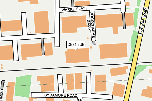
DE74 2UB lies on Pond End in Willow Farm Business Park, Derby. DE74 2UB is located in the Castle Donington Central electoral ward, within the local authority district of North West Leicestershire and the English Parliamentary constituency of North West Leicestershire. The Sub Integrated Care Board (ICB) Location is NHS Leicester, Leicestershire and Rutland ICB - 04V and the police force is Leicestershire. This postcode has been in use since December 2001.


GetTheData
Source: OS OpenMap – Local (Ordnance Survey)
Source: OS VectorMap District (Ordnance Survey)
Licence: Open Government Licence (requires attribution)
| Easting | 444515 |
| Northing | 328836 |
| Latitude | 52.855204 |
| Longitude | -1.340352 |
GetTheData
Source: Open Postcode Geo
Licence: Open Government Licence
| Street | Pond End |
| Locality | Willow Farm Business Park |
| Town/City | Derby |
| Country | England |
| Postcode District | DE74 |
➜ See where DE74 is on a map ➜ Where is Castle Donington? | |
GetTheData
Source: Land Registry Price Paid Data
Licence: Open Government Licence
Elevation or altitude of DE74 2UB as distance above sea level:
| Metres | Feet | |
|---|---|---|
| Elevation | 40m | 131ft |
Elevation is measured from the approximate centre of the postcode, to the nearest point on an OS contour line from OS Terrain 50, which has contour spacing of ten vertical metres.
➜ How high above sea level am I? Find the elevation of your current position using your device's GPS.
GetTheData
Source: Open Postcode Elevation
Licence: Open Government Licence
| Ward | Castle Donington Central |
| Constituency | North West Leicestershire |
GetTheData
Source: ONS Postcode Database
Licence: Open Government Licence
| Willow Farm Business Park (Station Road) | Castle Donington | 417m |
| Willow Farm Business Park (Station Road) | Castle Donington | 430m |
| Gasny Avenue (Station Road) | Castle Donington | 570m |
| Gasny Avenue (Station Road) | Castle Donington | 578m |
| Willow Road (Trent Lane) | Castle Donington | 653m |
| Long Eaton Station | 4.9km |
GetTheData
Source: NaPTAN
Licence: Open Government Licence
GetTheData
Source: ONS Postcode Database
Licence: Open Government Licence


➜ Get more ratings from the Food Standards Agency
GetTheData
Source: Food Standards Agency
Licence: FSA terms & conditions
| Last Collection | |||
|---|---|---|---|
| Location | Mon-Fri | Sat | Distance |
| Trent Lane, Castle Donington | 18:30 | 696m | |
| Trent Lane | 17:30 | 10:30 | 697m |
| Cavendish Bridge | 17:00 | 10:30 | 982m |
GetTheData
Source: Dracos
Licence: Creative Commons Attribution-ShareAlike
| Risk of DE74 2UB flooding from rivers and sea | High |
| ➜ DE74 2UB flood map | |
GetTheData
Source: Open Flood Risk by Postcode
Licence: Open Government Licence
The below table lists the International Territorial Level (ITL) codes (formerly Nomenclature of Territorial Units for Statistics (NUTS) codes) and Local Administrative Units (LAU) codes for DE74 2UB:
| ITL 1 Code | Name |
|---|---|
| TLF | East Midlands (England) |
| ITL 2 Code | Name |
| TLF2 | Leicestershire, Rutland and Northamptonshire |
| ITL 3 Code | Name |
| TLF22 | Leicestershire CC and Rutland |
| LAU 1 Code | Name |
| E07000134 | North West Leicestershire |
GetTheData
Source: ONS Postcode Directory
Licence: Open Government Licence
The below table lists the Census Output Area (OA), Lower Layer Super Output Area (LSOA), and Middle Layer Super Output Area (MSOA) for DE74 2UB:
| Code | Name | |
|---|---|---|
| OA | E00131570 | |
| LSOA | E01025925 | North West Leicestershire 001B |
| MSOA | E02005397 | North West Leicestershire 001 |
GetTheData
Source: ONS Postcode Directory
Licence: Open Government Licence
| DE74 2NN | Redwing Court | 131m |
| DE74 2US | Sills Road | 202m |
| DE74 2HZ | Gasny Avenue | 531m |
| DE74 2NL | Station Road | 665m |
| DE74 2NX | Trent Lane | 726m |
| DE74 2NT | Victoria Street | 789m |
| DE74 2UU | Station Road | 926m |
| DE74 2GP | Blyth Court | 939m |
| DE72 2HL | Cavendish Bridge | 1014m |
| DE74 2GL | Glover Road | 1020m |
GetTheData
Source: Open Postcode Geo; Land Registry Price Paid Data
Licence: Open Government Licence