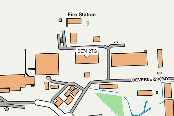
DE74 2TG is located in the Daleacre Hill electoral ward, within the local authority district of North West Leicestershire and the English Parliamentary constituency of North West Leicestershire. The Sub Integrated Care Board (ICB) Location is NHS Leicester, Leicestershire and Rutland ICB - 04V and the police force is Leicestershire. This postcode has been in use since May 1994.


GetTheData
Source: OS OpenMap – Local (Ordnance Survey)
Source: OS VectorMap District (Ordnance Survey)
Licence: Open Government Licence (requires attribution)
| Easting | 445577 |
| Northing | 325819 |
| Latitude | 52.827996 |
| Longitude | -1.325002 |
GetTheData
Source: Open Postcode Geo
Licence: Open Government Licence
| Country | England |
| Postcode District | DE74 |
➜ See where DE74 is on a map | |
GetTheData
Source: Land Registry Price Paid Data
Licence: Open Government Licence
Elevation or altitude of DE74 2TG as distance above sea level:
| Metres | Feet | |
|---|---|---|
| Elevation | 80m | 262ft |
Elevation is measured from the approximate centre of the postcode, to the nearest point on an OS contour line from OS Terrain 50, which has contour spacing of ten vertical metres.
➜ How high above sea level am I? Find the elevation of your current position using your device's GPS.
GetTheData
Source: Open Postcode Elevation
Licence: Open Government Licence
| Ward | Daleacre Hill |
| Constituency | North West Leicestershire |
GetTheData
Source: ONS Postcode Database
Licence: Open Government Licence
| Coach Park | East Midlands Airport | 222m |
| Building 100 (Beverley Road) | East Midlands Airport | 222m |
| Coach Park | East Midlands Airport | 227m |
| Coach Park | East Midlands Airport | 231m |
| Coach Park | East Midlands Airport | 236m |
| East Midlands Parkway Station | 5.7km |
GetTheData
Source: NaPTAN
Licence: Open Government Licence
GetTheData
Source: ONS Postcode Database
Licence: Open Government Licence


➜ Get more ratings from the Food Standards Agency
GetTheData
Source: Food Standards Agency
Licence: FSA terms & conditions
| Last Collection | |||
|---|---|---|---|
| Location | Mon-Fri | Sat | Distance |
| Old Diseworth Post Office | 17:00 | 10:30 | 1,267m |
| Hastings Street | 17:30 | 10:30 | 1,494m |
| The Woodcroft | 17:00 | 10:30 | 1,621m |
GetTheData
Source: Dracos
Licence: Creative Commons Attribution-ShareAlike
The below table lists the International Territorial Level (ITL) codes (formerly Nomenclature of Territorial Units for Statistics (NUTS) codes) and Local Administrative Units (LAU) codes for DE74 2TG:
| ITL 1 Code | Name |
|---|---|
| TLF | East Midlands (England) |
| ITL 2 Code | Name |
| TLF2 | Leicestershire, Rutland and Northamptonshire |
| ITL 3 Code | Name |
| TLF22 | Leicestershire CC and Rutland |
| LAU 1 Code | Name |
| E07000134 | North West Leicestershire |
GetTheData
Source: ONS Postcode Directory
Licence: Open Government Licence
The below table lists the Census Output Area (OA), Lower Layer Super Output Area (LSOA), and Middle Layer Super Output Area (MSOA) for DE74 2TG:
| Code | Name | |
|---|---|---|
| OA | E00131581 | |
| LSOA | E01025925 | North West Leicestershire 001B |
| MSOA | E02005397 | North West Leicestershire 001 |
GetTheData
Source: ONS Postcode Directory
Licence: Open Government Licence
| DE74 2SA | 561m | |
| DE74 2PU | The Birches | 592m |
| DE74 2QB | 620m | |
| DE74 2TZ | Herald Way | 900m |
| DE74 2QD | Grimesgate | 1134m |
| DE74 2SJ | Cheslyn Court | 1147m |
| DE74 2LY | Stonehill | 1253m |
| DE74 2LX | Meadow Crescent | 1295m |
| DE74 2QE | Clements Gate | 1302m |
| DE74 2LZ | Stonehill | 1309m |
GetTheData
Source: Open Postcode Geo; Land Registry Price Paid Data
Licence: Open Government Licence