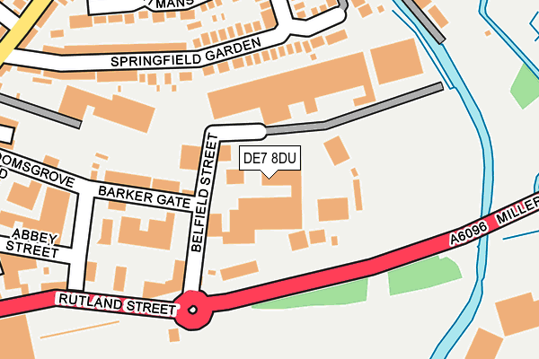
DE7 8DU is located in the Awsworth Road electoral ward, within the local authority district of Erewash and the English Parliamentary constituency of Erewash. The Sub Integrated Care Board (ICB) Location is NHS Derby and Derbyshire ICB - 15M and the police force is Derbyshire. This postcode has been in use since January 1980.


GetTheData
Source: OS OpenMap – Local (Ordnance Survey)
Source: OS VectorMap District (Ordnance Survey)
Licence: Open Government Licence (requires attribution)
| Easting | 446855 |
| Northing | 342654 |
| Latitude | 52.979211 |
| Longitude | -1.303617 |
GetTheData
Source: Open Postcode Geo
Licence: Open Government Licence
| Country | England |
| Postcode District | DE7 |
➜ See where DE7 is on a map ➜ Where is Ilkeston? | |
GetTheData
Source: Land Registry Price Paid Data
Licence: Open Government Licence
Elevation or altitude of DE7 8DU as distance above sea level:
| Metres | Feet | |
|---|---|---|
| Elevation | 50m | 164ft |
Elevation is measured from the approximate centre of the postcode, to the nearest point on an OS contour line from OS Terrain 50, which has contour spacing of ten vertical metres.
➜ How high above sea level am I? Find the elevation of your current position using your device's GPS.
GetTheData
Source: Open Postcode Elevation
Licence: Open Government Licence
| Ward | Awsworth Road |
| Constituency | Erewash |
GetTheData
Source: ONS Postcode Database
Licence: Open Government Licence
| Tesco (Rutland Street) | Ilkeston | 292m |
| Springfield Gardens (Awsworth Road) | Ilkeston | 294m |
| Springfield Gardens (Awsworth Road) | Ilkeston | 296m |
| Bloomsgrove Road (Granby Street) | Ilkeston | 338m |
| Bloomsgrove Road (Cotmanhay Road) | Ilkeston | 358m |
| Ilkeston Station | 0.6km |
| Langley Mill Station | 4.7km |
GetTheData
Source: NaPTAN
Licence: Open Government Licence
| Median download speed | 47.0Mbps |
| Average download speed | 45.8Mbps |
| Maximum download speed | 67.63Mbps |
| Median upload speed | 9.5Mbps |
| Average upload speed | 11.6Mbps |
| Maximum upload speed | 20.00Mbps |
GetTheData
Source: Ofcom
Licence: Ofcom Terms of Use (requires attribution)
Estimated total energy consumption in DE7 8DU by fuel type, 2015.
| Consumption (kWh) | 213,221 |
|---|---|
| Meter count | 9 |
| Mean (kWh/meter) | 23,691 |
| Median (kWh/meter) | 12,172 |
GetTheData
Source: Postcode level gas estimates: 2015 (experimental)
Source: Postcode level electricity estimates: 2015 (experimental)
Licence: Open Government Licence
GetTheData
Source: ONS Postcode Database
Licence: Open Government Licence


➜ Get more ratings from the Food Standards Agency
GetTheData
Source: Food Standards Agency
Licence: FSA terms & conditions
| Last Collection | |||
|---|---|---|---|
| Location | Mon-Fri | Sat | Distance |
| Barker Gate | 17:30 | 07:30 | 160m |
| Tesco | 17:30 | 10:30 | 297m |
| Awsworth Road | 17:30 | 07:30 | 337m |
GetTheData
Source: Dracos
Licence: Creative Commons Attribution-ShareAlike
The below table lists the International Territorial Level (ITL) codes (formerly Nomenclature of Territorial Units for Statistics (NUTS) codes) and Local Administrative Units (LAU) codes for DE7 8DU:
| ITL 1 Code | Name |
|---|---|
| TLF | East Midlands (England) |
| ITL 2 Code | Name |
| TLF1 | Derbyshire and Nottinghamshire |
| ITL 3 Code | Name |
| TLF13 | South and West Derbyshire |
| LAU 1 Code | Name |
| E07000036 | Erewash |
GetTheData
Source: ONS Postcode Directory
Licence: Open Government Licence
The below table lists the Census Output Area (OA), Lower Layer Super Output Area (LSOA), and Middle Layer Super Output Area (MSOA) for DE7 8DU:
| Code | Name | |
|---|---|---|
| OA | E00099482 | |
| LSOA | E01019662 | Erewash 003D |
| MSOA | E02004080 | Erewash 003 |
GetTheData
Source: ONS Postcode Directory
Licence: Open Government Licence
| DE7 8DS | Barker Gate | 105m |
| DE7 8HY | Springfield Gardens | 134m |
| DE7 8JA | Springfield Gardens | 162m |
| DE7 8HX | Awsworth Road | 197m |
| DE7 8HZ | Manning View | 212m |
| DE7 8LT | Boatmans Close | 221m |
| DE7 8DG | Rutland Street | 248m |
| DE7 8GG | Mill Street | 251m |
| DE7 8HW | Spring Garden Terrace | 267m |
| DE7 8DQ | Bloomsgrove Road | 273m |
GetTheData
Source: Open Postcode Geo; Land Registry Price Paid Data
Licence: Open Government Licence