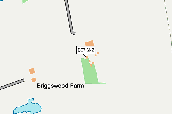
DE7 6NZ lies on Common Lane in Stanley, Ilkeston. DE7 6NZ is located in the Little Eaton & Stanley electoral ward, within the local authority district of Erewash and the English Parliamentary constituency of Mid Derbyshire. The Sub Integrated Care Board (ICB) Location is NHS Derby and Derbyshire ICB - 15M and the police force is Derbyshire. This postcode has been in use since December 1994.


GetTheData
Source: OS OpenMap – Local (Ordnance Survey)
Source: OS VectorMap District (Ordnance Survey)
Licence: Open Government Licence (requires attribution)
| Easting | 441822 |
| Northing | 341421 |
| Latitude | 52.968543 |
| Longitude | -1.378730 |
GetTheData
Source: Open Postcode Geo
Licence: Open Government Licence
| Street | Common Lane |
| Locality | Stanley |
| Town/City | Ilkeston |
| Country | England |
| Postcode District | DE7 |
➜ See where DE7 is on a map | |
GetTheData
Source: Land Registry Price Paid Data
Licence: Open Government Licence
Elevation or altitude of DE7 6NZ as distance above sea level:
| Metres | Feet | |
|---|---|---|
| Elevation | 110m | 361ft |
Elevation is measured from the approximate centre of the postcode, to the nearest point on an OS contour line from OS Terrain 50, which has contour spacing of ten vertical metres.
➜ How high above sea level am I? Find the elevation of your current position using your device's GPS.
GetTheData
Source: Open Postcode Elevation
Licence: Open Government Licence
| Ward | Little Eaton & Stanley |
| Constituency | Mid Derbyshire |
GetTheData
Source: ONS Postcode Database
Licence: Open Government Licence
| Robinsons Garage (Belper Road) | Stanley Common | 620m |
| Robinsons Garage (Belper Road) | Stanley Common | 628m |
| Bagot Street (Station Road) | West Hallam | 676m |
| Bagot Street (Station Road) | West Hallam | 682m |
| Common Lane (Belper Road) | Stanley Common | 704m |
GetTheData
Source: NaPTAN
Licence: Open Government Licence
| Percentage of properties with Next Generation Access | 100.0% |
| Percentage of properties with Superfast Broadband | 100.0% |
| Percentage of properties with Ultrafast Broadband | 0.0% |
| Percentage of properties with Full Fibre Broadband | 0.0% |
Superfast Broadband is between 30Mbps and 300Mbps
Ultrafast Broadband is > 300Mbps
| Percentage of properties unable to receive 2Mbps | 0.0% |
| Percentage of properties unable to receive 5Mbps | 0.0% |
| Percentage of properties unable to receive 10Mbps | 0.0% |
| Percentage of properties unable to receive 30Mbps | 0.0% |
GetTheData
Source: Ofcom
Licence: Ofcom Terms of Use (requires attribution)
GetTheData
Source: ONS Postcode Database
Licence: Open Government Licence


➜ Get more ratings from the Food Standards Agency
GetTheData
Source: Food Standards Agency
Licence: FSA terms & conditions
| Last Collection | |||
|---|---|---|---|
| Location | Mon-Fri | Sat | Distance |
| Hayeswood Road | 17:30 | 08:00 | 690m |
| Simon Lane | 16:00 | 09:00 | 787m |
| Stanley Post Office | 17:30 | 10:15 | 840m |
GetTheData
Source: Dracos
Licence: Creative Commons Attribution-ShareAlike
The below table lists the International Territorial Level (ITL) codes (formerly Nomenclature of Territorial Units for Statistics (NUTS) codes) and Local Administrative Units (LAU) codes for DE7 6NZ:
| ITL 1 Code | Name |
|---|---|
| TLF | East Midlands (England) |
| ITL 2 Code | Name |
| TLF1 | Derbyshire and Nottinghamshire |
| ITL 3 Code | Name |
| TLF13 | South and West Derbyshire |
| LAU 1 Code | Name |
| E07000036 | Erewash |
GetTheData
Source: ONS Postcode Directory
Licence: Open Government Licence
The below table lists the Census Output Area (OA), Lower Layer Super Output Area (LSOA), and Middle Layer Super Output Area (MSOA) for DE7 6NZ:
| Code | Name | |
|---|---|---|
| OA | E00099678 | |
| LSOA | E01019701 | Erewash 004C |
| MSOA | E02004081 | Erewash 004 |
GetTheData
Source: ONS Postcode Directory
Licence: Open Government Licence
| DE7 6GL | The Crescent | 457m |
| DE7 6GH | The Crescent | 488m |
| DE7 6XA | Crown Hill Way | 578m |
| DE7 6GZ | Newdigate Street | 584m |
| DE7 6HA | Bagot Street | 608m |
| DE7 6GG | Common Lane | 629m |
| DE7 6FP | Belper Road | 639m |
| DE7 6GY | Belper Road | 680m |
| DE7 6GX | Station Road | 690m |
| DE7 6FE | Coronation Road | 699m |
GetTheData
Source: Open Postcode Geo; Land Registry Price Paid Data
Licence: Open Government Licence