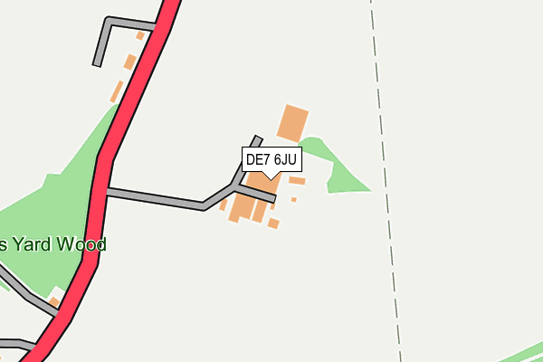
DE7 6JU is located in the Little Eaton & Stanley electoral ward, within the local authority district of Erewash and the English Parliamentary constituency of Mid Derbyshire. The Sub Integrated Care Board (ICB) Location is NHS Derby and Derbyshire ICB - 15M and the police force is Derbyshire. This postcode has been in use since August 2011.


GetTheData
Source: OS OpenMap – Local (Ordnance Survey)
Source: OS VectorMap District (Ordnance Survey)
Licence: Open Government Licence (requires attribution)
| Easting | 439172 |
| Northing | 340013 |
| Latitude | 52.956086 |
| Longitude | -1.418355 |
GetTheData
Source: Open Postcode Geo
Licence: Open Government Licence
| Country | England |
| Postcode District | DE7 |
➜ See where DE7 is on a map | |
GetTheData
Source: Land Registry Price Paid Data
Licence: Open Government Licence
Elevation or altitude of DE7 6JU as distance above sea level:
| Metres | Feet | |
|---|---|---|
| Elevation | 120m | 394ft |
Elevation is measured from the approximate centre of the postcode, to the nearest point on an OS contour line from OS Terrain 50, which has contour spacing of ten vertical metres.
➜ How high above sea level am I? Find the elevation of your current position using your device's GPS.
GetTheData
Source: Open Postcode Elevation
Licence: Open Government Licence
| Ward | Little Eaton & Stanley |
| Constituency | Mid Derbyshire |
GetTheData
Source: ONS Postcode Database
Licence: Open Government Licence
| Broomfield Cottages (A608 Main Road) | Broomfield | 221m |
| Broomfield Cottages (A608 Main Road) | Broomfield | 228m |
| Broomfield College (A608) | Broomfield | 253m |
| Broomfield College (A608) | Broomfield | 280m |
| Derby College (Bus Park) | Broomfield | 466m |
| Spondon Station | 4.9km |
| Derby Station | 5.3km |
| Duffield Station | 5.8km |
GetTheData
Source: NaPTAN
Licence: Open Government Licence
GetTheData
Source: ONS Postcode Database
Licence: Open Government Licence


➜ Get more ratings from the Food Standards Agency
GetTheData
Source: Food Standards Agency
Licence: FSA terms & conditions
| Last Collection | |||
|---|---|---|---|
| Location | Mon-Fri | Sat | Distance |
| Oakwood | 17:30 | 11:30 | 913m |
| Morley Road | 17:30 | 11:30 | 1,126m |
| Breadsall Moor | 16:00 | 08:30 | 1,447m |
GetTheData
Source: Dracos
Licence: Creative Commons Attribution-ShareAlike
The below table lists the International Territorial Level (ITL) codes (formerly Nomenclature of Territorial Units for Statistics (NUTS) codes) and Local Administrative Units (LAU) codes for DE7 6JU:
| ITL 1 Code | Name |
|---|---|
| TLF | East Midlands (England) |
| ITL 2 Code | Name |
| TLF1 | Derbyshire and Nottinghamshire |
| ITL 3 Code | Name |
| TLF13 | South and West Derbyshire |
| LAU 1 Code | Name |
| E07000036 | Erewash |
GetTheData
Source: ONS Postcode Directory
Licence: Open Government Licence
The below table lists the Census Output Area (OA), Lower Layer Super Output Area (LSOA), and Middle Layer Super Output Area (MSOA) for DE7 6JU:
| Code | Name | |
|---|---|---|
| OA | E00099530 | |
| LSOA | E01019671 | Erewash 004B |
| MSOA | E02004081 | Erewash 004 |
GetTheData
Source: ONS Postcode Directory
Licence: Open Government Licence
| DE7 6DN | Broomfield Cottages | 226m |
| DE21 2QZ | Crossdale Grove | 646m |
| DE21 2XR | Speedwell Close | 663m |
| DE21 2PE | Hasgill Close | 674m |
| DE21 2PB | Brandelhow Court | 692m |
| DE21 4TN | Poplar Grange | 696m |
| DE21 4RF | Lime Lane | 702m |
| DE21 2SY | Gilderdale Way | 720m |
| DE21 2XZ | Consort Gardens | 724m |
| DE21 2TP | Kyle Grove | 726m |
GetTheData
Source: Open Postcode Geo; Land Registry Price Paid Data
Licence: Open Government Licence