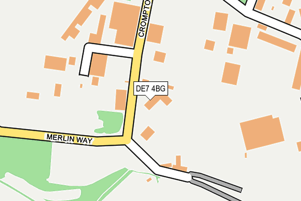
DE7 4BG lies on Crompton Road in Ilkeston. DE7 4BG is located in the Hallam Fields electoral ward, within the local authority district of Erewash and the English Parliamentary constituency of Erewash. The Sub Integrated Care Board (ICB) Location is NHS Derby and Derbyshire ICB - 15M and the police force is Derbyshire. This postcode has been in use since January 1980.


GetTheData
Source: OS OpenMap – Local (Ordnance Survey)
Source: OS VectorMap District (Ordnance Survey)
Licence: Open Government Licence (requires attribution)
| Easting | 447618 |
| Northing | 339455 |
| Latitude | 52.950390 |
| Longitude | -1.292724 |
GetTheData
Source: Open Postcode Geo
Licence: Open Government Licence
| Street | Crompton Road |
| Town/City | Ilkeston |
| Country | England |
| Postcode District | DE7 |
➜ See where DE7 is on a map ➜ Where is Ilkeston? | |
GetTheData
Source: Land Registry Price Paid Data
Licence: Open Government Licence
Elevation or altitude of DE7 4BG as distance above sea level:
| Metres | Feet | |
|---|---|---|
| Elevation | 50m | 164ft |
Elevation is measured from the approximate centre of the postcode, to the nearest point on an OS contour line from OS Terrain 50, which has contour spacing of ten vertical metres.
➜ How high above sea level am I? Find the elevation of your current position using your device's GPS.
GetTheData
Source: Open Postcode Elevation
Licence: Open Government Licence
| Ward | Hallam Fields |
| Constituency | Erewash |
GetTheData
Source: ONS Postcode Database
Licence: Open Government Licence
CASTLE ENVIRONMENTAL, CROMPTON ROAD, ILKESTON, DE7 4BG 1999 30 JUL £100,000 |
GetTheData
Source: HM Land Registry Price Paid Data
Licence: Contains HM Land Registry data © Crown copyright and database right 2025. This data is licensed under the Open Government Licence v3.0.
| Hallam Fields Road (Corporation Road) | Hallam Fields | 620m |
| Hallam Fields Road (Corporation Road) | Hallam Fields | 654m |
| Mitchell Terrace (Longfield Lane) | Hallam Fields | 675m |
| Haynes Avenue (Ilkeston Road) | Trowell | 731m |
| Haynes Avenue (Ilkeston Road) | Trowell | 733m |
| Ilkeston Station | 3.3km |
| Attenborough Station | 6.4km |
GetTheData
Source: NaPTAN
Licence: Open Government Licence
| Median download speed | 24.8Mbps |
| Average download speed | 28.8Mbps |
| Maximum download speed | 77.71Mbps |
| Median upload speed | 4.9Mbps |
| Average upload speed | 5.7Mbps |
| Maximum upload speed | 20.00Mbps |
GetTheData
Source: Ofcom
Licence: Ofcom Terms of Use (requires attribution)
GetTheData
Source: ONS Postcode Database
Licence: Open Government Licence


➜ Get more ratings from the Food Standards Agency
GetTheData
Source: Food Standards Agency
Licence: FSA terms & conditions
| Last Collection | |||
|---|---|---|---|
| Location | Mon-Fri | Sat | Distance |
| Kingston Avenue | 17:30 | 07:15 | 543m |
| Ilkeston Road | 17:30 | 11:30 | 788m |
| Trowell Post Office | 16:45 | 12:15 | 831m |
GetTheData
Source: Dracos
Licence: Creative Commons Attribution-ShareAlike
The below table lists the International Territorial Level (ITL) codes (formerly Nomenclature of Territorial Units for Statistics (NUTS) codes) and Local Administrative Units (LAU) codes for DE7 4BG:
| ITL 1 Code | Name |
|---|---|
| TLF | East Midlands (England) |
| ITL 2 Code | Name |
| TLF1 | Derbyshire and Nottinghamshire |
| ITL 3 Code | Name |
| TLF13 | South and West Derbyshire |
| LAU 1 Code | Name |
| E07000036 | Erewash |
GetTheData
Source: ONS Postcode Directory
Licence: Open Government Licence
The below table lists the Census Output Area (OA), Lower Layer Super Output Area (LSOA), and Middle Layer Super Output Area (MSOA) for DE7 4BG:
| Code | Name | |
|---|---|---|
| OA | E00170729 | |
| LSOA | E01019658 | Erewash 006A |
| MSOA | E02004083 | Erewash 006 |
GetTheData
Source: ONS Postcode Directory
Licence: Open Government Licence
| DE7 4AZ | Hallam Fields Road | 282m |
| DE7 4BT | Somerleyton Drive | 420m |
| DE7 4BD | Kingston Avenue | 465m |
| DE7 4BB | Hexham Avenue | 483m |
| DE7 4BA | Kingston Avenue | 499m |
| DE7 4SA | Thistle Road | 594m |
| DE7 4RA | Merlin Way | 598m |
| DE7 4FT | Charnos Street | 601m |
| DE7 4SB | Gadsby Close | 631m |
| DE7 4BX | Noskwith Street | 672m |
GetTheData
Source: Open Postcode Geo; Land Registry Price Paid Data
Licence: Open Government Licence