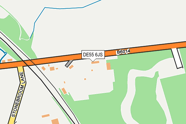
DE55 6JS is located in the Tibshelf electoral ward, within the local authority district of Bolsover and the English Parliamentary constituency of Bolsover. The Sub Integrated Care Board (ICB) Location is NHS Derby and Derbyshire ICB - 15M and the police force is Derbyshire. This postcode has been in use since August 1992.


GetTheData
Source: OS OpenMap – Local (Ordnance Survey)
Source: OS VectorMap District (Ordnance Survey)
Licence: Open Government Licence (requires attribution)
| Easting | 442129 |
| Northing | 360235 |
| Latitude | 53.137630 |
| Longitude | -1.371706 |
GetTheData
Source: Open Postcode Geo
Licence: Open Government Licence
| Country | England |
| Postcode District | DE55 |
➜ See where DE55 is on a map ➜ Where is Stonebroom? | |
GetTheData
Source: Land Registry Price Paid Data
Licence: Open Government Licence
Elevation or altitude of DE55 6JS as distance above sea level:
| Metres | Feet | |
|---|---|---|
| Elevation | 110m | 361ft |
Elevation is measured from the approximate centre of the postcode, to the nearest point on an OS contour line from OS Terrain 50, which has contour spacing of ten vertical metres.
➜ How high above sea level am I? Find the elevation of your current position using your device's GPS.
GetTheData
Source: Open Postcode Elevation
Licence: Open Government Licence
| Ward | Tibshelf |
| Constituency | Bolsover |
GetTheData
Source: ONS Postcode Database
Licence: Open Government Licence
| Love Lane (Stonebroom Lane) | Morton | 322m |
| Love Lane (Stonebroom Lane) | Morton | 340m |
| Corner Pin (Station Road) | Morton | 366m |
| Corner Pin (Station Road) | Morton | 404m |
| Morton Lodge (Pilsley Road) | Morton | 456m |
| Alfreton Station | 4.1km |
GetTheData
Source: NaPTAN
Licence: Open Government Licence
GetTheData
Source: ONS Postcode Database
Licence: Open Government Licence


➜ Get more ratings from the Food Standards Agency
GetTheData
Source: Food Standards Agency
Licence: FSA terms & conditions
| Last Collection | |||
|---|---|---|---|
| Location | Mon-Fri | Sat | Distance |
| Stonebroom Post Office | 16:30 | 10:00 | 735m |
| Morton Post Office | 16:00 | 09:30 | 961m |
| Quarry Road | 16:30 | 10:00 | 1,391m |
GetTheData
Source: Dracos
Licence: Creative Commons Attribution-ShareAlike
The below table lists the International Territorial Level (ITL) codes (formerly Nomenclature of Territorial Units for Statistics (NUTS) codes) and Local Administrative Units (LAU) codes for DE55 6JS:
| ITL 1 Code | Name |
|---|---|
| TLF | East Midlands (England) |
| ITL 2 Code | Name |
| TLF1 | Derbyshire and Nottinghamshire |
| ITL 3 Code | Name |
| TLF12 | East Derbyshire |
| LAU 1 Code | Name |
| E07000033 | Bolsover |
GetTheData
Source: ONS Postcode Directory
Licence: Open Government Licence
The below table lists the Census Output Area (OA), Lower Layer Super Output Area (LSOA), and Middle Layer Super Output Area (MSOA) for DE55 6JS:
| Code | Name | |
|---|---|---|
| OA | E00098726 | |
| LSOA | E01019520 | Bolsover 008C |
| MSOA | E02004052 | Bolsover 008 |
GetTheData
Source: ONS Postcode Directory
Licence: Open Government Licence
| DE55 6JR | Doe Hill Lane | 143m |
| DE55 6HT | Westwood Gardens | 354m |
| DE55 6JP | Love Lane | 383m |
| DE55 6HP | Pilsley Road | 452m |
| DE55 6HS | Penfold Way | 478m |
| DE55 6HN | Station Road | 498m |
| DE55 6HR | Bacchus Way | 534m |
| DE55 6LL | Dale Close | 645m |
| DE55 6HJ | Pit Lane | 693m |
| DE55 6LQ | Stonebroom Industrial Estate | 701m |
GetTheData
Source: Open Postcode Geo; Land Registry Price Paid Data
Licence: Open Government Licence