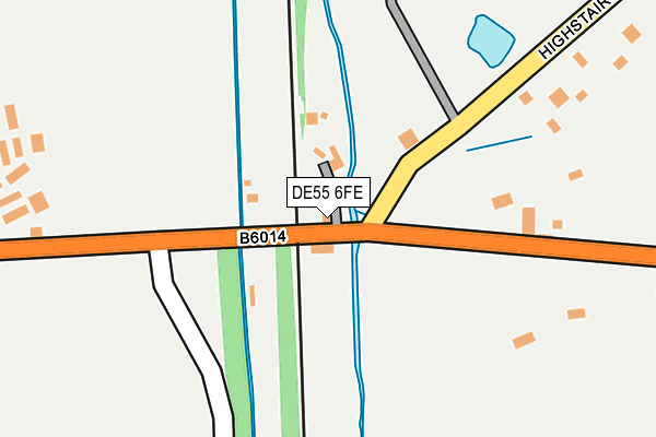
DE55 6FE lies on Smithymoor in Stretton, Alfreton. DE55 6FE is located in the Pilsley & Morton electoral ward, within the local authority district of North East Derbyshire and the English Parliamentary constituency of Bolsover. The Sub Integrated Care Board (ICB) Location is NHS Derby and Derbyshire ICB - 15M and the police force is Derbyshire. This postcode has been in use since August 1992.


GetTheData
Source: OS OpenMap – Local (Ordnance Survey)
Source: OS VectorMap District (Ordnance Survey)
Licence: Open Government Licence (requires attribution)
| Easting | 438746 |
| Northing | 361433 |
| Latitude | 53.148654 |
| Longitude | -1.422128 |
GetTheData
Source: Open Postcode Geo
Licence: Open Government Licence
| Street | Smithymoor |
| Locality | Stretton |
| Town/City | Alfreton |
| Country | England |
| Postcode District | DE55 |
➜ See where DE55 is on a map ➜ Where is Smithy Moor? | |
GetTheData
Source: Land Registry Price Paid Data
Licence: Open Government Licence
Elevation or altitude of DE55 6FE as distance above sea level:
| Metres | Feet | |
|---|---|---|
| Elevation | 110m | 361ft |
Elevation is measured from the approximate centre of the postcode, to the nearest point on an OS contour line from OS Terrain 50, which has contour spacing of ten vertical metres.
➜ How high above sea level am I? Find the elevation of your current position using your device's GPS.
GetTheData
Source: Open Postcode Elevation
Licence: Open Government Licence
| Ward | Pilsley & Morton |
| Constituency | Bolsover |
GetTheData
Source: ONS Postcode Database
Licence: Open Government Licence
| Nursery (Main Road) | Stretton | 556m |
| Nursery (Main Road) | Stretton | 603m |
| Top Farm (Main Road) | Stretton | 632m |
| Top Farm (Main Road) | Stretton | 659m |
| Morton Road | Stretton | 666m |
GetTheData
Source: NaPTAN
Licence: Open Government Licence
| Percentage of properties with Next Generation Access | 100.0% |
| Percentage of properties with Superfast Broadband | 72.2% |
| Percentage of properties with Ultrafast Broadband | 0.0% |
| Percentage of properties with Full Fibre Broadband | 0.0% |
Superfast Broadband is between 30Mbps and 300Mbps
Ultrafast Broadband is > 300Mbps
| Median download speed | 24.6Mbps |
| Average download speed | 24.1Mbps |
| Maximum download speed | 66.92Mbps |
| Median upload speed | 6.7Mbps |
| Average upload speed | 5.2Mbps |
| Maximum upload speed | 10.31Mbps |
| Percentage of properties unable to receive 2Mbps | 0.0% |
| Percentage of properties unable to receive 5Mbps | 0.0% |
| Percentage of properties unable to receive 10Mbps | 5.6% |
| Percentage of properties unable to receive 30Mbps | 27.8% |
GetTheData
Source: Ofcom
Licence: Ofcom Terms of Use (requires attribution)
Estimated total energy consumption in DE55 6FE by fuel type, 2015.
| Consumption (kWh) | 299,799 |
|---|---|
| Meter count | 16 |
| Mean (kWh/meter) | 18,737 |
| Median (kWh/meter) | 19,731 |
| Consumption (kWh) | 116,426 |
|---|---|
| Meter count | 18 |
| Mean (kWh/meter) | 6,468 |
| Median (kWh/meter) | 4,772 |
GetTheData
Source: Postcode level gas estimates: 2015 (experimental)
Source: Postcode level electricity estimates: 2015 (experimental)
Licence: Open Government Licence
GetTheData
Source: ONS Postcode Database
Licence: Open Government Licence


➜ Get more ratings from the Food Standards Agency
GetTheData
Source: Food Standards Agency
Licence: FSA terms & conditions
| Last Collection | |||
|---|---|---|---|
| Location | Mon-Fri | Sat | Distance |
| Highstair Lane | 16:00 | 08:00 | 125m |
| Old Stretton Post Office | 16:00 | 07:30 | 635m |
| Handley Lane | 16:00 | 09:30 | 1,280m |
GetTheData
Source: Dracos
Licence: Creative Commons Attribution-ShareAlike
| Risk of DE55 6FE flooding from rivers and sea | Medium |
| ➜ DE55 6FE flood map | |
GetTheData
Source: Open Flood Risk by Postcode
Licence: Open Government Licence
The below table lists the International Territorial Level (ITL) codes (formerly Nomenclature of Territorial Units for Statistics (NUTS) codes) and Local Administrative Units (LAU) codes for DE55 6FE:
| ITL 1 Code | Name |
|---|---|
| TLF | East Midlands (England) |
| ITL 2 Code | Name |
| TLF1 | Derbyshire and Nottinghamshire |
| ITL 3 Code | Name |
| TLF12 | East Derbyshire |
| LAU 1 Code | Name |
| E07000038 | North East Derbyshire |
GetTheData
Source: ONS Postcode Directory
Licence: Open Government Licence
The below table lists the Census Output Area (OA), Lower Layer Super Output Area (LSOA), and Middle Layer Super Output Area (MSOA) for DE55 6FE:
| Code | Name | |
|---|---|---|
| OA | E00100274 | |
| LSOA | E01019814 | North East Derbyshire 013A |
| MSOA | E02004117 | North East Derbyshire 013 |
GetTheData
Source: ONS Postcode Directory
Licence: Open Government Licence
| DE55 6FD | Highstairs Lane | 387m |
| DE55 6EU | Smiths Lane | 516m |
| DE55 6ET | Main Road | 576m |
| DE55 6EW | Main Road | 606m |
| DE55 6FB | Main Road | 763m |
| DE55 6EX | 865m | |
| S45 9AU | Handley Lane | 940m |
| S45 9AT | Handley Lane | 1067m |
| DE55 6FZ | Burnshaw Street | 1125m |
| DE55 6FW | Mickley Lane | 1164m |
GetTheData
Source: Open Postcode Geo; Land Registry Price Paid Data
Licence: Open Government Licence