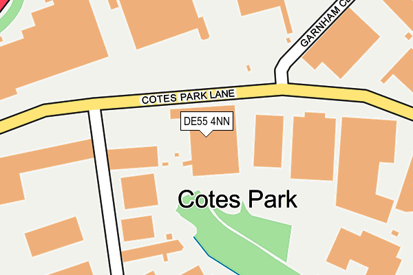
DE55 4NN is located in the Somercotes electoral ward, within the local authority district of Amber Valley and the English Parliamentary constituency of Amber Valley. The Sub Integrated Care Board (ICB) Location is NHS Derby and Derbyshire ICB - 15M and the police force is Derbyshire. This postcode has been in use since January 1980.


GetTheData
Source: OS OpenMap – Local (Ordnance Survey)
Source: OS VectorMap District (Ordnance Survey)
Licence: Open Government Licence (requires attribution)
| Easting | 442427 |
| Northing | 354726 |
| Latitude | 53.088070 |
| Longitude | -1.367980 |
GetTheData
Source: Open Postcode Geo
Licence: Open Government Licence
| Country | England |
| Postcode District | DE55 |
➜ See where DE55 is on a map ➜ Where is Somercotes? | |
GetTheData
Source: Land Registry Price Paid Data
Licence: Open Government Licence
Elevation or altitude of DE55 4NN as distance above sea level:
| Metres | Feet | |
|---|---|---|
| Elevation | 140m | 459ft |
Elevation is measured from the approximate centre of the postcode, to the nearest point on an OS contour line from OS Terrain 50, which has contour spacing of ten vertical metres.
➜ How high above sea level am I? Find the elevation of your current position using your device's GPS.
GetTheData
Source: Open Postcode Elevation
Licence: Open Government Licence
| Ward | Somercotes |
| Constituency | Amber Valley |
GetTheData
Source: ONS Postcode Database
Licence: Open Government Licence
| Cotes Park Lane (Nottingham Road) | Cotes Park | 496m |
| Cotes Park Lane (Nottingham Road) | Cotes Park | 508m |
| Birchwood Road | Outseats Estate | 508m |
| Wimsey Way (Nottingham Road) | Cotes Park | 544m |
| Chatham Avenue (Flowery Leys Lane) | Outseats Estate | 561m |
| Alfreton Station | 1.4km |
GetTheData
Source: NaPTAN
Licence: Open Government Licence
GetTheData
Source: ONS Postcode Database
Licence: Open Government Licence


➜ Get more ratings from the Food Standards Agency
GetTheData
Source: Food Standards Agency
Licence: FSA terms & conditions
| Last Collection | |||
|---|---|---|---|
| Location | Mon-Fri | Sat | Distance |
| Cotes Park Business Box | 18:30 | 184m | |
| Alfreton Delivery Office Box | 17:30 | 12:00 | 456m |
| Flowery Lees Lane | 17:00 | 09:30 | 494m |
GetTheData
Source: Dracos
Licence: Creative Commons Attribution-ShareAlike
The below table lists the International Territorial Level (ITL) codes (formerly Nomenclature of Territorial Units for Statistics (NUTS) codes) and Local Administrative Units (LAU) codes for DE55 4NN:
| ITL 1 Code | Name |
|---|---|
| TLF | East Midlands (England) |
| ITL 2 Code | Name |
| TLF1 | Derbyshire and Nottinghamshire |
| ITL 3 Code | Name |
| TLF13 | South and West Derbyshire |
| LAU 1 Code | Name |
| E07000032 | Amber Valley |
GetTheData
Source: ONS Postcode Directory
Licence: Open Government Licence
The below table lists the Census Output Area (OA), Lower Layer Super Output Area (LSOA), and Middle Layer Super Output Area (MSOA) for DE55 4NN:
| Code | Name | |
|---|---|---|
| OA | E00098473 | |
| LSOA | E01019468 | Amber Valley 003C |
| MSOA | E02004031 | Amber Valley 003 |
GetTheData
Source: ONS Postcode Directory
Licence: Open Government Licence
| DE55 4QQ | Birchwood Way | 336m |
| DE55 4QJ | West Way | 380m |
| DE55 7QJ | Elmwood Drive | 449m |
| DE55 7QD | Birchwood Road | 450m |
| DE55 7RL | Monk Road | 499m |
| DE55 7QE | Flowery Leys Lane | 500m |
| DE55 4HQ | Nottingham Road | 502m |
| DE55 7QB | Birchwood Road | 503m |
| DE55 7QL | Ash Court | 519m |
| DE55 7QF | Briar Close | 532m |
GetTheData
Source: Open Postcode Geo; Land Registry Price Paid Data
Licence: Open Government Licence