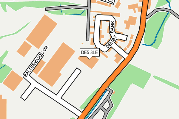
DE5 8LE is located in the Kilburn, Denby, Holbrook & Horsley electoral ward, within the local authority district of Amber Valley and the English Parliamentary constituency of Amber Valley. The Sub Integrated Care Board (ICB) Location is NHS Derby and Derbyshire ICB - 15M and the police force is Derbyshire. This postcode has been in use since September 2016.


GetTheData
Source: OS OpenMap – Local (Ordnance Survey)
Source: OS VectorMap District (Ordnance Survey)
Licence: Open Government Licence (requires attribution)
| Easting | 439761 |
| Northing | 348307 |
| Latitude | 53.030596 |
| Longitude | -1.408571 |
GetTheData
Source: Open Postcode Geo
Licence: Open Government Licence
| Country | England |
| Postcode District | DE5 |
➜ See where DE5 is on a map ➜ Where is Ripley? | |
GetTheData
Source: Land Registry Price Paid Data
Licence: Open Government Licence
Elevation or altitude of DE5 8LE as distance above sea level:
| Metres | Feet | |
|---|---|---|
| Elevation | 100m | 328ft |
Elevation is measured from the approximate centre of the postcode, to the nearest point on an OS contour line from OS Terrain 50, which has contour spacing of ten vertical metres.
➜ How high above sea level am I? Find the elevation of your current position using your device's GPS.
GetTheData
Source: Open Postcode Elevation
Licence: Open Government Licence
| Ward | Kilburn, Denby, Holbrook & Horsley |
| Constituency | Amber Valley |
GetTheData
Source: ONS Postcode Database
Licence: Open Government Licence
| Denby Bank (Derby Road) | Marehay | 153m |
| Denby Bank (Derby Road) | Marehay | 176m |
| Mount Pleasant Farm (Derby Road) | Denby | 184m |
| Mount Pleasant Farm (Derby Road) | Denby | 244m |
| Pargate Close (Upper Marehay Road) | Marehay | 291m |
| Belper Station | 5km |
| Ambergate Station | 5.9km |
GetTheData
Source: NaPTAN
Licence: Open Government Licence
GetTheData
Source: ONS Postcode Database
Licence: Open Government Licence


➜ Get more ratings from the Food Standards Agency
GetTheData
Source: Food Standards Agency
Licence: FSA terms & conditions
| Last Collection | |||
|---|---|---|---|
| Location | Mon-Fri | Sat | Distance |
| Royal Oak | 16:00 | 08:00 | 356m |
| Upper Marehay Road | 17:30 | 08:00 | 418m |
| Derby Road | 17:30 | 07:15 | 848m |
GetTheData
Source: Dracos
Licence: Creative Commons Attribution-ShareAlike
The below table lists the International Territorial Level (ITL) codes (formerly Nomenclature of Territorial Units for Statistics (NUTS) codes) and Local Administrative Units (LAU) codes for DE5 8LE:
| ITL 1 Code | Name |
|---|---|
| TLF | East Midlands (England) |
| ITL 2 Code | Name |
| TLF1 | Derbyshire and Nottinghamshire |
| ITL 3 Code | Name |
| TLF13 | South and West Derbyshire |
| LAU 1 Code | Name |
| E07000032 | Amber Valley |
GetTheData
Source: ONS Postcode Directory
Licence: Open Government Licence
The below table lists the Census Output Area (OA), Lower Layer Super Output Area (LSOA), and Middle Layer Super Output Area (MSOA) for DE5 8LE:
| Code | Name | |
|---|---|---|
| OA | E00098351 | |
| LSOA | E01019448 | Amber Valley 015B |
| MSOA | E02004043 | Amber Valley 015 |
GetTheData
Source: ONS Postcode Directory
Licence: Open Government Licence
| DE5 8LA | Denby Bank | 94m |
| DE5 8LD | Denby Bank | 111m |
| DE5 8LB | Denby Bank | 128m |
| DE5 8JU | Pargate Close | 217m |
| DE5 8JF | Upper Marehay | 290m |
| DE5 8JN | Derby Road | 359m |
| DE5 8JP | Mulberry Mews | 377m |
| DE5 8JQ | Belle Vue Avenue | 429m |
| DE5 8JG | Upper Marehay | 491m |
| DE5 8JT | Swallow Court | 497m |
GetTheData
Source: Open Postcode Geo; Land Registry Price Paid Data
Licence: Open Government Licence