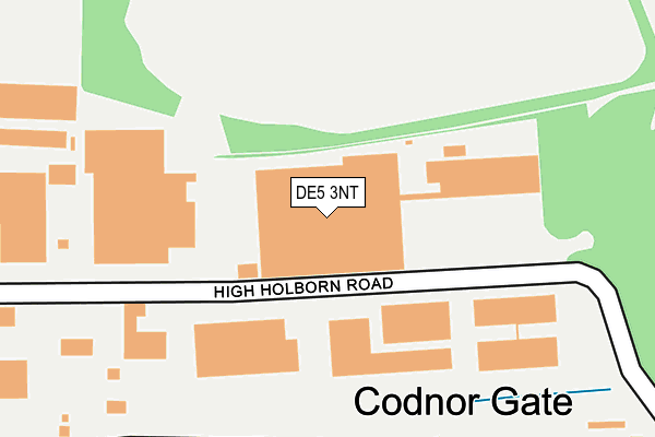
DE5 3NT is located in the Codnor, Langley Mill & Aldercar electoral ward, within the local authority district of Amber Valley and the English Parliamentary constituency of Amber Valley. The Sub Integrated Care Board (ICB) Location is NHS Derby and Derbyshire ICB - 15M and the police force is Derbyshire. This postcode has been in use since May 2005.


GetTheData
Source: OS OpenMap – Local (Ordnance Survey)
Source: OS VectorMap District (Ordnance Survey)
Licence: Open Government Licence (requires attribution)
| Easting | 441800 |
| Northing | 350428 |
| Latitude | 53.049486 |
| Longitude | -1.377898 |
GetTheData
Source: Open Postcode Geo
Licence: Open Government Licence
| Country | England |
| Postcode District | DE5 |
➜ See where DE5 is on a map ➜ Where is Ripley? | |
GetTheData
Source: Land Registry Price Paid Data
Licence: Open Government Licence
Elevation or altitude of DE5 3NT as distance above sea level:
| Metres | Feet | |
|---|---|---|
| Elevation | 130m | 427ft |
Elevation is measured from the approximate centre of the postcode, to the nearest point on an OS contour line from OS Terrain 50, which has contour spacing of ten vertical metres.
➜ How high above sea level am I? Find the elevation of your current position using your device's GPS.
GetTheData
Source: Open Postcode Elevation
Licence: Open Government Licence
| Ward | Codnor, Langley Mill & Aldercar |
| Constituency | Amber Valley |
GetTheData
Source: ONS Postcode Database
Licence: Open Government Licence
| Gate Inn (Nottingham Road) | Codnor | 261m |
| Gate Inn (Nottingham Road) | Codnor | 311m |
| Glasshouse Hill | Codnor | 352m |
| Glasshouse Hill | Codnor | 365m |
| High Holborn Road (Alfreton Road) | Codnor | 375m |
| Langley Mill Station | 4.7km |
GetTheData
Source: NaPTAN
Licence: Open Government Licence
GetTheData
Source: ONS Postcode Database
Licence: Open Government Licence


➜ Get more ratings from the Food Standards Agency
GetTheData
Source: Food Standards Agency
Licence: FSA terms & conditions
| Last Collection | |||
|---|---|---|---|
| Location | Mon-Fri | Sat | Distance |
| Codnor Gate Business Box | 18:30 | 97m | |
| Codnor | 17:30 | 07:30 | 249m |
| Steam Mill Lane | 17:30 | 07:30 | 591m |
GetTheData
Source: Dracos
Licence: Creative Commons Attribution-ShareAlike
The below table lists the International Territorial Level (ITL) codes (formerly Nomenclature of Territorial Units for Statistics (NUTS) codes) and Local Administrative Units (LAU) codes for DE5 3NT:
| ITL 1 Code | Name |
|---|---|
| TLF | East Midlands (England) |
| ITL 2 Code | Name |
| TLF1 | Derbyshire and Nottinghamshire |
| ITL 3 Code | Name |
| TLF13 | South and West Derbyshire |
| LAU 1 Code | Name |
| E07000032 | Amber Valley |
GetTheData
Source: ONS Postcode Directory
Licence: Open Government Licence
The below table lists the Census Output Area (OA), Lower Layer Super Output Area (LSOA), and Middle Layer Super Output Area (MSOA) for DE5 3NT:
| Code | Name | |
|---|---|---|
| OA | E00098219 | |
| LSOA | E01019420 | Amber Valley 005A |
| MSOA | E02004033 | Amber Valley 005 |
GetTheData
Source: ONS Postcode Directory
Licence: Open Government Licence
| DE5 3NW | High Holborn Road | 128m |
| DE5 9QW | Codnor Gate | 232m |
| DE5 9QU | Stirland Street | 289m |
| DE5 9PP | Brookfield Close | 357m |
| DE5 9RA | Smith Avenue | 365m |
| DE5 9SJ | Redmoor Close | 370m |
| DE5 9RD | Gate Brook Close | 403m |
| DE5 9SE | The Orchard | 425m |
| DE5 3JX | Nottingham Road | 449m |
| DE5 9QS | Glass House Hill | 459m |
GetTheData
Source: Open Postcode Geo; Land Registry Price Paid Data
Licence: Open Government Licence