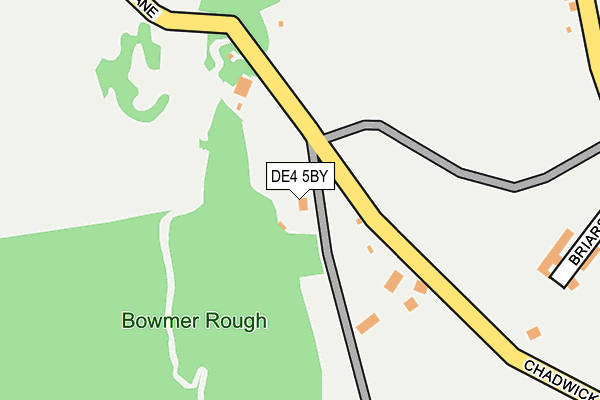
DE4 5BY lies on Chadwick Nick Lane in Crich, Matlock. DE4 5BY is located in the Crich & South Wingfield electoral ward, within the local authority district of Amber Valley and the English Parliamentary constituency of Derbyshire Dales. The Sub Integrated Care Board (ICB) Location is NHS Derby and Derbyshire ICB - 15M and the police force is Derbyshire. This postcode has been in use since January 1980.


GetTheData
Source: OS OpenMap – Local (Ordnance Survey)
Source: OS VectorMap District (Ordnance Survey)
Licence: Open Government Licence (requires attribution)
| Easting | 434904 |
| Northing | 353041 |
| Latitude | 53.073467 |
| Longitude | -1.480482 |
GetTheData
Source: Open Postcode Geo
Licence: Open Government Licence
| Street | Chadwick Nick Lane |
| Locality | Crich |
| Town/City | Matlock |
| Country | England |
| Postcode District | DE4 |
➜ See where DE4 is on a map ➜ Where is Crich? | |
GetTheData
Source: Land Registry Price Paid Data
Licence: Open Government Licence
Elevation or altitude of DE4 5BY as distance above sea level:
| Metres | Feet | |
|---|---|---|
| Elevation | 200m | 656ft |
Elevation is measured from the approximate centre of the postcode, to the nearest point on an OS contour line from OS Terrain 50, which has contour spacing of ten vertical metres.
➜ How high above sea level am I? Find the elevation of your current position using your device's GPS.
GetTheData
Source: Open Postcode Elevation
Licence: Open Government Licence
| Ward | Crich & South Wingfield |
| Constituency | Derbyshire Dales |
GetTheData
Source: ONS Postcode Database
Licence: Open Government Licence
| The Common 146 (The Common) | Crich | 357m |
| The Common 146 (The Common) | Crich | 366m |
| Fritchley Lane (The Common) | Fritchley | 441m |
| Fritchley Lane (Crich Road) | Fritchley | 494m |
| New Road (The Common) | Crich | 525m |
| Ambergate Station | 1.4km |
| Whatstandwell Station | 1.9km |
| Cromford Station | 6.4km |
GetTheData
Source: NaPTAN
Licence: Open Government Licence
| Percentage of properties with Next Generation Access | 100.0% |
| Percentage of properties with Superfast Broadband | 80.0% |
| Percentage of properties with Ultrafast Broadband | 0.0% |
| Percentage of properties with Full Fibre Broadband | 0.0% |
Superfast Broadband is between 30Mbps and 300Mbps
Ultrafast Broadband is > 300Mbps
| Median download speed | 29.1Mbps |
| Average download speed | 22.0Mbps |
| Maximum download speed | 31.42Mbps |
| Median upload speed | 4.5Mbps |
| Average upload speed | 4.1Mbps |
| Maximum upload speed | 5.65Mbps |
| Percentage of properties unable to receive 2Mbps | 0.0% |
| Percentage of properties unable to receive 5Mbps | 0.0% |
| Percentage of properties unable to receive 10Mbps | 0.0% |
| Percentage of properties unable to receive 30Mbps | 20.0% |
GetTheData
Source: Ofcom
Licence: Ofcom Terms of Use (requires attribution)
GetTheData
Source: ONS Postcode Database
Licence: Open Government Licence


➜ Get more ratings from the Food Standards Agency
GetTheData
Source: Food Standards Agency
Licence: FSA terms & conditions
| Last Collection | |||
|---|---|---|---|
| Location | Mon-Fri | Sat | Distance |
| The Briars | 17:00 | 09:30 | 384m |
| The Common | 17:00 | 09:30 | 604m |
| Fritchley Green | 16:00 | 08:00 | 844m |
GetTheData
Source: Dracos
Licence: Creative Commons Attribution-ShareAlike
The below table lists the International Territorial Level (ITL) codes (formerly Nomenclature of Territorial Units for Statistics (NUTS) codes) and Local Administrative Units (LAU) codes for DE4 5BY:
| ITL 1 Code | Name |
|---|---|
| TLF | East Midlands (England) |
| ITL 2 Code | Name |
| TLF1 | Derbyshire and Nottinghamshire |
| ITL 3 Code | Name |
| TLF13 | South and West Derbyshire |
| LAU 1 Code | Name |
| E07000032 | Amber Valley |
GetTheData
Source: ONS Postcode Directory
Licence: Open Government Licence
The below table lists the Census Output Area (OA), Lower Layer Super Output Area (LSOA), and Middle Layer Super Output Area (MSOA) for DE4 5BY:
| Code | Name | |
|---|---|---|
| OA | E00098243 | |
| LSOA | E01019424 | Amber Valley 002C |
| MSOA | E02004030 | Amber Valley 002 |
GetTheData
Source: ONS Postcode Directory
Licence: Open Government Licence
| DE4 5BW | The Common | 385m |
| DE4 5FX | Woodside | 393m |
| DE4 5BZ | Amber Hill | 438m |
| DE56 2HZ | Dale Close | 448m |
| DE56 2HL | Chadwick Nick Lane | 483m |
| DE4 5BX | New Road | 543m |
| DE56 2FN | Fritchley Lane | 576m |
| DE4 5BJ | The Common | 584m |
| DE56 2FL | Bullbridge Hill | 628m |
| DE4 5HR | Tors Springs | 629m |
GetTheData
Source: Open Postcode Geo; Land Registry Price Paid Data
Licence: Open Government Licence