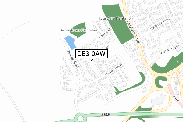
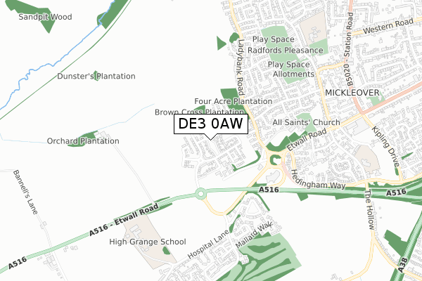
DE3 0AW is located in the Etwall electoral ward, within the local authority district of South Derbyshire and the English Parliamentary constituency of South Derbyshire. The Sub Integrated Care Board (ICB) Location is NHS Derby and Derbyshire ICB - 15M and the police force is Derbyshire. This postcode has been in use since November 2019.


GetTheData
Source: OS Open Zoomstack (Ordnance Survey)
Licence: Open Government Licence (requires attribution)
Attribution: Contains OS data © Crown copyright and database right 2024
Source: Open Postcode Geo
Licence: Open Government Licence (requires attribution)
Attribution: Contains OS data © Crown copyright and database right 2024; Contains Royal Mail data © Royal Mail copyright and database right 2024; Source: Office for National Statistics licensed under the Open Government Licence v.3.0
| Easting | 430126 |
| Northing | 334003 |
| Latitude | 52.902644 |
| Longitude | -1.553557 |
GetTheData
Source: Open Postcode Geo
Licence: Open Government Licence
| Country | England |
| Postcode District | DE3 |
➜ See where DE3 is on a map ➜ Where is Derby? | |
GetTheData
Source: Land Registry Price Paid Data
Licence: Open Government Licence
| Ward | Etwall |
| Constituency | South Derbyshire |
GetTheData
Source: ONS Postcode Database
Licence: Open Government Licence
21, BARBON DRIVE, MICKLEOVER, DERBY, DE3 0AW 2021 26 MAR £498,995 |
19, BARBON DRIVE, MICKLEOVER, DERBY, DE3 0AW 2021 19 MAR £384,995 |
17, BARBON DRIVE, MICKLEOVER, DERBY, DE3 0AW 2021 18 MAR £384,995 |
5, BARBON DRIVE, MICKLEOVER, DERBY, DE3 0AW 2021 9 MAR £399,995 |
15, BARBON DRIVE, MICKLEOVER, DERBY, DE3 0AW 2021 26 FEB £293,995 |
16, BARBON DRIVE, MICKLEOVER, DERBY, DE3 0AW 2021 29 JAN £399,995 |
20, BARBON DRIVE, MICKLEOVER, DERBY, DE3 0AW 2020 18 DEC £299,995 |
24, BARBON DRIVE, MICKLEOVER, DERBY, DE3 0AW 2020 18 DEC £484,995 |
22, BARBON DRIVE, MICKLEOVER, DERBY, DE3 0AW 2020 10 DEC £403,995 |
11, BARBON DRIVE, MICKLEOVER, DERBY, DE3 0AW 2020 3 DEC £399,995 |
GetTheData
Source: HM Land Registry Price Paid Data
Licence: Contains HM Land Registry data © Crown copyright and database right 2024. This data is licensed under the Open Government Licence v3.0.
| Mickleover Turn (Etwall Road) | The Pastures | 252m |
| Mickleover Turn (Etwall Road) | The Pastures | 259m |
| All Saints Court (Etwall Road) | Mickleover | 319m |
| Lidgate Close (Ladybank Road) | Mickleover | 330m |
| All Saints Court (Etwall Road) | Mickleover | 342m |
GetTheData
Source: NaPTAN
Licence: Open Government Licence
GetTheData
Source: ONS Postcode Database
Licence: Open Government Licence


➜ Get more ratings from the Food Standards Agency
GetTheData
Source: Food Standards Agency
Licence: FSA terms & conditions
| Last Collection | |||
|---|---|---|---|
| Location | Mon-Fri | Sat | Distance |
| Pastures Hospital | 17:30 | 11:00 | 477m |
| Catterick Drive | 17:30 | 11:00 | 509m |
| Glenfield Cresent | 17:30 | 11:00 | 657m |
GetTheData
Source: Dracos
Licence: Creative Commons Attribution-ShareAlike
The below table lists the International Territorial Level (ITL) codes (formerly Nomenclature of Territorial Units for Statistics (NUTS) codes) and Local Administrative Units (LAU) codes for DE3 0AW:
| ITL 1 Code | Name |
|---|---|
| TLF | East Midlands (England) |
| ITL 2 Code | Name |
| TLF1 | Derbyshire and Nottinghamshire |
| ITL 3 Code | Name |
| TLF13 | South and West Derbyshire |
| LAU 1 Code | Name |
| E07000039 | South Derbyshire |
GetTheData
Source: ONS Postcode Directory
Licence: Open Government Licence
The below table lists the Census Output Area (OA), Lower Layer Super Output Area (LSOA), and Middle Layer Super Output Area (MSOA) for DE3 0AW:
| Code | Name | |
|---|---|---|
| OA | E00174607 | |
| LSOA | E01019839 | South Derbyshire 001A |
| MSOA | E02004118 | South Derbyshire 001 |
GetTheData
Source: ONS Postcode Directory
Licence: Open Government Licence
| DE3 0TP | Howden Close | 125m |
| DE3 0TN | Ladybank Road | 160m |
| DE3 0TR | Paxton Close | 170m |
| DE3 0TL | Cumbria Walk | 215m |
| DE3 0TW | Ladybank Road | 258m |
| DE3 0TJ | Alverton Close | 267m |
| DE3 0BY | Woodcock Square | 325m |
| DE3 0TH | Sedgefield Green | 326m |
| DE3 0NX | Hedingham Way | 352m |
| DE3 0DT | Wilson Close | 365m |
GetTheData
Source: Open Postcode Geo; Land Registry Price Paid Data
Licence: Open Government Licence