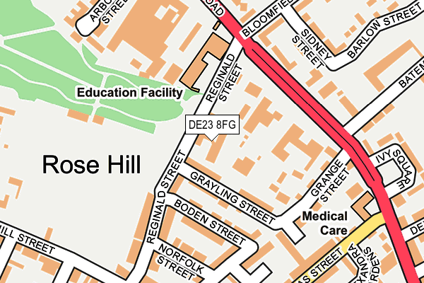
DE23 8FG is located in the Arboretum electoral ward, within the unitary authority of Derby and the English Parliamentary constituency of Derby South. The Sub Integrated Care Board (ICB) Location is NHS Derby and Derbyshire ICB - 15M and the police force is Derbyshire. This postcode has been in use since August 1992.


GetTheData
Source: OS OpenMap – Local (Ordnance Survey)
Source: OS VectorMap District (Ordnance Survey)
Licence: Open Government Licence (requires attribution)
| Easting | 435788 |
| Northing | 334938 |
| Latitude | 52.910703 |
| Longitude | -1.469282 |
GetTheData
Source: Open Postcode Geo
Licence: Open Government Licence
| Country | England |
| Postcode District | DE23 |
➜ See where DE23 is on a map ➜ Where is Derby? | |
GetTheData
Source: Land Registry Price Paid Data
Licence: Open Government Licence
Elevation or altitude of DE23 8FG as distance above sea level:
| Metres | Feet | |
|---|---|---|
| Elevation | 60m | 197ft |
Elevation is measured from the approximate centre of the postcode, to the nearest point on an OS contour line from OS Terrain 50, which has contour spacing of ten vertical metres.
➜ How high above sea level am I? Find the elevation of your current position using your device's GPS.
GetTheData
Source: Open Postcode Elevation
Licence: Open Government Licence
| Ward | Arboretum |
| Constituency | Derby South |
GetTheData
Source: ONS Postcode Database
Licence: Open Government Licence
| Crown Derby (Osmaston Road) | Rose Hill | 197m |
| Ivy Square (Osmaston Road) | Rose Hill | 205m |
| Crown Derby (Osmaston Road) | Rose Hill | 215m |
| Douglas Street | Rose Hill | 237m |
| Ivy Square (Osmaston Road) | Rose Hill | 253m |
| Derby Station | 0.8km |
| Peartree Station | 1.5km |
| Spondon Station | 3.9km |
GetTheData
Source: NaPTAN
Licence: Open Government Licence
| Percentage of properties with Next Generation Access | 100.0% |
| Percentage of properties with Superfast Broadband | 100.0% |
| Percentage of properties with Ultrafast Broadband | 100.0% |
| Percentage of properties with Full Fibre Broadband | 0.0% |
Superfast Broadband is between 30Mbps and 300Mbps
Ultrafast Broadband is > 300Mbps
| Percentage of properties unable to receive 2Mbps | 0.0% |
| Percentage of properties unable to receive 5Mbps | 0.0% |
| Percentage of properties unable to receive 10Mbps | 0.0% |
| Percentage of properties unable to receive 30Mbps | 0.0% |
GetTheData
Source: Ofcom
Licence: Ofcom Terms of Use (requires attribution)
Estimated total energy consumption in DE23 8FG by fuel type, 2015.
| Consumption (kWh) | 39,840 |
|---|---|
| Meter count | 7 |
| Mean (kWh/meter) | 5,691 |
| Median (kWh/meter) | 4,769 |
| Consumption (kWh) | 49,753 |
|---|---|
| Meter count | 35 |
| Mean (kWh/meter) | 1,422 |
| Median (kWh/meter) | 1,164 |
GetTheData
Source: Postcode level gas estimates: 2015 (experimental)
Source: Postcode level electricity estimates: 2015 (experimental)
Licence: Open Government Licence
GetTheData
Source: ONS Postcode Database
Licence: Open Government Licence


➜ Get more ratings from the Food Standards Agency
GetTheData
Source: Food Standards Agency
Licence: FSA terms & conditions
| Last Collection | |||
|---|---|---|---|
| Location | Mon-Fri | Sat | Distance |
| Litchurch | 17:30 | 11:00 | 268m |
| Osmaton Road | 17:30 | 10:30 | 320m |
| St Thomas Post Office | 17:30 | 12:00 | 474m |
GetTheData
Source: Dracos
Licence: Creative Commons Attribution-ShareAlike
The below table lists the International Territorial Level (ITL) codes (formerly Nomenclature of Territorial Units for Statistics (NUTS) codes) and Local Administrative Units (LAU) codes for DE23 8FG:
| ITL 1 Code | Name |
|---|---|
| TLF | East Midlands (England) |
| ITL 2 Code | Name |
| TLF1 | Derbyshire and Nottinghamshire |
| ITL 3 Code | Name |
| TLF11 | Derby |
| LAU 1 Code | Name |
| E06000015 | Derby |
GetTheData
Source: ONS Postcode Directory
Licence: Open Government Licence
The below table lists the Census Output Area (OA), Lower Layer Super Output Area (LSOA), and Middle Layer Super Output Area (MSOA) for DE23 8FG:
| Code | Name | |
|---|---|---|
| OA | E00068081 | |
| LSOA | E01033167 | Derby 018G |
| MSOA | E02002813 | Derby 018 |
GetTheData
Source: ONS Postcode Directory
Licence: Open Government Licence
| DE23 8FQ | Reginald Street | 44m |
| DE23 8FS | Grayling Street | 76m |
| DE23 8JX | Osmaston Road | 99m |
| DE23 8HA | Grange Street | 118m |
| DE23 8GX | Boden Street | 121m |
| DE23 8FR | Reginald Street | 142m |
| DE23 8HD | Grange Street | 162m |
| DE23 8BH | Grange Street | 162m |
| DE23 8FW | Norfolk Street | 178m |
| DE1 2TU | Sidney Street | 183m |
GetTheData
Source: Open Postcode Geo; Land Registry Price Paid Data
Licence: Open Government Licence