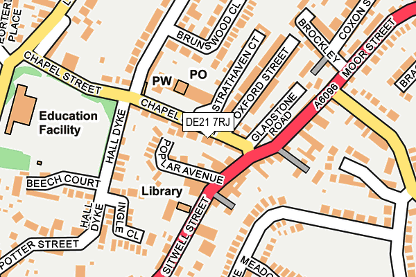
DE21 7RJ is located in the Spondon electoral ward, within the unitary authority of Derby and the English Parliamentary constituency of Mid Derbyshire. The Sub Integrated Care Board (ICB) Location is NHS Derby and Derbyshire ICB - 15M and the police force is Derbyshire. This postcode has been in use since December 1994.


GetTheData
Source: OS OpenMap – Local (Ordnance Survey)
Source: OS VectorMap District (Ordnance Survey)
Licence: Open Government Licence (requires attribution)
| Easting | 440149 |
| Northing | 336126 |
| Latitude | 52.921075 |
| Longitude | -1.404292 |
GetTheData
Source: Open Postcode Geo
Licence: Open Government Licence
| Country | England |
| Postcode District | DE21 |
➜ See where DE21 is on a map ➜ Where is Derby? | |
GetTheData
Source: Land Registry Price Paid Data
Licence: Open Government Licence
Elevation or altitude of DE21 7RJ as distance above sea level:
| Metres | Feet | |
|---|---|---|
| Elevation | 80m | 262ft |
Elevation is measured from the approximate centre of the postcode, to the nearest point on an OS contour line from OS Terrain 50, which has contour spacing of ten vertical metres.
➜ How high above sea level am I? Find the elevation of your current position using your device's GPS.
GetTheData
Source: Open Postcode Elevation
Licence: Open Government Licence
| Ward | Spondon |
| Constituency | Mid Derbyshire |
GetTheData
Source: ONS Postcode Database
Licence: Open Government Licence
| White Swan (Sitwell Street) | Spondon | 68m |
| Chapel Street Shops (Chapel Street) | Spondon | 69m |
| White Swan (Sitwell Street) | Spondon | 72m |
| Chapel Street Shops (Chapel Street) | Spondon | 73m |
| Sitwell Street | Spondon | 218m |
| Spondon Station | 1.1km |
| Derby Station | 4km |
| Peartree Station | 5.4km |
GetTheData
Source: NaPTAN
Licence: Open Government Licence
GetTheData
Source: ONS Postcode Database
Licence: Open Government Licence


➜ Get more ratings from the Food Standards Agency
GetTheData
Source: Food Standards Agency
Licence: FSA terms & conditions
| Last Collection | |||
|---|---|---|---|
| Location | Mon-Fri | Sat | Distance |
| Sitwell Street | 17:30 | 11:00 | 71m |
| Spondon Village Post Office | 17:30 | 11:30 | 75m |
| Stoney Lane | 17:30 | 11:00 | 267m |
GetTheData
Source: Dracos
Licence: Creative Commons Attribution-ShareAlike
The below table lists the International Territorial Level (ITL) codes (formerly Nomenclature of Territorial Units for Statistics (NUTS) codes) and Local Administrative Units (LAU) codes for DE21 7RJ:
| ITL 1 Code | Name |
|---|---|
| TLF | East Midlands (England) |
| ITL 2 Code | Name |
| TLF1 | Derbyshire and Nottinghamshire |
| ITL 3 Code | Name |
| TLF11 | Derby |
| LAU 1 Code | Name |
| E06000015 | Derby |
GetTheData
Source: ONS Postcode Directory
Licence: Open Government Licence
The below table lists the Census Output Area (OA), Lower Layer Super Output Area (LSOA), and Middle Layer Super Output Area (MSOA) for DE21 7RJ:
| Code | Name | |
|---|---|---|
| OA | E00068632 | |
| LSOA | E01013592 | Derby 010A |
| MSOA | E02002805 | Derby 010 |
GetTheData
Source: ONS Postcode Directory
Licence: Open Government Licence
| DE21 7JP | Chapel Street | 27m |
| DE21 7FJ | Poplar Avenue | 57m |
| DE21 7JQ | Chapel Side | 76m |
| DE21 7FG | Sitwell Street | 79m |
| DE21 7JJ | Gladstone Road | 110m |
| DE21 7JL | Oxford Street | 114m |
| DE21 7JN | Oxford Street | 126m |
| DE21 7FH | Sitwell Street | 135m |
| DE21 7EA | Moor Street | 135m |
| DE21 7RH | Strathaven Court | 140m |
GetTheData
Source: Open Postcode Geo; Land Registry Price Paid Data
Licence: Open Government Licence