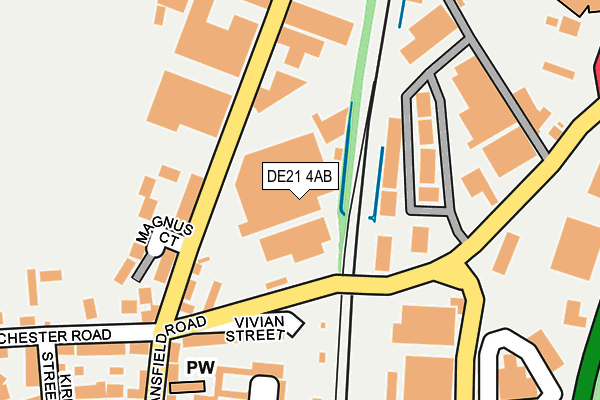
DE21 4AB is located in the Darley electoral ward, within the unitary authority of Derby and the English Parliamentary constituency of Derby North. The Sub Integrated Care Board (ICB) Location is NHS Derby and Derbyshire ICB - 15M and the police force is Derbyshire. This postcode has been in use since June 1996.


GetTheData
Source: OS OpenMap – Local (Ordnance Survey)
Source: OS VectorMap District (Ordnance Survey)
Licence: Open Government Licence (requires attribution)
| Easting | 435769 |
| Northing | 337661 |
| Latitude | 52.935181 |
| Longitude | -1.469265 |
GetTheData
Source: Open Postcode Geo
Licence: Open Government Licence
| Country | England |
| Postcode District | DE21 |
➜ See where DE21 is on a map ➜ Where is Derby? | |
GetTheData
Source: Land Registry Price Paid Data
Licence: Open Government Licence
Elevation or altitude of DE21 4AB as distance above sea level:
| Metres | Feet | |
|---|---|---|
| Elevation | 50m | 164ft |
Elevation is measured from the approximate centre of the postcode, to the nearest point on an OS contour line from OS Terrain 50, which has contour spacing of ten vertical metres.
➜ How high above sea level am I? Find the elevation of your current position using your device's GPS.
GetTheData
Source: Open Postcode Elevation
Licence: Open Government Licence
| Ward | Darley |
| Constituency | Derby North |
GetTheData
Source: ONS Postcode Database
Licence: Open Government Licence
| Stores Road (Mansfield Road) | Little Chester | 220m |
| Stores Road (Mansfield Road) | Little Chester | 222m |
| Coach And Horses (Mansfield Road) | Little Chester | 242m |
| Coach And Horses (Mansfield Road) | Little Chester | 258m |
| Chester Park (Alfreton Road) | Little Chester | 269m |
| Derby Station | 2.1km |
| Peartree Station | 4.3km |
| Spondon Station | 4.7km |
GetTheData
Source: NaPTAN
Licence: Open Government Licence
| Median download speed | 26.1Mbps |
| Average download speed | 34.6Mbps |
| Maximum download speed | 80.00Mbps |
| Median upload speed | 5.6Mbps |
| Average upload speed | 7.1Mbps |
| Maximum upload speed | 20.00Mbps |
GetTheData
Source: Ofcom
Licence: Ofcom Terms of Use (requires attribution)
GetTheData
Source: ONS Postcode Database
Licence: Open Government Licence


➜ Get more ratings from the Food Standards Agency
GetTheData
Source: Food Standards Agency
Licence: FSA terms & conditions
| Last Collection | |||
|---|---|---|---|
| Location | Mon-Fri | Sat | Distance |
| Smalley Road | 18:30 | 11:30 | 198m |
| Stores Road Business Box | 18:30 | 200m | |
| Old Chester Road | 18:30 | 11:30 | 296m |
GetTheData
Source: Dracos
Licence: Creative Commons Attribution-ShareAlike
| Risk of DE21 4AB flooding from rivers and sea | Medium |
| ➜ DE21 4AB flood map | |
GetTheData
Source: Open Flood Risk by Postcode
Licence: Open Government Licence
The below table lists the International Territorial Level (ITL) codes (formerly Nomenclature of Territorial Units for Statistics (NUTS) codes) and Local Administrative Units (LAU) codes for DE21 4AB:
| ITL 1 Code | Name |
|---|---|
| TLF | East Midlands (England) |
| ITL 2 Code | Name |
| TLF1 | Derbyshire and Nottinghamshire |
| ITL 3 Code | Name |
| TLF11 | Derby |
| LAU 1 Code | Name |
| E06000015 | Derby |
GetTheData
Source: ONS Postcode Directory
Licence: Open Government Licence
The below table lists the Census Output Area (OA), Lower Layer Super Output Area (LSOA), and Middle Layer Super Output Area (MSOA) for DE21 4AB:
| Code | Name | |
|---|---|---|
| OA | E00068285 | |
| LSOA | E01013525 | Derby 008D |
| MSOA | E02002803 | Derby 008 |
GetTheData
Source: ONS Postcode Directory
Licence: Open Government Licence
| DE21 4TR | Magnus Court | 122m |
| DE1 3RZ | Vivian Street | 147m |
| DE21 4AA | Alfreton Road | 154m |
| DE21 4TQ | Magnus Court | 176m |
| DE1 3RH | Auriga Court | 200m |
| DE21 4SZ | Parker Industrial Estate | 213m |
| DE1 3RF | Mansfield Road | 244m |
| DE1 3RX | Roman Road | 246m |
| DE21 4AY | Centurion Way Business Park | 249m |
| DE1 3RB | Mansfield Road | 266m |
GetTheData
Source: Open Postcode Geo; Land Registry Price Paid Data
Licence: Open Government Licence