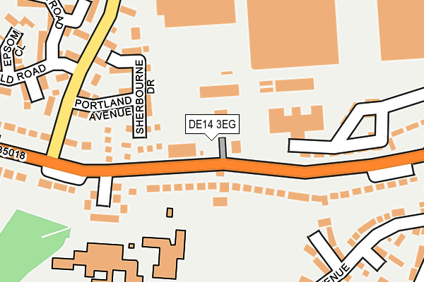
DE14 3EG is located in the Branston electoral ward, within the local authority district of East Staffordshire and the English Parliamentary constituency of Burton. The Sub Integrated Care Board (ICB) Location is NHS Staffordshire and Stoke-on-Trent ICB - 05D and the police force is Staffordshire. This postcode has been in use since January 1980.


GetTheData
Source: OS OpenMap – Local (Ordnance Survey)
Source: OS VectorMap District (Ordnance Survey)
Licence: Open Government Licence (requires attribution)
| Easting | 423241 |
| Northing | 321197 |
| Latitude | 52.787868 |
| Longitude | -1.656821 |
GetTheData
Source: Open Postcode Geo
Licence: Open Government Licence
| Country | England |
| Postcode District | DE14 |
➜ See where DE14 is on a map ➜ Where is Burton upon Trent? | |
GetTheData
Source: Land Registry Price Paid Data
Licence: Open Government Licence
Elevation or altitude of DE14 3EG as distance above sea level:
| Metres | Feet | |
|---|---|---|
| Elevation | 50m | 164ft |
Elevation is measured from the approximate centre of the postcode, to the nearest point on an OS contour line from OS Terrain 50, which has contour spacing of ten vertical metres.
➜ How high above sea level am I? Find the elevation of your current position using your device's GPS.
GetTheData
Source: Open Postcode Elevation
Licence: Open Government Licence
| Ward | Branston |
| Constituency | Burton |
GetTheData
Source: ONS Postcode Database
Licence: Open Government Licence
| Paget School (Burton Road) | Branston | 29m |
| Paget High School (Burton Rd) | Branston | 89m |
| Paget High School (Burton Rd) | Branston | 124m |
| Lingfield Road (Regent's Park Road) | Regents Park | 217m |
| Lingfield Road (Arnot Road) | Regents Park | 225m |
| Burton-on-Trent Station | 2.2km |
GetTheData
Source: NaPTAN
Licence: Open Government Licence
GetTheData
Source: ONS Postcode Database
Licence: Open Government Licence


➜ Get more ratings from the Food Standards Agency
GetTheData
Source: Food Standards Agency
Licence: FSA terms & conditions
| Last Collection | |||
|---|---|---|---|
| Location | Mon-Fri | Sat | Distance |
| Montpellier, Regents Park Road | 17:30 | 10:45 | 217m |
| Branston | 17:30 | 10:45 | 229m |
| Fairway | 17:30 | 10:45 | 353m |
GetTheData
Source: Dracos
Licence: Creative Commons Attribution-ShareAlike
| Risk of DE14 3EG flooding from rivers and sea | Low |
| ➜ DE14 3EG flood map | |
GetTheData
Source: Open Flood Risk by Postcode
Licence: Open Government Licence
The below table lists the International Territorial Level (ITL) codes (formerly Nomenclature of Territorial Units for Statistics (NUTS) codes) and Local Administrative Units (LAU) codes for DE14 3EG:
| ITL 1 Code | Name |
|---|---|
| TLG | West Midlands (England) |
| ITL 2 Code | Name |
| TLG2 | Shropshire and Staffordshire |
| ITL 3 Code | Name |
| TLG24 | Staffordshire CC |
| LAU 1 Code | Name |
| E07000193 | East Staffordshire |
GetTheData
Source: ONS Postcode Directory
Licence: Open Government Licence
The below table lists the Census Output Area (OA), Lower Layer Super Output Area (LSOA), and Middle Layer Super Output Area (MSOA) for DE14 3EG:
| Code | Name | |
|---|---|---|
| OA | E00149869 | |
| LSOA | E01029414 | East Staffordshire 013B |
| MSOA | E02006143 | East Staffordshire 013 |
GetTheData
Source: ONS Postcode Directory
Licence: Open Government Licence
| DE14 3GE | Sherbourne Drive | 108m |
| DE14 3GF | Hylton Close | 134m |
| DE14 3DR | Burton Road | 165m |
| DE14 3GD | Portland Avenue | 169m |
| DE14 3DP | Burton Road | 190m |
| DE14 3EE | Mellor Road | 206m |
| DE14 3GB | Montpelier Close | 220m |
| DE14 3GZ | Turnbury Close | 227m |
| DE14 3BH | Aintree Close | 239m |
| DE14 3GH | Sandown Close | 253m |
GetTheData
Source: Open Postcode Geo; Land Registry Price Paid Data
Licence: Open Government Licence