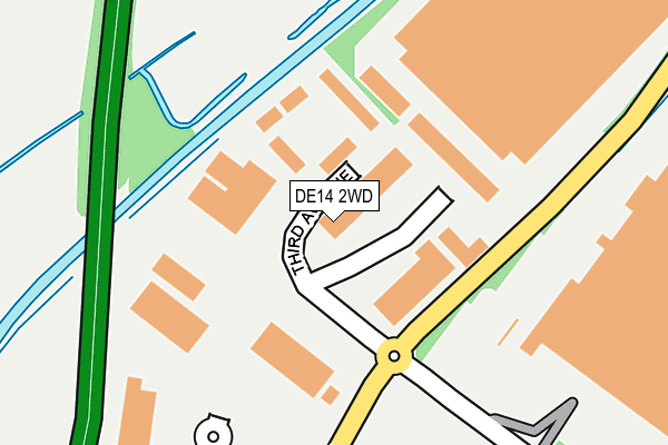
DE14 2WD is located in the Branston electoral ward, within the local authority district of East Staffordshire and the English Parliamentary constituency of Burton. The Sub Integrated Care Board (ICB) Location is NHS Staffordshire and Stoke-on-Trent ICB - 05D and the police force is Staffordshire. This postcode has been in use since May 1994.


GetTheData
Source: OS OpenMap – Local (Ordnance Survey)
Source: OS VectorMap District (Ordnance Survey)
Licence: Open Government Licence (requires attribution)
| Easting | 422600 |
| Northing | 322402 |
| Latitude | 52.798709 |
| Longitude | -1.666249 |
GetTheData
Source: Open Postcode Geo
Licence: Open Government Licence
| Country | England |
| Postcode District | DE14 |
➜ See where DE14 is on a map ➜ Where is Burton upon Trent? | |
GetTheData
Source: Land Registry Price Paid Data
Licence: Open Government Licence
Elevation or altitude of DE14 2WD as distance above sea level:
| Metres | Feet | |
|---|---|---|
| Elevation | 50m | 164ft |
Elevation is measured from the approximate centre of the postcode, to the nearest point on an OS contour line from OS Terrain 50, which has contour spacing of ten vertical metres.
➜ How high above sea level am I? Find the elevation of your current position using your device's GPS.
GetTheData
Source: Open Postcode Elevation
Licence: Open Government Licence
| Ward | Branston |
| Constituency | Burton |
GetTheData
Source: ONS Postcode Database
Licence: Open Government Licence
| Second Avenue (The Parkway) | Burton Upon Trent | 193m |
| Second Avenue (The Parkway) | Burton Upon Trent | 244m |
| Boots (The Parkway) | Burton Upon Trent | 275m |
| Morrisons Store (Wellington Rd) | Beans Covert | 450m |
| Centrum East Retail Park (Wellington Rd) | Beans Covert | 507m |
| Burton-on-Trent Station | 1.8km |
GetTheData
Source: NaPTAN
Licence: Open Government Licence
| Median download speed | 45.1Mbps |
| Average download speed | 39.5Mbps |
| Maximum download speed | 52.94Mbps |
| Median upload speed | 8.5Mbps |
| Average upload speed | 7.8Mbps |
| Maximum upload speed | 11.55Mbps |
GetTheData
Source: Ofcom
Licence: Ofcom Terms of Use (requires attribution)
GetTheData
Source: ONS Postcode Database
Licence: Open Government Licence


➜ Get more ratings from the Food Standards Agency
GetTheData
Source: Food Standards Agency
Licence: FSA terms & conditions
| Last Collection | |||
|---|---|---|---|
| Location | Mon-Fri | Sat | Distance |
| Centrum 100 Business Box | 18:30 | 498m | |
| Morrisons Bot | 17:30 | 11:30 | 506m |
| Harwood Avenue | 17:30 | 10:45 | 698m |
GetTheData
Source: Dracos
Licence: Creative Commons Attribution-ShareAlike
| Risk of DE14 2WD flooding from rivers and sea | High |
| ➜ DE14 2WD flood map | |
GetTheData
Source: Open Flood Risk by Postcode
Licence: Open Government Licence
The below table lists the International Territorial Level (ITL) codes (formerly Nomenclature of Territorial Units for Statistics (NUTS) codes) and Local Administrative Units (LAU) codes for DE14 2WD:
| ITL 1 Code | Name |
|---|---|
| TLG | West Midlands (England) |
| ITL 2 Code | Name |
| TLG2 | Shropshire and Staffordshire |
| ITL 3 Code | Name |
| TLG24 | Staffordshire CC |
| LAU 1 Code | Name |
| E07000193 | East Staffordshire |
GetTheData
Source: ONS Postcode Directory
Licence: Open Government Licence
The below table lists the Census Output Area (OA), Lower Layer Super Output Area (LSOA), and Middle Layer Super Output Area (MSOA) for DE14 2WD:
| Code | Name | |
|---|---|---|
| OA | E00149864 | |
| LSOA | E01029413 | East Staffordshire 013A |
| MSOA | E02006143 | East Staffordshire 013 |
GetTheData
Source: ONS Postcode Directory
Licence: Open Government Licence
| DE14 2WP | Sixth Avenue | 431m |
| DE14 2WG | Eighth Avenue | 545m |
| DE14 3JP | Spinney Road | 560m |
| DE14 2AA | Wellington Road | 588m |
| DE14 3JJ | Warwick Close | 612m |
| DE14 3JW | Harcourt Road | 615m |
| DE14 3JN | Harwood Avenue | 660m |
| DE14 3JE | Clewley Road | 669m |
| DE14 2TG | Wellington Road | 669m |
| DE14 3JL | Harwood Avenue | 706m |
GetTheData
Source: Open Postcode Geo; Land Registry Price Paid Data
Licence: Open Government Licence