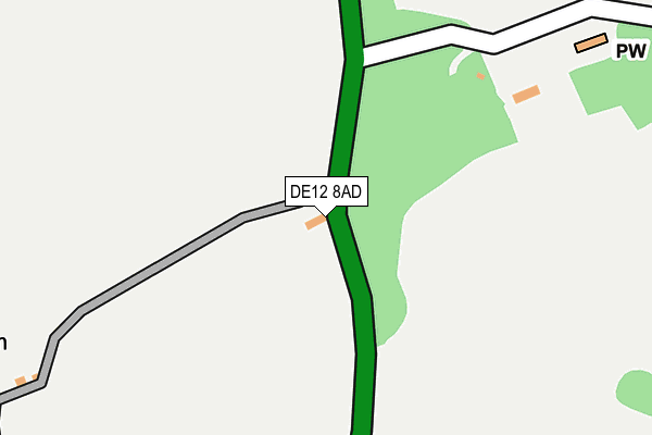
DE12 8AD is located in the Appleby electoral ward, within the local authority district of North West Leicestershire and the English Parliamentary constituency of North West Leicestershire. The Sub Integrated Care Board (ICB) Location is NHS Leicester, Leicestershire and Rutland ICB - 04V and the police force is Leicestershire. This postcode has been in use since January 1980.


GetTheData
Source: OS OpenMap – Local (Ordnance Survey)
Source: OS VectorMap District (Ordnance Survey)
Licence: Open Government Licence (requires attribution)
| Easting | 430158 |
| Northing | 311761 |
| Latitude | 52.702704 |
| Longitude | -1.555124 |
GetTheData
Source: Open Postcode Geo
Licence: Open Government Licence
| Country | England |
| Postcode District | DE12 |
➜ See where DE12 is on a map ➜ Where is Stretton en le Field? | |
GetTheData
Source: Land Registry Price Paid Data
Licence: Open Government Licence
Elevation or altitude of DE12 8AD as distance above sea level:
| Metres | Feet | |
|---|---|---|
| Elevation | 90m | 295ft |
Elevation is measured from the approximate centre of the postcode, to the nearest point on an OS contour line from OS Terrain 50, which has contour spacing of ten vertical metres.
➜ How high above sea level am I? Find the elevation of your current position using your device's GPS.
GetTheData
Source: Open Postcode Elevation
Licence: Open Government Licence
| Ward | Appleby |
| Constituency | North West Leicestershire |
GetTheData
Source: ONS Postcode Database
Licence: Open Government Licence
| Rectory Lane (Acresford Road) | Stretton-en-le-field | 114m |
| Rectory Lane (Acresford Road) | Stretton-en-le-field | 119m |
| The Anchorage (Acresford Road) | Acresford | 1,282m |
| The Anchorage (Acresford Road) | Acresford | 1,295m |
| Measham Road | Acresford | 1,390m |
GetTheData
Source: NaPTAN
Licence: Open Government Licence
| Percentage of properties with Next Generation Access | 100.0% |
| Percentage of properties with Superfast Broadband | 0.0% |
| Percentage of properties with Ultrafast Broadband | 0.0% |
| Percentage of properties with Full Fibre Broadband | 0.0% |
Superfast Broadband is between 30Mbps and 300Mbps
Ultrafast Broadband is > 300Mbps
| Percentage of properties unable to receive 2Mbps | 0.0% |
| Percentage of properties unable to receive 5Mbps | 100.0% |
| Percentage of properties unable to receive 10Mbps | 100.0% |
| Percentage of properties unable to receive 30Mbps | 100.0% |
GetTheData
Source: Ofcom
Licence: Ofcom Terms of Use (requires attribution)
GetTheData
Source: ONS Postcode Database
Licence: Open Government Licence


➜ Get more ratings from the Food Standards Agency
GetTheData
Source: Food Standards Agency
Licence: FSA terms & conditions
| Last Collection | |||
|---|---|---|---|
| Location | Mon-Fri | Sat | Distance |
| Acresford | 16:00 | 09:30 | 1,398m |
| Chilcote | 16:00 | 09:30 | 1,723m |
| Netherseal So | 16:00 | 11:15 | 1,923m |
GetTheData
Source: Dracos
Licence: Creative Commons Attribution-ShareAlike
The below table lists the International Territorial Level (ITL) codes (formerly Nomenclature of Territorial Units for Statistics (NUTS) codes) and Local Administrative Units (LAU) codes for DE12 8AD:
| ITL 1 Code | Name |
|---|---|
| TLF | East Midlands (England) |
| ITL 2 Code | Name |
| TLF2 | Leicestershire, Rutland and Northamptonshire |
| ITL 3 Code | Name |
| TLF22 | Leicestershire CC and Rutland |
| LAU 1 Code | Name |
| E07000134 | North West Leicestershire |
GetTheData
Source: ONS Postcode Directory
Licence: Open Government Licence
The below table lists the Census Output Area (OA), Lower Layer Super Output Area (LSOA), and Middle Layer Super Output Area (MSOA) for DE12 8AD:
| Code | Name | |
|---|---|---|
| OA | E00131503 | |
| LSOA | E01025913 | North West Leicestershire 012A |
| MSOA | E02005408 | North West Leicestershire 012 |
GetTheData
Source: ONS Postcode Directory
Licence: Open Government Licence
| DE12 8AF | Rectory Lane | 397m |
| DE12 8AQ | Acresford Road | 1093m |
| DE12 8AJ | Measham Road | 1336m |
| DE12 8AG | Acresford Road | 1381m |
| DE12 8AL | Mill Yard | 1421m |
| DE12 8AA | Hilltop Cottage | 1443m |
| DE12 8AW | Brookfield Cottages | 1444m |
| DE12 8AX | Coopers Close | 1493m |
| DE12 8DQ | 1544m | |
| DE12 8DU | Hurst Court | 1591m |
GetTheData
Source: Open Postcode Geo; Land Registry Price Paid Data
Licence: Open Government Licence