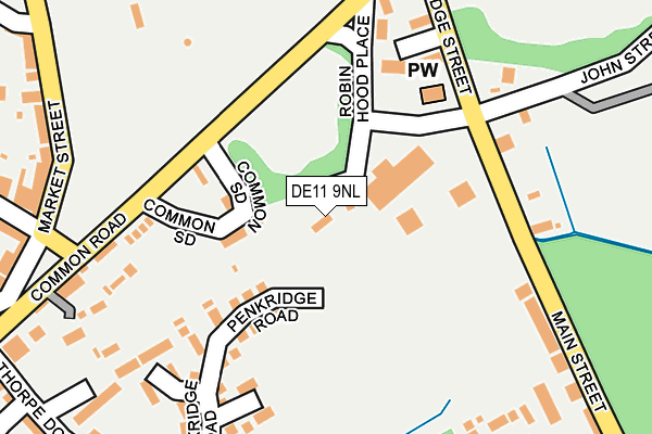
DE11 9NL is located in the Church Gresley electoral ward, within the local authority district of South Derbyshire and the English Parliamentary constituency of South Derbyshire. The Sub Integrated Care Board (ICB) Location is NHS Derby and Derbyshire ICB - 15M and the police force is Derbyshire. This postcode has been in use since January 1980.


GetTheData
Source: OS OpenMap – Local (Ordnance Survey)
Source: OS VectorMap District (Ordnance Survey)
Licence: Open Government Licence (requires attribution)
| Easting | 430118 |
| Northing | 318544 |
| Latitude | 52.763681 |
| Longitude | -1.555095 |
GetTheData
Source: Open Postcode Geo
Licence: Open Government Licence
| Country | England |
| Postcode District | DE11 |
➜ See where DE11 is on a map ➜ Where is Swadlincote? | |
GetTheData
Source: Land Registry Price Paid Data
Licence: Open Government Licence
Elevation or altitude of DE11 9NL as distance above sea level:
| Metres | Feet | |
|---|---|---|
| Elevation | 120m | 394ft |
Elevation is measured from the approximate centre of the postcode, to the nearest point on an OS contour line from OS Terrain 50, which has contour spacing of ten vertical metres.
➜ How high above sea level am I? Find the elevation of your current position using your device's GPS.
GetTheData
Source: Open Postcode Elevation
Licence: Open Government Licence
| Ward | Church Gresley |
| Constituency | South Derbyshire |
GetTheData
Source: ONS Postcode Database
Licence: Open Government Licence
| Edward Street (Main Street) | Albert Village | 221m |
| Common Road (Market Street) | Church Gresley | 262m |
| Edward Street (Main Street) | Albert Village | 264m |
| Memorial Hall (York Road) | Church Gresley | 291m |
| York Road (Coppice Side) | Church Gresley | 298m |
GetTheData
Source: NaPTAN
Licence: Open Government Licence
GetTheData
Source: ONS Postcode Database
Licence: Open Government Licence


➜ Get more ratings from the Food Standards Agency
GetTheData
Source: Food Standards Agency
Licence: FSA terms & conditions
| Last Collection | |||
|---|---|---|---|
| Location | Mon-Fri | Sat | Distance |
| Church Gresley Tso | 16:00 | 11:00 | 286m |
| Albert Village Post Office | 17:30 | 11:45 | 434m |
| Oak Street | 16:00 | 11:00 | 621m |
GetTheData
Source: Dracos
Licence: Creative Commons Attribution-ShareAlike
The below table lists the International Territorial Level (ITL) codes (formerly Nomenclature of Territorial Units for Statistics (NUTS) codes) and Local Administrative Units (LAU) codes for DE11 9NL:
| ITL 1 Code | Name |
|---|---|
| TLF | East Midlands (England) |
| ITL 2 Code | Name |
| TLF1 | Derbyshire and Nottinghamshire |
| ITL 3 Code | Name |
| TLF13 | South and West Derbyshire |
| LAU 1 Code | Name |
| E07000039 | South Derbyshire |
GetTheData
Source: ONS Postcode Directory
Licence: Open Government Licence
The below table lists the Census Output Area (OA), Lower Layer Super Output Area (LSOA), and Middle Layer Super Output Area (MSOA) for DE11 9NL:
| Code | Name | |
|---|---|---|
| OA | E00100386 | |
| LSOA | E01019837 | South Derbyshire 012A |
| MSOA | E02006919 | South Derbyshire 012 |
GetTheData
Source: ONS Postcode Directory
Licence: Open Government Licence
| DE11 9NN | Common Side | 107m |
| DE11 9FP | Kirkland Way | 160m |
| DE11 9FH | Penkridge Road | 185m |
| DE11 9PY | Uldale Grove | 217m |
| DE11 9PZ | Leyburn Close | 224m |
| DE11 9NW | Common Road | 250m |
| DE11 8DU | Peter Street | 265m |
| DE11 9FG | Arnside Close | 266m |
| DE11 9PR | Market Street | 287m |
| DE11 9FN | Deepdene Close | 299m |
GetTheData
Source: Open Postcode Geo; Land Registry Price Paid Data
Licence: Open Government Licence