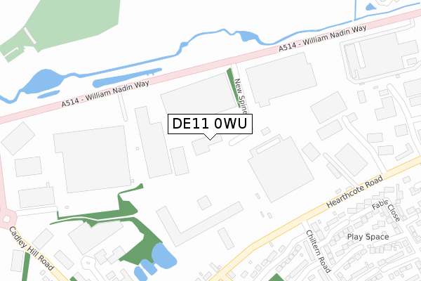
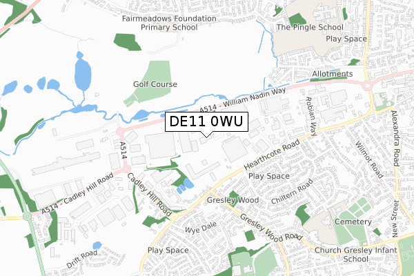
DE11 0WU is located in the Swadlincote electoral ward, within the local authority district of South Derbyshire and the English Parliamentary constituency of South Derbyshire. The Sub Integrated Care Board (ICB) Location is NHS Derby and Derbyshire ICB - 15M and the police force is Derbyshire. This postcode has been in use since February 2019.


GetTheData
Source: OS Open Zoomstack (Ordnance Survey)
Licence: Open Government Licence (requires attribution)
Attribution: Contains OS data © Crown copyright and database right 2024
Source: Open Postcode Geo
Licence: Open Government Licence (requires attribution)
Attribution: Contains OS data © Crown copyright and database right 2024; Contains Royal Mail data © Royal Mail copyright and database right 2024; Source: Office for National Statistics licensed under the Open Government Licence v.3.0
| Easting | 428684 |
| Northing | 319376 |
| Latitude | 52.771237 |
| Longitude | -1.576274 |
GetTheData
Source: Open Postcode Geo
Licence: Open Government Licence
| Country | England |
| Postcode District | DE11 |
➜ See where DE11 is on a map ➜ Where is Swadlincote? | |
GetTheData
Source: Land Registry Price Paid Data
Licence: Open Government Licence
| Ward | Swadlincote |
| Constituency | South Derbyshire |
GetTheData
Source: ONS Postcode Database
Licence: Open Government Licence
| Tetron Point (William Nadin Way) | Swadlincote | 213m |
| Tnt Depot (William Nadin Way) | Swadlincote | 219m |
| Tetron Point (William Nadin Way) | Swadlincote | 224m |
| Tnt Depot (William Nadin Way) | Swadlincote | 229m |
| Chiltern Road (Hearthcote Road) | Swadlincote | 279m |
| Burton-on-Trent Station | 5.9km |
GetTheData
Source: NaPTAN
Licence: Open Government Licence
GetTheData
Source: ONS Postcode Database
Licence: Open Government Licence


➜ Get more ratings from the Food Standards Agency
GetTheData
Source: Food Standards Agency
Licence: FSA terms & conditions
| Last Collection | |||
|---|---|---|---|
| Location | Mon-Fri | Sat | Distance |
| Chiltern Road | 16:00 | 11:00 | 455m |
| Wye Dale | 16:00 | 11:00 | 531m |
| Robian Way Business Box | 18:30 | 658m | |
GetTheData
Source: Dracos
Licence: Creative Commons Attribution-ShareAlike
The below table lists the International Territorial Level (ITL) codes (formerly Nomenclature of Territorial Units for Statistics (NUTS) codes) and Local Administrative Units (LAU) codes for DE11 0WU:
| ITL 1 Code | Name |
|---|---|
| TLF | East Midlands (England) |
| ITL 2 Code | Name |
| TLF1 | Derbyshire and Nottinghamshire |
| ITL 3 Code | Name |
| TLF13 | South and West Derbyshire |
| LAU 1 Code | Name |
| E07000039 | South Derbyshire |
GetTheData
Source: ONS Postcode Directory
Licence: Open Government Licence
The below table lists the Census Output Area (OA), Lower Layer Super Output Area (LSOA), and Middle Layer Super Output Area (MSOA) for DE11 0WU:
| Code | Name | |
|---|---|---|
| OA | E00100577 | |
| LSOA | E01019879 | South Derbyshire 009D |
| MSOA | E02004126 | South Derbyshire 009 |
GetTheData
Source: ONS Postcode Directory
Licence: Open Government Licence
| DE11 0BB | William Nadin Way | 276m |
| DE11 9SA | Handsacre Close | 313m |
| DE11 9DU | Hearthcote Road | 353m |
| DE11 9SD | Bardolph Close | 372m |
| DE11 9SB | Solney Close | 382m |
| DE11 9SW | Chiltern Road | 412m |
| DE11 9DL | Boardman Road | 418m |
| DE11 9SE | Ingleby Close | 444m |
| DE11 9QR | Gresley Wood Road | 448m |
| DE11 9SF | Twyford Close | 449m |
GetTheData
Source: Open Postcode Geo; Land Registry Price Paid Data
Licence: Open Government Licence