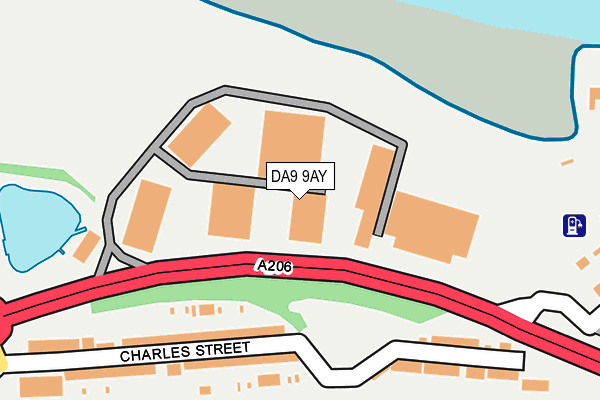
DA9 9AY is located in the Stone Castle electoral ward, within the local authority district of Dartford and the English Parliamentary constituency of Dartford. The Sub Integrated Care Board (ICB) Location is NHS Kent and Medway ICB - 91Q and the police force is Kent. This postcode has been in use since September 2007.


GetTheData
Source: OS OpenMap – Local (Ordnance Survey)
Source: OS VectorMap District (Ordnance Survey)
Licence: Open Government Licence (requires attribution)
| Easting | 557901 |
| Northing | 175134 |
| Latitude | 51.453173 |
| Longitude | 0.271160 |
GetTheData
Source: Open Postcode Geo
Licence: Open Government Licence
| Country | England |
| Postcode District | DA9 |
➜ See where DA9 is on a map ➜ Where is Dartford? | |
GetTheData
Source: Land Registry Price Paid Data
Licence: Open Government Licence
Elevation or altitude of DA9 9AY as distance above sea level:
| Metres | Feet | |
|---|---|---|
| Elevation | 10m | 33ft |
Elevation is measured from the approximate centre of the postcode, to the nearest point on an OS contour line from OS Terrain 50, which has contour spacing of ten vertical metres.
➜ How high above sea level am I? Find the elevation of your current position using your device's GPS.
GetTheData
Source: Open Postcode Elevation
Licence: Open Government Licence
| Ward | Stone Castle |
| Constituency | Dartford |
GetTheData
Source: ONS Postcode Database
Licence: Open Government Licence
| Stone Crossing (Crossways Boulevard) | Stone | 405m |
| Asda (Crossways Boulevard) | Greenhithe | 461m |
| Asda (Asda Grounds) | Greenhithe | 463m |
| Asda (Crossways Boulevard) | Greenhithe | 488m |
| Asda (Asda Grounds) | Greenhithe | 488m |
| Stone Crossing Station | 0.6km |
| Greenhithe for Bluewater Station | 0.7km |
| Swanscombe Station | 2.7km |
GetTheData
Source: NaPTAN
Licence: Open Government Licence
| Median download speed | 50.3Mbps |
| Average download speed | 43.1Mbps |
| Maximum download speed | 80.00Mbps |
| Median upload speed | 12.9Mbps |
| Average upload speed | 11.0Mbps |
| Maximum upload speed | 20.00Mbps |
GetTheData
Source: Ofcom
Licence: Ofcom Terms of Use (requires attribution)
Estimated total energy consumption in DA9 9AY by fuel type, 2015.
| Consumption (kWh) | 228,918 |
|---|---|
| Meter count | 19 |
| Mean (kWh/meter) | 12,048 |
| Median (kWh/meter) | 9,004 |
GetTheData
Source: Postcode level gas estimates: 2015 (experimental)
Source: Postcode level electricity estimates: 2015 (experimental)
Licence: Open Government Licence
GetTheData
Source: ONS Postcode Database
Licence: Open Government Licence


➜ Get more ratings from the Food Standards Agency
GetTheData
Source: Food Standards Agency
Licence: FSA terms & conditions
| Last Collection | |||
|---|---|---|---|
| Location | Mon-Fri | Sat | Distance |
| Crossways | 18:30 | 11:00 | 177m |
| Cowley Avenue | 17:30 | 11:00 | 434m |
| Bell Close | 17:30 | 11:00 | 484m |
GetTheData
Source: Dracos
Licence: Creative Commons Attribution-ShareAlike
| Risk of DA9 9AY flooding from rivers and sea | Very Low |
| ➜ DA9 9AY flood map | |
GetTheData
Source: Open Flood Risk by Postcode
Licence: Open Government Licence
The below table lists the International Territorial Level (ITL) codes (formerly Nomenclature of Territorial Units for Statistics (NUTS) codes) and Local Administrative Units (LAU) codes for DA9 9AY:
| ITL 1 Code | Name |
|---|---|
| TLJ | South East (England) |
| ITL 2 Code | Name |
| TLJ4 | Kent |
| ITL 3 Code | Name |
| TLJ43 | Kent Thames Gateway |
| LAU 1 Code | Name |
| E07000107 | Dartford |
GetTheData
Source: ONS Postcode Directory
Licence: Open Government Licence
The below table lists the Census Output Area (OA), Lower Layer Super Output Area (LSOA), and Middle Layer Super Output Area (MSOA) for DA9 9AY:
| Code | Name | |
|---|---|---|
| OA | E00122713 | |
| LSOA | E01024172 | Dartford 006D |
| MSOA | E02005033 | Dartford 006 |
GetTheData
Source: ONS Postcode Directory
Licence: Open Government Licence
| DA9 9AN | Charles Street | 183m |
| DA9 9AJ | Charles Street | 208m |
| DA9 9AQ | Charles Street | 226m |
| DA9 9QJ | Sutherland Close | 253m |
| DA9 9QH | Jackson Close | 292m |
| DA9 9AL | Charles Street | 299m |
| DA9 9US | Ifield Place | 299m |
| DA9 9RB | Chambers Close | 319m |
| DA9 9QA | Cowley Avenue | 326m |
| DA9 9PJ | Cowley Avenue | 348m |
GetTheData
Source: Open Postcode Geo; Land Registry Price Paid Data
Licence: Open Government Licence