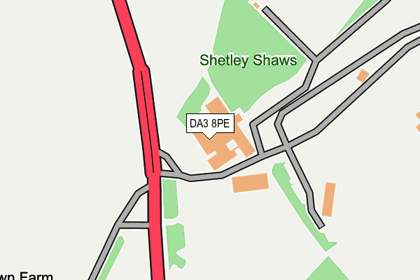
DA3 8PE is located in the Fawkham and West Kingsdown electoral ward, within the local authority district of Sevenoaks and the English Parliamentary constituency of Sevenoaks. The Sub Integrated Care Board (ICB) Location is NHS Kent and Medway ICB - 91Q and the police force is Kent. This postcode has been in use since February 1990.


GetTheData
Source: OS OpenMap – Local (Ordnance Survey)
Source: OS VectorMap District (Ordnance Survey)
Licence: Open Government Licence (requires attribution)
| Easting | 556993 |
| Northing | 164613 |
| Latitude | 51.358898 |
| Longitude | 0.253450 |
GetTheData
Source: Open Postcode Geo
Licence: Open Government Licence
| Country | England |
| Postcode District | DA3 |
➜ See where DA3 is on a map | |
GetTheData
Source: Land Registry Price Paid Data
Licence: Open Government Licence
Elevation or altitude of DA3 8PE as distance above sea level:
| Metres | Feet | |
|---|---|---|
| Elevation | 140m | 459ft |
Elevation is measured from the approximate centre of the postcode, to the nearest point on an OS contour line from OS Terrain 50, which has contour spacing of ten vertical metres.
➜ How high above sea level am I? Find the elevation of your current position using your device's GPS.
GetTheData
Source: Open Postcode Elevation
Licence: Open Government Licence
| Ward | Fawkham And West Kingsdown |
| Constituency | Sevenoaks |
GetTheData
Source: ONS Postcode Database
Licence: Open Government Licence
| Brands Hatch (London Road) | West Kingsdown | 94m |
| Brands Hatch (London Road) | West Kingsdown | 125m |
| Gorse Hill Nursery (Main Road Gorse Hill) | Farningham | 699m |
| Hever Road (London Road) | West Kingsdown | 803m |
| Millfield Road (London Road) | West Kingsdown | 823m |
| Eynsford Station | 3.4km |
| Farningham Road Station | 4.9km |
| Longfield Station | 5.3km |
GetTheData
Source: NaPTAN
Licence: Open Government Licence
GetTheData
Source: ONS Postcode Database
Licence: Open Government Licence


➜ Get more ratings from the Food Standards Agency
GetTheData
Source: Food Standards Agency
Licence: FSA terms & conditions
| Last Collection | |||
|---|---|---|---|
| Location | Mon-Fri | Sat | Distance |
| Coltstead | 16:00 | 11:30 | 3,456m |
| New Ash Green Post Office | 17:00 | 11:45 | 3,683m |
| Penenden | 16:00 | 11:30 | 3,750m |
GetTheData
Source: Dracos
Licence: Creative Commons Attribution-ShareAlike
The below table lists the International Territorial Level (ITL) codes (formerly Nomenclature of Territorial Units for Statistics (NUTS) codes) and Local Administrative Units (LAU) codes for DA3 8PE:
| ITL 1 Code | Name |
|---|---|
| TLJ | South East (England) |
| ITL 2 Code | Name |
| TLJ4 | Kent |
| ITL 3 Code | Name |
| TLJ46 | West Kent |
| LAU 1 Code | Name |
| E07000111 | Sevenoaks |
GetTheData
Source: ONS Postcode Directory
Licence: Open Government Licence
The below table lists the Census Output Area (OA), Lower Layer Super Output Area (LSOA), and Middle Layer Super Output Area (MSOA) for DA3 8PE:
| Code | Name | |
|---|---|---|
| OA | E00124046 | |
| LSOA | E01024437 | Sevenoaks 007C |
| MSOA | E02005093 | Sevenoaks 007 |
GetTheData
Source: ONS Postcode Directory
Licence: Open Government Licence
| TN15 6DQ | Neal Road | 418m |
| TN15 6DX | Hever Avenue | 474m |
| TN15 6DG | Neal Road | 527m |
| TN15 6DR | Symonds Close | 553m |
| TN15 6DU | Hever Avenue | 589m |
| TN15 6DF | Neal Road | 643m |
| TN15 6DP | Gillies Road | 650m |
| TN15 6BQ | Blue Chalet Industrial Park | 692m |
| TN15 6DN | Phelps Close | 699m |
| TN15 6DT | Hever Avenue | 724m |
GetTheData
Source: Open Postcode Geo; Land Registry Price Paid Data
Licence: Open Government Licence