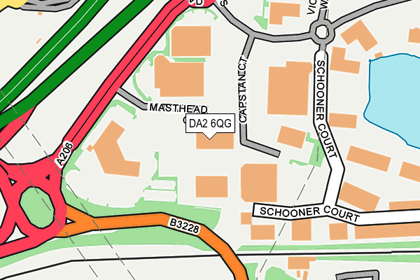
DA2 6QG is located in the Stone Castle electoral ward, within the local authority district of Dartford and the English Parliamentary constituency of Dartford. The Sub Integrated Care Board (ICB) Location is NHS Kent and Medway ICB - 91Q and the police force is Kent. This postcode has been in use since July 1990.


GetTheData
Source: OS OpenMap – Local (Ordnance Survey)
Source: OS VectorMap District (Ordnance Survey)
Licence: Open Government Licence (requires attribution)
| Easting | 556242 |
| Northing | 175066 |
| Latitude | 51.453022 |
| Longitude | 0.247302 |
GetTheData
Source: Open Postcode Geo
Licence: Open Government Licence
| Country | England |
| Postcode District | DA2 |
➜ See where DA2 is on a map ➜ Where is Dartford? | |
GetTheData
Source: Land Registry Price Paid Data
Licence: Open Government Licence
Elevation or altitude of DA2 6QG as distance above sea level:
| Metres | Feet | |
|---|---|---|
| Elevation | 10m | 33ft |
Elevation is measured from the approximate centre of the postcode, to the nearest point on an OS contour line from OS Terrain 50, which has contour spacing of ten vertical metres.
➜ How high above sea level am I? Find the elevation of your current position using your device's GPS.
GetTheData
Source: Open Postcode Elevation
Licence: Open Government Licence
| Ward | Stone Castle |
| Constituency | Dartford |
GetTheData
Source: ONS Postcode Database
Licence: Open Government Licence
| Crossways Boulevard | Dartford | 498m |
| Crossways Boulevard | Dartford | 513m |
| Galleon Boulevard (Crossways Boulevard) | Dartford | 687m |
| Bridges Drive (Attlee Drive) | Temple Hill | 718m |
| Bridges Drive (Attlee Drive) | Temple Hill | 722m |
| Stone Crossing Station | 1.2km |
| Dartford Station | 2km |
| Greenhithe for Bluewater Station | 2.3km |
GetTheData
Source: NaPTAN
Licence: Open Government Licence
GetTheData
Source: ONS Postcode Database
Licence: Open Government Licence


➜ Get more ratings from the Food Standards Agency
GetTheData
Source: Food Standards Agency
Licence: FSA terms & conditions
| Last Collection | |||
|---|---|---|---|
| Location | Mon-Fri | Sat | Distance |
| Farnol Road | 17:30 | 11:15 | 820m |
| Attlee Drive | 17:30 | 11:30 | 961m |
| Hillhouse Road | 17:15 | 12:15 | 1,059m |
GetTheData
Source: Dracos
Licence: Creative Commons Attribution-ShareAlike
The below table lists the International Territorial Level (ITL) codes (formerly Nomenclature of Territorial Units for Statistics (NUTS) codes) and Local Administrative Units (LAU) codes for DA2 6QG:
| ITL 1 Code | Name |
|---|---|
| TLJ | South East (England) |
| ITL 2 Code | Name |
| TLJ4 | Kent |
| ITL 3 Code | Name |
| TLJ43 | Kent Thames Gateway |
| LAU 1 Code | Name |
| E07000107 | Dartford |
GetTheData
Source: ONS Postcode Directory
Licence: Open Government Licence
The below table lists the Census Output Area (OA), Lower Layer Super Output Area (LSOA), and Middle Layer Super Output Area (MSOA) for DA2 6QG:
| Code | Name | |
|---|---|---|
| OA | E00122714 | |
| LSOA | E01024172 | Dartford 006D |
| MSOA | E02005033 | Dartford 006 |
GetTheData
Source: ONS Postcode Directory
Licence: Open Government Licence
| DA2 6QQ | Schooner Court | 226m |
| DA2 6NW | Schooner Court | 252m |
| DA2 6QD | Victory Way | 311m |
| DA2 6DT | Victory Way | 317m |
| DA2 6QH | Anchor Boulevard | 380m |
| DA2 6NX | Galleon Boulevard | 380m |
| DA2 6QE | Galleon Boulevard | 448m |
| DA9 9BB | Cotton Lane | 569m |
| DA2 6FQ | Cotton Lane | 579m |
| DA1 5DS | Kipling Road | 584m |
GetTheData
Source: Open Postcode Geo; Land Registry Price Paid Data
Licence: Open Government Licence